
Washington
Recent Articles
More Articles

Hoh River, Olympic National Park
Hoh River starts from the terminus of the Hoh Glacier at an elevation of roughly 4,200 feet (1,280 m) on the northeast flank of Mount Olympus in Olympic National Park and flows generally west-southwest for 56 miles (90 km) draining a watershed of 191,360 acres (77,441 ha) to the Pacific Ocean, about 99 miles (159 km) west of Seattle and 15 miles (24 km) south of Forks, Washington.

Browns Point, East Passage
Browns Point is a conspicuous landmark in Puget Sound located at the southern end of East Passage and at the entrance to Commencement Bay, about 21 miles (34 km) south-southwest of Seattle and 4 miles (6.5 km) north of Tacoma, Washington.

Point Robinson, Maury Island
Point Robinson is the eastern point of Maury Island in Puget Sound and the site of a historic lighthouse, about 15 miles (24 km) south of Seattle and 10 miles (16 km) north-northeast of Tacoma, Washington.
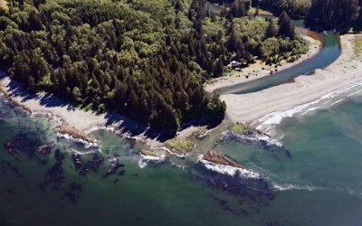
Hoko River, Kydaka Point
Hoko River starts in the foothills of the Olympic Mountains at an elevation of roughly 1150 feet (351 m) and flows generally north for 25 miles (40 km), draining a rugged heavily logged watershed of 48,000 acres (19,425 ha) to Kydaka Point on the Strait of Juan de Fuca, about 13 miles (21 km) southeast of Neah Bay and 3.3 miles (5 km) northwest of Sekiu, Washington.
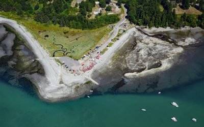
Little Boston, Point Julia
Little Boston is a community at the base of Point Julia on the east side entrance of Port Gamble, an inlet on the Kitsap Peninsula near the entrance to Hood Canal, about 21 miles (34 km) northwest of Seattle and 20 miles (32 km) southeast of Port Townsend, Washington.
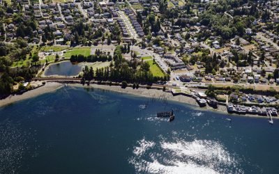
Titlow Beach, Tacoma Narrows
Titlow Beach is an urban neighborhood on the eastern shore of the Tacoma Narrows at the site of a historical fish camp used by the Puyallup and Nisqually tribes situated on a tidal wetland now called Titlow Lagoon, about 5.8 miles (9.4 km) south-southeast of Gig Harbor and 5.3 miles (8.5 km) west of downtown Tacoma, Washington.
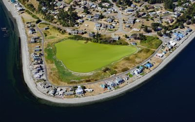
Diamond Point, Discovery Bay
Diamond Point is a community on the northeast tip of the Miller Peninsula which forms part of the Olympic Peninsula on the Strait of Juan de Fuca at the entrance to Discovery Bay, about 44 miles (71 km) northwest of Seattle and 7.5 miles (12 km) west-southwest of Port Townsend, Washington.
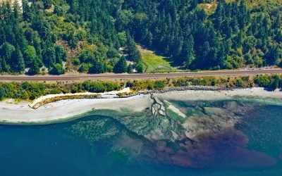
Fort Nisqually, Sequalitchew Creek
Fort Nisqually was a historical trading post established by the Hudson’s Bay Company in 1833 on Sequalitchew Creek, 1.3 miles (2.1 km) east of South Puget Sound at an elevation of 220 feet (67 m), about 14 miles (22.5 km) southwest of Tacoma and 2 miles (3.2 km) northwest of Dupont, Washington.
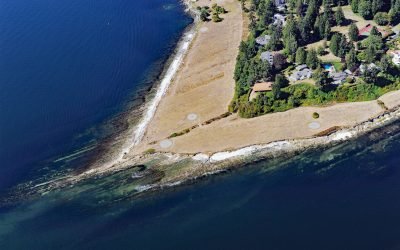
Restoration Point, Bainbridge Island
Restoration Point is a conspicuous ledge on the southern end of Bainbridge Island in Puget Sound, about 7 miles (11 km) east-northeast of Bremerton and 7 miles (11 km) west-southwest of Seattle, Washington.

Tongue Point, Semiahmoo Spit
Tongue Point is at the end of Semiahmoo Spit, a sand bar of 125 acres (51 ha) and about 1 mile (1.6 km) long that partially encloses Drayton Harbor, about 21 miles (34 km) northwest of Bellingham and 1 mile (1.6 km) west of Blaine, Washington.
About the background graphic
This ‘warming stripe’ graphic is a visual representation of the change in global temperature from 1850 (top) to 2019 (bottom). Each stripe represents the average global temperature for one year. The average temperature from 1971-2000 is set as the boundary between blue and red. The colour scale goes from -0.7°C to +0.7°C. The data are from the UK Met Office HadCRUT4.6 dataset.
Click here for more information about the #warmingstripes.