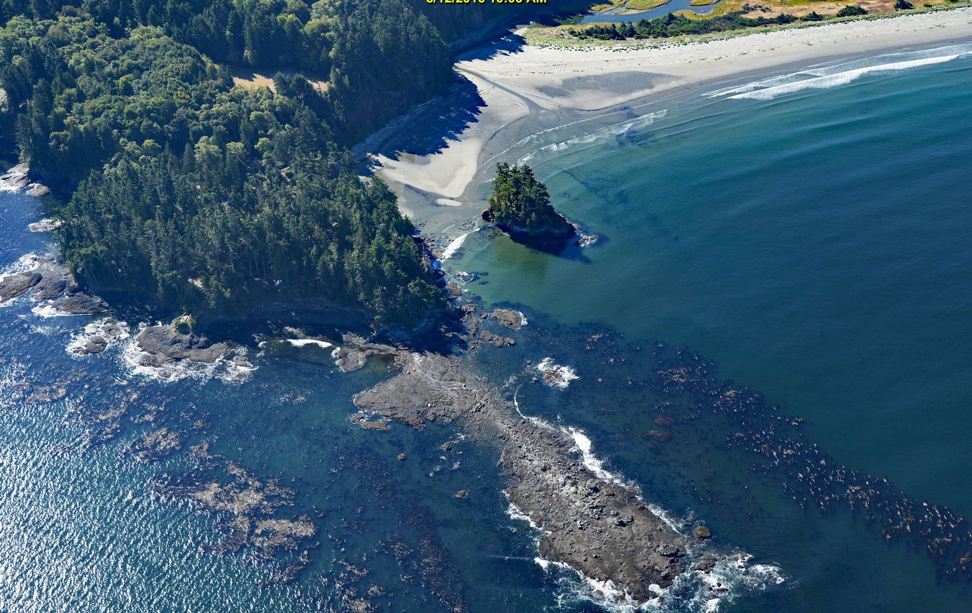
Tongue Point is a rocky ledge in the Strait of Juan de Fuca that projects from a peninsula forming the eastern shore of Crescent Bay on the north coast of the Olympic Peninsula and the site of a historical port and shipwreck, about 44 miles (71 km) east-southeast of Neah Bay and 13 miles (21 km) west-northwest of Port Angeles, Washington. The point is named for the flat ledge which is almost 800 feet (244 m) long and 200 feet (61 m) wide when exposed at very low tides. Crescent Bay has a sandy beach over 1 mile (1.6 km) long and is the estuary for Salt Creek that drains a watershed of 12,108 acres (4,900 ha). The creek historically supported spawning habitat for coho and chum salmon, steelhead and cutthroat trout, and Pacific lamprey, however, the watershed has been heavily logged and modified by culverts, livestock grazing, and development resulting in loss of pools and spawning gravel. The watershed is formed mostly by marine sedimentary rocks that developed during the Miocene and Oligocene, and the points forming Crescent Bay, including Tongue Point, comprise volcanic rocks representing the Crescent Formation that developed during the Eocene and consist of submarine basalt flows, flow breccia, and pillow basalt.
The north coast of the Olympic Peninsula, between the Hoko River to the west and present-day Port Discovery to the east, is the traditional territory of the Klallam people. The Lower Elwha Klallam inhabited several villages along the coast including the mouth of the Elwha River and in the area of present-day Port Angeles. In 1892, Crescent Bay was the site of a development called Port Crescent that was envisaged as a deep-water harbor for ocean going vessels that would export timber. The development was partially motivated by the prospect of a railway linking the Olympic Peninsula to Tacoma. A promotion company was formed and a town site consisting of 20,000 lots on 166 blocks was surveyed. A wharf was built at the west end of the bay, but development of the harbor was stopped when numerous uncharted reefs were discovered near the bay entrance. Development of the town continued near the wharf and soon there were two saloons, the Markham House, the Port Crescent Hotel, stores and all the amenities of a frontier town. But without the railway, it was difficult to attract residents and by the 1920s, the town was nearly deserted. An unattended camp fire on the beach spread through accumulated drift logs and into the oil soaked ground of an old oil house, then burned along the boardwalk to the hotel, and soon the entire town was engulfed in flames. In 1941, a coastal artillery camp with two fixed gun batteries was established on a military reservation of 196 acres (79 ha) on Striped Peak at Tongue Point and later named Fort Hayden. Facilities included barracks for about 150 personnel were built along Salt Creek. The post was abandoned in 1948 and today is the Salt Creek Recreation Area.
The Diamond Knot was a general cargo ship built in 1944 by Consolidated Steel Corporation in Wilmington, California for the War Shipping Administration and surplussed after World War II. In August 1947, the ship was owned and operated by the Alaska Steamship Company and inbound to Seattle from Naknek, Alaska with a cargo of more than 7.4 million cans of salmon. Proceeding through thick fog in the Strait of Juan De Fuca without radar, the ship rounded Point Wilson and collided with the outbound freighter Fenn Victory with such forced that the prow of the Fenn Victory penetrated 14 feet (4 m) through the amidship section of the Diamond Knot. The two ships were locked together and the tugboats Matilda Foss and Foss No. 21 responded to the distress signals. The ships were separated after several hours of cutting with axes and acetylene torches. Fenn Victory was able to return to port and continued operating as a freighter until being decommissioned in 1949 and scrapped in 1984. Diamond Knot was towed stern-first to Crescent Bay with the intention of beaching the vessel and salvaging the cargo. The entrance of Crescent Bay is well known for strong tidal currents and two of the holds on Diamond Knot were flooded when the tow cables had to cut and the ship rolled over and sank in 135 feet (41 m) of water. Insurance monies were paid out and the underwriters decided to offset their losses by salvaging the salmon. First, they salvaged $22,000 of fish oil and then salvage divers cut holes in the hull and used an ingenious vacuum system to remove 5.7 million cans of salmon worth $2,100,100. Today, the wreck is a popular dive site. Read more here and here. Explore more of Tongue Point and Crescent Bay here:

