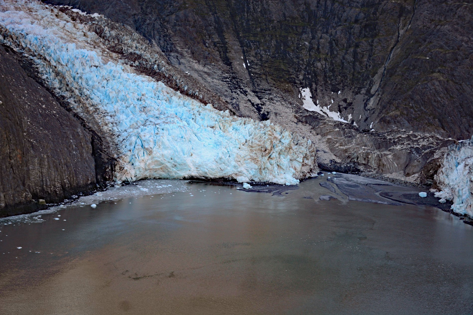
Gilman Glacier starts at an elevation of roughly 6,000 feet (1,828 m)in the Fairweather Range of the Saint Elias Mountains and flows generally northwest for 7.5 miles (12 km) to Johns Hopkins Inlet in Glacier Bay National Park and Preserve, about 105 miles (169 km) southeast of Yakutat and 58 miles (93 km) northwest of Gustavus, Alaska. Gilman Glacier was named in 1936 by William O. Field and William S. Cooper for Daniel C. Gilman, who was the first president of Johns Hopkins University. Johns Hopkins Inlet is a fjord that starts at the terminus of the Johns Hopkins Glacier and extends for about 10 miles (16 km) to the head of Glacier Bay. This region of the Fairweather Range is heavily glaciated and the limited amount of exposed bedrock represents sedimentary rocks of the Valdez Group, a part of the Southern Margin composite terrane, and consists of metamorphosed carbonaceous siltstone, greywacke, and mudstone that formed as fan deposits in a deep-water marine trench during the Cretaceous. Metamorphism occurred in the Eocene when magma intruded these strata and formed plutons of granodiorite, granite, quartz monzonite, tonalite, and quartz diorite.
Gilman Glacier is one of approximately 36 glaciers in Alaska, and only 6 in Glacier Bay, that terminate in tidewater. Between the end of the Little Ice Age and the present, the tidewater glaciers of Glacier Bay have retreated over 60 miles (100 km). Most of these glaciers are currently thinning and retreating; however, some, such as Johns Hopkins Glacier and Gilman Glacier, periodically thicken and advance. In the 1970s, Johns Hopkins Glacier flowed down the main valley at about 3,000 feet (914 m) per year, or about 8 feet (2.4 m) per day. Today, the flow rate is approximately 5 to 12 feet (1.5-3.5 m) per day. Glacier surface velocities vary seasonally with peak values occurring in late spring or early summer, and the lowest values occurring late in the summer or early fall. Johns Hopkins and Gilman may be the only advancing tidewater glaciers in the Fairweather Range and this is because they have relatively large snow accumulation zones at high elevations that allow for a high rate of ice formation followed by relatively short descents to sea level. In about 1990, Johns Hopkins Glacier joined Gilman Glacier, and since then, the two glaciers have separated and joined several times. The two glaciers most recently joined in 2016, and are currently attached at the eastern edge, creating an ice cliff 150 to 200 feet (45-60 m) high.
High latitude fjords have been found to support deep sea organisms at shallower depths because the oceanographic characteristics mimic a deep-sea environment. For example, the Red Tree cold-water coral has been observed in Johns Hopkins Inlet. This invertebrate is an alcyonacean in the family Primnoidae found only in the North Pacific Ocean. Mature colonies are massive tree or bush-like structures, often exceeding 6 feet (2 m) in height and several feet in width with the age of large structures exceeding 100 years. Their depth of occurrence ranges between 20 and 3,350 feet (6-1,029 m), though they are most commonly found at around 1,650 feet (500 m) on seamounts and along the continental shelf edge of the Northeast Pacific. The large, complex structure of these coral colonies provides habitat for a diverse community of associated species, suggesting that colonies have a positive effect on biodiversity and therefore exhibit characteristics of a keystone species. Some coral structures are important habitat for rockfish and crabs, and therefore, may be economically important in the Gulf of Alaska and Bering Sea. Read more here and here. Explore more of Gilman Glacier and Johns Hopkins Inlet here:

