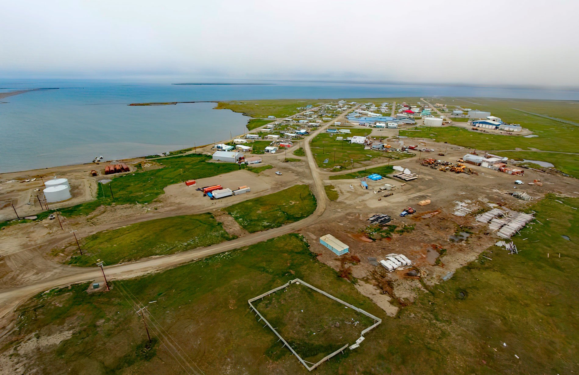
Kaktovik is a community on Barter Island and historically was a major trading center for the Iñupiat from Alaska and Inuit from Canada, situated between the Arctic Coastal Plain and the Beaufort Sea with Arey Lagoon to the west and Kaktovik Lagoon to the east, about 113 miles (182 km) east of Deadhorse and 66 miles (106 km) west-northwest of Gordon, Alaska. The name ‘Kaktovik’ is derived from the Iñupiaq word ‘Qaaktugvik’ meaning ‘seining place’. The Arctic Coastal Plain is a large region of low, flat, boggy tundra underlain by thick ground ice, and solid permafrost, covered in summer with thermokarst ‘lakes’ of melted ice which are susceptible to erosion and thawing. Features such as ice wedges and pingo mounds of soil and ice are common. This coast has an arctic climate warm enough to allow plant growth in late June, July, and August, but even then frosts may occur. Barter Island is about 50 miles (80 km) north of the Brooks Range which formed during the Mesozoic convergence of the continental Arctic Alaska terrane and is the northernmost manifestation of the North American Cordillera.
Kaktovik is one of the most geographically isolated villages in Alaska. Historically, Barter Island had no permanent settlements but was used as a seasonal encampment for semi-nomadic family groups that depended on sea mammals, caribou, and birds for subsistence. The arrival of commercial whalers in the 19th century disrupted their cultural isolation. In the early 1920s, Tom Gordon opened a trading post on the western side of Barter Island for the H.B. Liebes Company of San Francisco and this provided the Iñupiat with an opportunity to exchange trapped furs for manufactured goods until the fur prices dropped during the Great Depression. To provide a more stable economy for the Iñupiat people and prevent food shortages, semi-domesticated reindeer were brought to Alaska from Siberia but most of the herd starved during the severe winters of 1936 and 1937. Others were killed during that time to provide food and clothing for residents who were also close to starvation during those years. In late 1937, 3,000 additional reindeer were transferred from Barrow to Barter Island in one more attempt to establish the herd, but the herd diverted course and returned to Barrow, taking the remnants of the Barter Island herd with it. The Barter Island trading post closed in 1938 with the death of Tom Gordon and the other trading posts closed by 1943. Without a local source of supplies, Kaktovik residents were forced to travel either west to Barrow or east to Hershel Island in Canada.
During World War II many Iñupiat hunters were recruited into the Alaska Territorial Guard, but the Arctic coast became heavily militarized during the Cold War between the United States and the Soviet Union. In 1947, a construction company arrived on Barter Island to build an airstrip in preparation for what would become a Distant Early Warning radar installation as part of the plan to defend North America from Soviet intercontinental ballistic missiles. Four years later, the U.S. Department of the Interior authorized the U.S. Air Force to assume control over all 4500 acres (1821 ha) on Barter Island including all of Kaktovik forcing the village residents to relocate. The U.S. Department of Defense built an Air Force Base with an expanded airstrip and aircraft hangars and in the process destroyed many sod homes and ice cellars used to store food. Eventually, new ice cellars were dug and houses were rebuilt often with materials offered by the military or obtained from the refuse dump. By 1957, with the initial radar installation completed, many village residents had obtained employment as construction workers and maintenance personnel. Today, most residents maintain a traditional subsistence lifestyle, in part due to the village isolation. Kaktovik is one of eleven villages in the Alaska Eskimo Whaling Commission and participates in the fall hunt when bowhead whales move westwards. From 1973 to 1988, 1-2 bowheads per year were caught, increasing to 2-4 whales from 1989 to 2000. Historically 83 percent of the whales have been caught in September. Read more here and here. Explore more of Kaktovik and Barter Island here:

