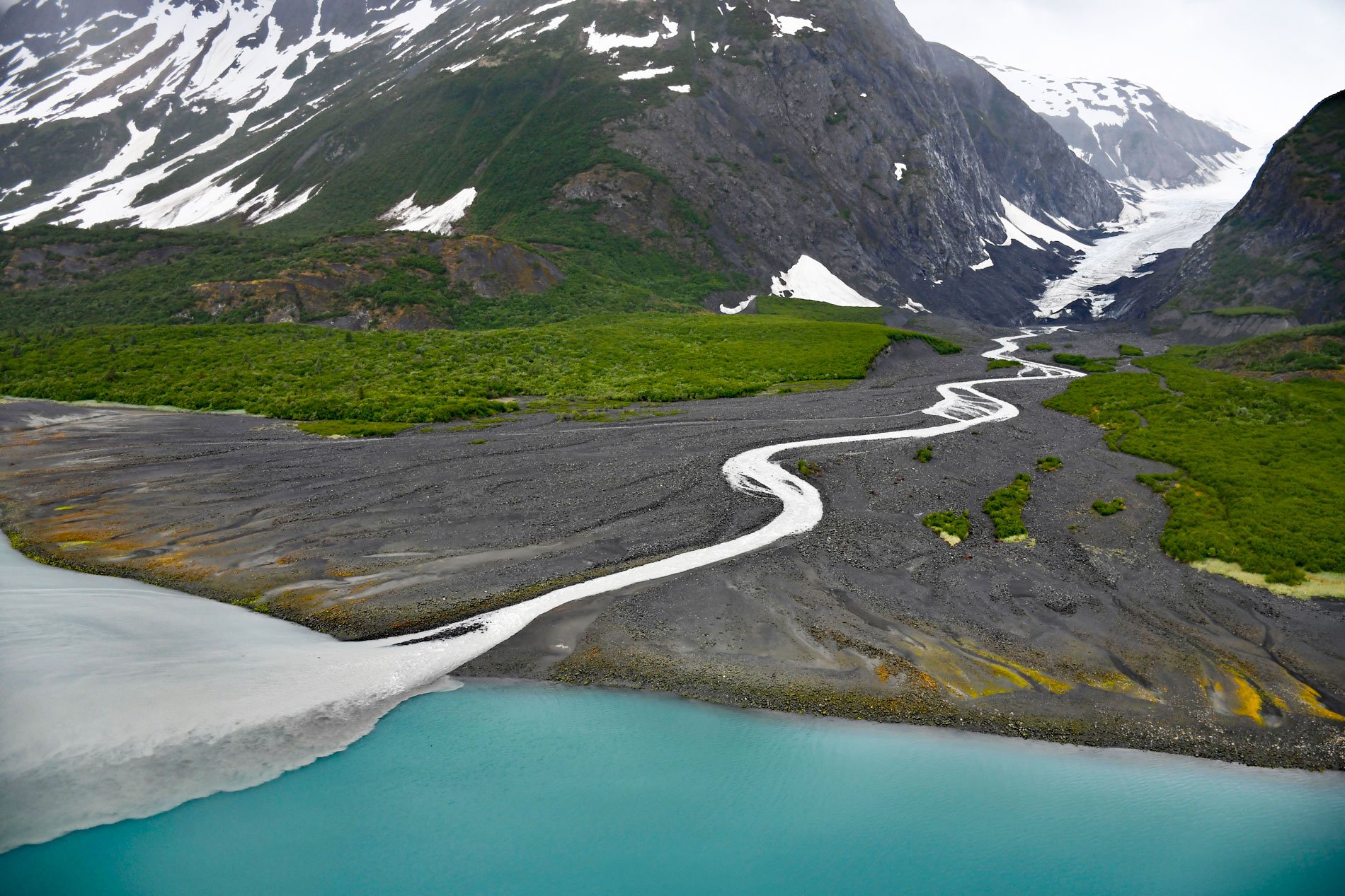
Dinglestadt Glacier has two land terminating lobes that straddle a watershed divide in the Kenai Mountains, with a minor lobe descending southeast for 4 miles (6 km) from an elevation of roughly 3300 feet (1006 m) to a tidal delta on the western shore of McCarty Glacier in Kenai Fjords National Park, about 44 miles (71 km) south-southwest of Seward and 42 miles (68 km) east of Homer, Alaska. The main branch of the glacier descends northwest for 8 miles (13 km) to a proglacial lake at the head of Sheep Creek that flows for 19 miles (31 km) to Kachemak Bay, draining a watershed of 83,480 acres (33,783 ha). The rocks of the general area belong to the Southern Margin composite terrane, and the southern flank of the Kenai Mountains bordering McCarty Fjord represent rocks of the Valdez Group that developed during the Late Cretaceous and consist primarily of complexly deformed metasedimentary greywacke, siltstone, and shale generally considered to be deposits of turbidity currents in an oceanic trench. The glacier was named in 1913 by Alfred H. Brooks of the U.S. Geological Survey for Konstantin Dingelshtedt, an employee of the Russian-American Company, who in 1834 explored a portion of the west coast of the Kenai Peninsula with Alutiiq Creole navigator Ivan Chernof.
In the initial stage of Russian colonization of Alaska, Aleut, Alutiiq, and Dena’ina Athabaskan people were conscripted for service, but most lacked the required qualifications and skills for work on ships. In 1784, when permanent Russian settlements were established on Kodiak Island, more Alaska Natives were drawn into maritime service, but by the early 19th century, they were replaced by Creoles or people of mixed European and indigenous descent. By the end of the Russian America period, one-third to one-half of the navigators, first mates, and captains who commanded Russia-American Company ships were Alutiiq Creoles who played significant roles in the geographic discoveries in the territory. Ivan Chernof was a Creole taken as a child from the Alutiiq Sugpiaq on Kodiak by Russian promyshlenniki as a hostage in 1804. He was sent to school at Sitka and likely worked as a cabin boy on Russian ships. Like many Creole children, he may have been sent to Kronstadt and Saint Petersburg for maritime training, and then returned to Russian America as a certified navigator. In 1832, Chernof made surveys in the Aleutian Islands for Friedrich von Lütke and on the Kenai Peninsula for Mikhail Tebenkov. In 1838, Chernof was captain on the brig Polypheme during an expedition to the Arctic consisting of Alutiiq and Aleut Creoles commanded by Alexander Kashevarof.
In 1909, Ulysses S. Grant and Daniel F. Higgins observed the McCarty Glacier terminus near the entrance of James Lagoon, about 7 miles (11 km) south-southwest of Dinglestadt Glacier. This coincides with the location of a submerged terminal moraine with depths of only a few fathoms (5 m) in a fjord otherwise with depths of over 100 fathoms (183 m). Tree ring data suggest that the glacier terminus began to retreat about 1905 AD, and satellite imagery collected in 1973, 1986, and 2000 to examine all the glaciers in Kenai Fjords National Park indicates that McCarty Glacier has since retreated 9 miles (15 km). Dinglestadt Glacier gained centerline length and lower glacier area between 1984 and 1991, but retreated and decreased in area from 1991 to 2021 with in an overall net loss of ice. The large volume of sediment released by the retreating glacier has resulted in the active accumulation of an ice marginal delta and large sediment plumes discharged into McCarty Fjord. The delta observed at Dinglestadt Glacier is an example of coastal habitat expansion. The retreat of land-terminating glaciers has been accompanied by the development of forests and river systems resulting in expanded habitat for salmon and terrestrial mammals. Read more here and here. Explore more of Dinglestadt Glacier and Kenai Fjords National Park here:

