
Alaska
Recent Articles
More Articles

Cape Kookoolik, Saint Lawrence Island
Kookoolik is a historical community, also known as Kukulik, located on Cape Kookoolik on the northern coast of Saint Lawrence Island, about 160 miles (258 km) southwest of Nome and 4 miles (6.5 km) east of Savoonga, Alaska.
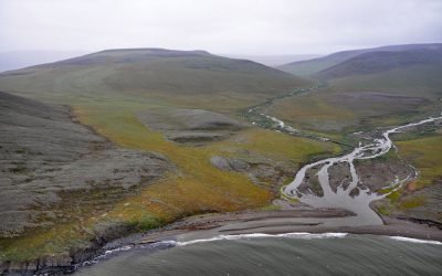
Kapaloak Creek, Cape Dyer
Kapaloak Creek starts from an elevation of roughly 1200 feet (366 m) in the Lisburne Hills and flows generally west for 8.5 miles (14 km) to Cape Dyer on the Chukchi Sea and the site of a historical Iñupiat village, about 110 miles (177 km) southwest of Point Lay and 25 miles (40 km) north-northeast of Point Hope, Alaska.

Washington Bay, Kuiu Island
Washington Bay trends east for 2 miles (3.2 km) on the northwest coast of Kuiu Island and is the site of a historical herring reduction facility near the head of the bay that is flanked by steep mountains rising abruptly to 2,800 feet (853 m) on the north and 2,200 feet (671 m) on the south, about 143 miles (230 km) northwest of Ketchikan and 24 miles (39 km) southwest of Kake, Alaska.
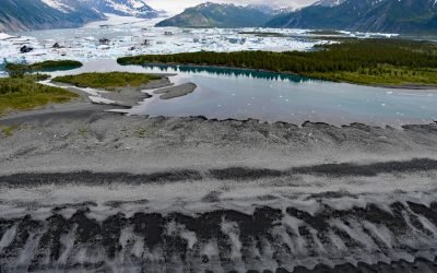
Bear Glacier, Aialik Peninsula
Bear Glacier starts from an elevation of roughly 4,000 feet (1,219 m) on the eastern flank of the Harding Icefield in Kenai Fjords National Park and descends generally southeast for 17 miles (27 km) to a proglacial lake dammed by a terminal moraine between Bear Glacier Point on the Aialik Peninsula to the south and Callisto Head to the north, about 72 miles (116 km) east-northeast of Homer and 13 miles (21 km) south of Seward, Alaska.
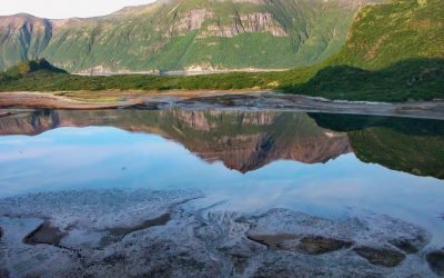
Kuliak Bay, Katmai National Park and Preserve
Kuliak Bay is about 4 miles (6.5 km) wide at the entrance on the western shore of Shelikof Strait and gradually tapers to the northwest for 5 miles (8 km) into Katmai National Park and Preserve on the Alaska Peninsula, about 92 miles (148 km) southeast of King Salmon and 74 miles (119 km) northwest of Kodiak, Alaska.

Margerie Glacier, Tarr Inlet
Margerie Glacier starts at an elevation of 9,860 feet (3,005 m) on the international border of the United States and Canada between Mount Root to the north and Mount Fairweather to the south and flows generally east for 21 miles (34 km) to tidewater at Tarr Inlet in Glacier Bay National Park and Preserve, about 101 miles (163 km) southeast of Yakutat and 66 miles (107 km) northwest of Gustavus, Alaska.
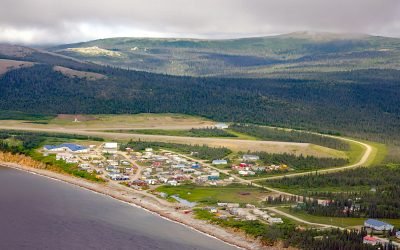
Elim, Norton Bay
Elim is a mixed Central Yup’ik and Iñupiaq community situated on the Iditarod Trail at the mouth of Elim Creek on the Seward Peninsula and the north shore of Norton Bay, about 39 miles (63 km) southwest of Koyuk and 24 miles (38 km) east-northeast of Golovin, Alaska.
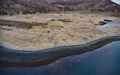
Ikatan Peninsula, Unimak Island
Ikatan Peninsula is connected to the northeastern tip of Unimak Island by a sand spit or tombolo separating Ikatan Bay to the north from Otter Cove to the south and is the site of the historical community of Ikatan, about 143 miles (230 km) northeast of Unalaska and 8 miles (13 km) south-southeast of False Pass, Alaska.

Whittier, Passage Canal
Whittier is a community and marine terminal for the Alaska Railroad and cruise ships, situated on the alluvial fan of Whittier Creek on the south shore of Passage Canal, a deglaciated fjord in northwestern Prince William Sound, about 82 miles (132 km) west-southwest of Valdez and 51 miles (82 km) southeast of Anchorage, Alaska.
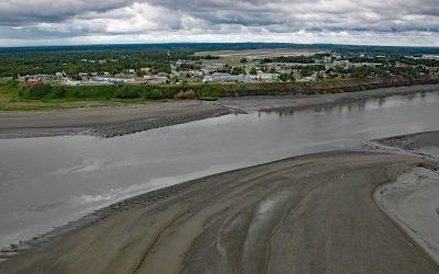
Kenai, Cook Inlet
Kenai is a community situated at the site of Shk’ituk’t, a historical Dena’ina village located on the west coast of the Kenai Peninsula, on the eastern shore of Cook Inlet at the mouth of the Kenai River, about 65 miles (15 km) southwest of Anchorage and 64 miles (103 km) north of Homer, Alaska.
About the background graphic
This ‘warming stripe’ graphic is a visual representation of the change in global temperature from 1850 (top) to 2019 (bottom). Each stripe represents the average global temperature for one year. The average temperature from 1971-2000 is set as the boundary between blue and red. The colour scale goes from -0.7°C to +0.7°C. The data are from the UK Met Office HadCRUT4.6 dataset.
Click here for more information about the #warmingstripes.