
Alaska
Recent Articles
More Articles
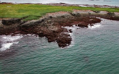
Shaw Island, Cook Inlet
Shaw Island is located in Katmai National Park and Preserve, 2.5 miles (4 km) north of the Alaska Peninsula near the entrance to Kamishak Bay on the western shore of Cook Inlet, about 119 miles (192 km) east-northeast of King Salmon and 79 miles (127 km) southwest of Homer, Alaska.
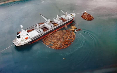
Broken Oar Cove, Yakutat Bay
Broken Oar Cove is an embayment on the southeast coast of Yakutat Bay and the site of a logging operation, about 208 miles (335 km) northwest of Juneau and 3.3 miles (5.3 km) northeast of Yakutat, Alaska.

Nunagiak, Point Belcher
Nunagiak is an abandoned village at Point Belcher that dates to the prehistorical Thule culture, located about 78 miles (126 km) southwest of Utquiagvik and 15 miles (24 km) northeast of Wainwright, Alaska.
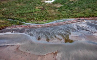
Kashvik Bay, Cape Kubugakli
Cape Kubugakli is a prominent headland on Shelikof Strait that forms the southwest coast of Kashvik Bay and marks the southern coastal boundary of Katmai National Park and Preserve, about 98 miles (158 km) west-northwest of Kodiak and 75 miles (121 km) southeast of King Salmon, Alaska.

Dutton, Cottonwood Bay
Dutton is a historical mining camp at the mouth of Ptarmigan Creek at the head of Cottonwood Bay, about 78 miles (126 km) west of Homer and 18 miles (29 km) southeast of Pedro Bay, Alaska.
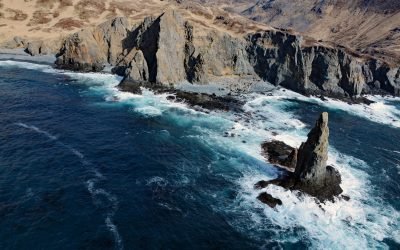
Tigalda Sea Stack, Krenitzin Islands
Sea stacks are a common feature on the Gulf of Alaska coast, particularly along the Alaska Peninsula and the Eastern Aleutian Islands, about 200 miles (323 km) southwest of Sand Point and 64 miles (103 km) east-northeast of Dutch Harbor, Alaska.
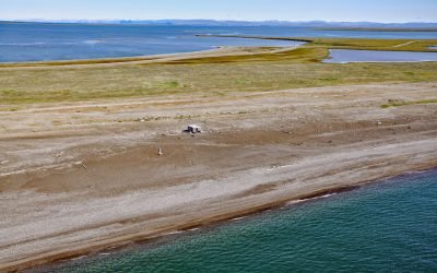
Jabbertown, Point Hope
Jabbertown is a historical shore whaling station on the Chukchi Sea coast, about 150 miles (242 km) northwest of Kotzebue and 2.5 miles (4 km) southeast of Point Hope, also known as Tikiġaq or Tigara, Alaska.
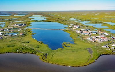
Nunam Iqua, Sheldon Point
Nunam Iqua is a small community on Sheldon Point located on the left bank of Kwemeluk Pass in the Yukon River delta, about 157 miles (253 km) northwest of Bethel and 12.4 miles (20 km) south-southwest of Alakanuk, Alaska.

Sealing Point, Cape Krusenstern
A sealing observation tower used seasonally by Iñupiat hunters is at the tip of Cape Krusenstern, about 48 miles (77 km) southeast of Kivalina and 35 miles (56 km) northwest of Kotzebue, Alaska.

Kustatan, West Foreland
Kustatan is a historical Dena’ina community on West Foreland, on the west side of Cook Inlet near the mouth of the Kustatan River, about 71 miles (115 km) southwest of Anchorage and 20 miles (32 km) northwest of Kenai, Alaska.
About the background graphic
This ‘warming stripe’ graphic is a visual representation of the change in global temperature from 1850 (top) to 2019 (bottom). Each stripe represents the average global temperature for one year. The average temperature from 1971-2000 is set as the boundary between blue and red. The colour scale goes from -0.7°C to +0.7°C. The data are from the UK Met Office HadCRUT4.6 dataset.
Click here for more information about the #warmingstripes.