
Alaska
Recent Articles
More Articles
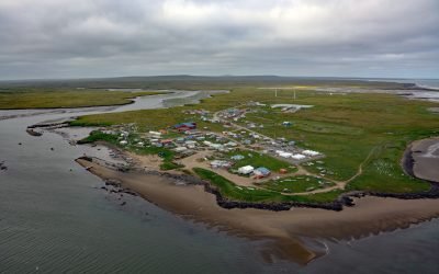
Mekoryuk, Nunivak Island
Mekoryuk is a community situated at the western entrance to Shoal Bay on the northern shore of Nunivak Island in the Bering Sea, about 153 miles (246 km) west-southwest of Bethel and 80 miles (129 km) south of Hooper Bay, Alaska.
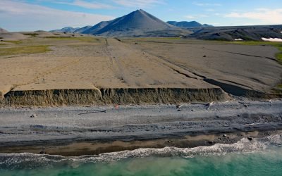
Lost River Mine, York Mountains
Lost River starts at an elevation of 1400 feet (427 m) on the south flank of the York Mountains on the Seward Peninsula and flows south for 9.5 miles (15 km) to the Bering Sea, about 86 miles (138 km) northwest of Nome and 31 miles (50 km) southeast of Wales, Alaska.
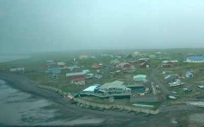
Nelson Lagoon, Bering Sea
Nelson Lagoon is a community situated on the Bering Sea coast of the Alaska Peninsula, on a narrow barrier sand spit forming the embayment of Nelson Lagoon, about 258 miles (415 km) northeast of Dutch Harbor and 24 miles (39 km) west of Port Moller, Alaska.
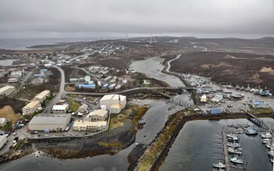
Sand Point, Popof Island
Sand Point is a community situated on Humboldt Harbor on the western shore of Popof Island, one of the Shumagin Islands in the Gulf of Alaska off the southern coast of the Alaska Peninsula, about 262 miles (422 km) northeast of Dutch Harbor and 65 miles (105 km) southwest of Perryville, Alaska.
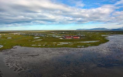
Hooper Bay, Bering Sea
Hooper Bay is a Central Yup’ik community located on the northern shore of an embayment also named Hooper Bay in the Bering Sea, between Dall Point to the north and Nuok Spit to the south, about 154 miles (248 km) west-northwest of Bethel and 28 miles (45 km) south-southwest of Scammon Bay, Alaska.
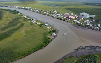
Kotlik, Apoon Pass
Kotlik is a Yup’ik community situated on Kotlik Slough, a side channel of Apoon Pass formed by the confluence of the Kotlik and Little Kotlik River in the Yukon River Delta, 6 miles (10 km) inland from Pastol Bay on the southern coast of Norton Sound, about 116 miles (187 km) southeast of Nome and 56 miles (90 km) southwest of Saint Michael, Alaska.
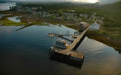
Hydaburg, Prince of Wales Island
Hydaburg is a community situated on Sukkwan Strait at the northern end of Cordova Bay, opposite Sukkwan Island to the south, on the highly convoluted southwestern coast of Prince of Wales Island in the Alexander Archipelago, about 160 miles (258 km) south-southeast of Sitka and 48 miles (77 km) west of Ketchikan, Alaska.
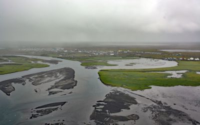
Quinhagak, Kanektok River
Quinhagak or Kwinhagak is a Central Yup’ik community situated on the Yukon-Kuskokwim Delta near the mouth of the Kanektok River, about 73 miles (118 km) south of Bethel and 45 miles (72 km) north of Goodnews Bay, Alaska.
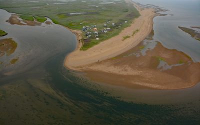
Moses Point, Kwiniuk River
Moses Point is a fish camp, used mostly by residents of Elim, situated at the mouth of the Kwiniuk River on the northern shore of Norton Bay, about 100 miles (160 km) east of Nome and 31 miles (50 km) southwest of Koyuk, Alaska.
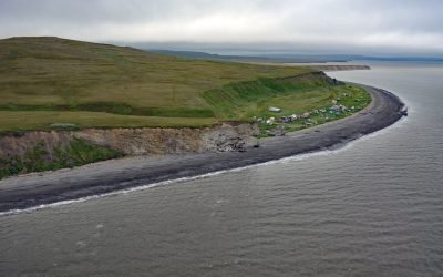
Umkumiut, Nelson Island
Umkumiut is a seasonally occupied Yup’ik fish camp in Kangirlvar Bay, also known as Toksook Bay, located on the western shore of Nelson Island in the Bering Sea, between Atrnak Point to the north and Chinigyak Cape to the south, about 118 miles (190 km) west-southwest of Bethel and 3.8 miles (6 km) southwest of Toksook Bay, Alaska.
About the background graphic
This ‘warming stripe’ graphic is a visual representation of the change in global temperature from 1850 (top) to 2019 (bottom). Each stripe represents the average global temperature for one year. The average temperature from 1971-2000 is set as the boundary between blue and red. The colour scale goes from -0.7°C to +0.7°C. The data are from the UK Met Office HadCRUT4.6 dataset.
Click here for more information about the #warmingstripes.