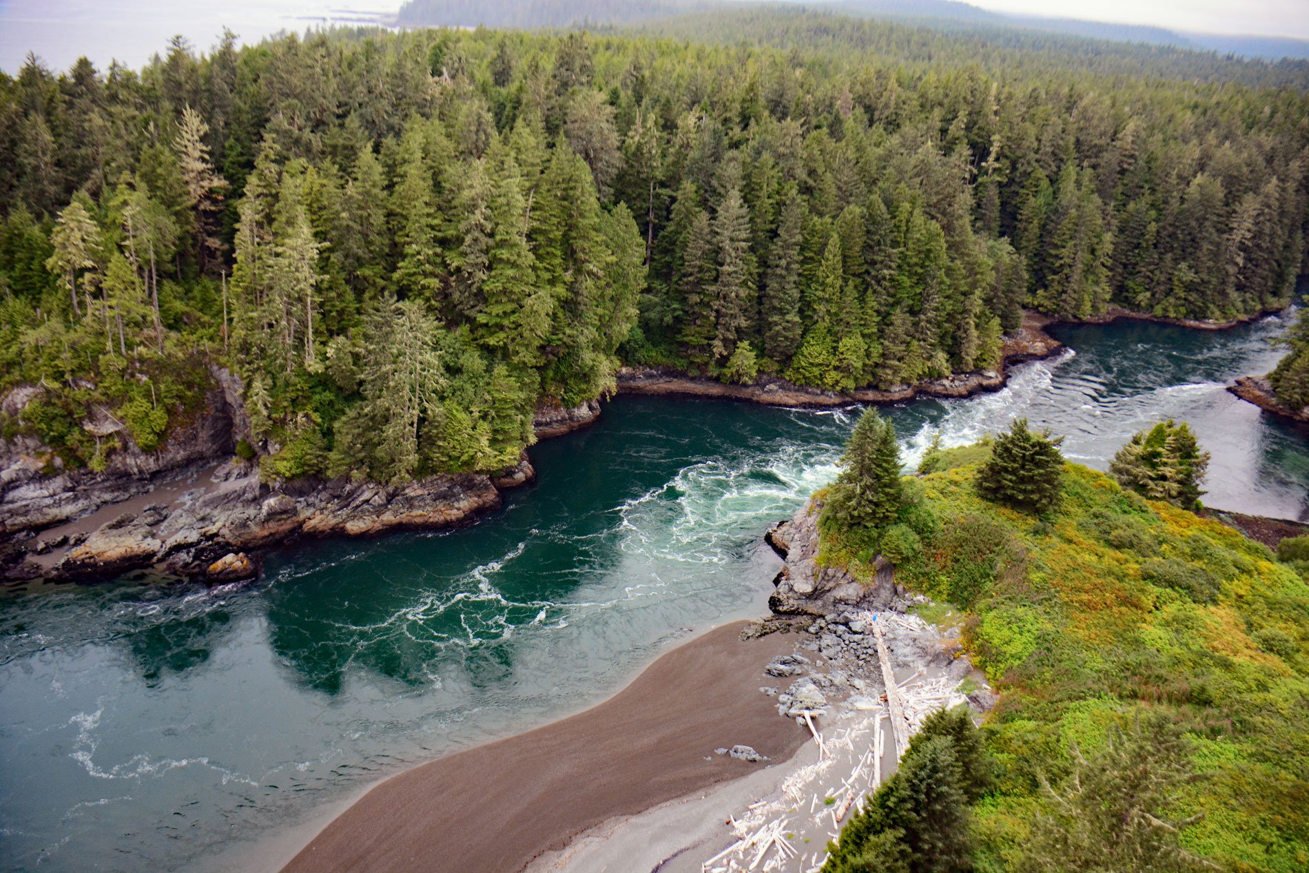
Whyac is a historical Ditidaht First Nation village on the southern shore beside Nitinat Narrows, a tidal channel about 1.9 miles (3 km) long that connects Nitinat Lake to the Pacific Ocean on the north shore of the Strait of Juan de Fuca on Vancouver Island, about 22 miles (35 km) northwest of Port Renfrew and 17 miles (27 km) southeast of Bamfield, British Columbia. The Ditidaht people often refer to the village site as ‘Whyac’, which is derived from ‘waayaa’ meaning ‘high place’, referring to the location on a high bluff at the entrance to Nitinat Narrows. The channel is navigable by small boats, although dangerous tidal bores, sand bars, rocks, and reefs occur. These rocks represent a stratigraphic sequence of sedimentary and volcanogenic rocks that comprise much of Vancouver Island and are part of the extensive Wrangellia terrane that developed during the Devonian to Jurassic as an island arc extending north to Haida Gwaii. The western and southern margins of Wrangellia are structurally juxtaposed with the Pacific Rim terrane, which consists of possible mélange deposits. The bedrock at Nitinat Narrows is part of the Carmanah Group of sedimentary rocks consisting of sandstone and siltstone from the late Eocene overlying igneous and metamorphic rocks of the West Coast Complex from the Paleozoic and Mesozoic.
The Ditidaht oral tradition indicates that the original Nitinaht or ‘Nitinat’ people were joined by another group that came from Tatoosh Island across the Strait of Juan De Fuca and established a settlement at present-day Jordan River and were called the ‘diitiida people’ which was later anglicized as ‘Ditidaht’ or sometimes pronounced as ‘Nitinaht’. Waayaa was the main Ditidaht village for many years. In historical times, a stockade was built around the village to protect the residents from enemy attacks. In 1864, the Vancouver Island Exploring Expedition led by Robert Brown visited the village and saw this stockade. Brown reported that most of the Nitinaht villages were fortified with wooden pickets to prevent any night attack. Waayaa was the principal village at that time, built on a cliff, stockaded on the seaward side, and could be reached only by a narrow entrance where the surf breaks continuously, making it virtually impregnable to hostile canoemen. The site was so small that houses here were built close to one another. In 1901, 63 Ditidaht people were living in 12 houses at Waayaa, and in 1914, there were only 14 houses. The village was inhabited until the 1960s when the last family moved to Malachan on Nitinat Lake.
The Ditidaht traditional territory is on southwestern Vancouver Island and several historical village sites on the coast became part of the Pacific Rim National Park in 1973. The park is 126,080 acres (51,023 ha) which represents the Pacific Coast Mountain landscape characterized by rugged coasts and temperate rainforests. The park comprises three separate regions including Long Beach, the Broken Group Islands, and the West Coast Trail. The West Coast Trail passes through the traditional territory of the Pacheedaht, Ditidaht, Huu-ay-aht, and Nuu-chah-nulth First Nations who have inhabited the area for more than 4,000 years. Native trails, used for trade and travel, existed in the area before European settlement. In the 1800s, Europeans began to use the area to build and maintain a telegraph line between Victoria and Cape Beale. More ships began to travel along the west coast of Vancouver Island, particularly between San Francisco and Alaska, and the reefs and breakers off the coast posed a danger to navigation. The West Coast Trail was originally called the Dominion Lifesaving Trail built in 1907 to allow shipwreck survivors and rescuers to travel through the forest making use of the telegraph line and cabins. In 1973, the trail became part of Pacific Rim National Park and is now a backpacking trail that follows the coast for 47 miles (75 km) and is considered one of the world’s best hiking trails. Read more here and here. Explore more of Whyac and Nitinat Narrows here:

