by CoastView | Sep 3, 2025 | 2025, Beaches, California, Coastal Features, Historical, Land Use, Natural History, Rivers
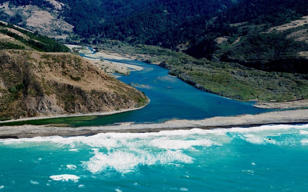
Listen to the article here https://coastview.org/wp-content/uploads/2025/06/Mattole-River.mp3 The Mattole River flows approximately 62 miles (100 km) through the King Range to the Lost Coast at the Punta Gorda State Marine Reserve, about 10 miles (16 km) south of Cape...

by CoastView | Sep 1, 2025 | 2025, Beaches, Coastal Features, Communities, Historical, Land Use, Natural History, Oregon, Parks, Rivers
Listen to the article here https://coastview.org/wp-content/uploads/2025/06/Cannon-Beach.mp3 Ecola Creek flows into the Pacific Ocean at the northern edge of Cannon Beach, a small resort community approximately 30 miles (48 km) north of Tillamook and 8 miles (12 km)...

by CoastView | Aug 26, 2025 | 2025, Beaches, California, Coastal Features, Communities, Headlands, Historical, Land Use, Lighthouses
Listen to the article here https://coastview.org/wp-content/uploads/2025/06/Santa-Barbara.mp3 The Santa Barbara Lighthouse is located between the East Mesa and West Mesa neighborhoods, approximately 2 miles (3 km) west of the Santa Barbara Harbor in Santa Barbara,...

by CoastView | Aug 24, 2025 | 2025, Beaches, Coastal Features, Islands, Land Use, Natural History, Rivers, Washington
Listen to the article here https://coastview.org/wp-content/uploads/2025/06/Tunnel-Island.mp3 The Raft River, a stream located entirely within the Quinault Indian Reservation on the Olympic Peninsula, flows into the Pacific Ocean at Tunnel Island, approximately 9...
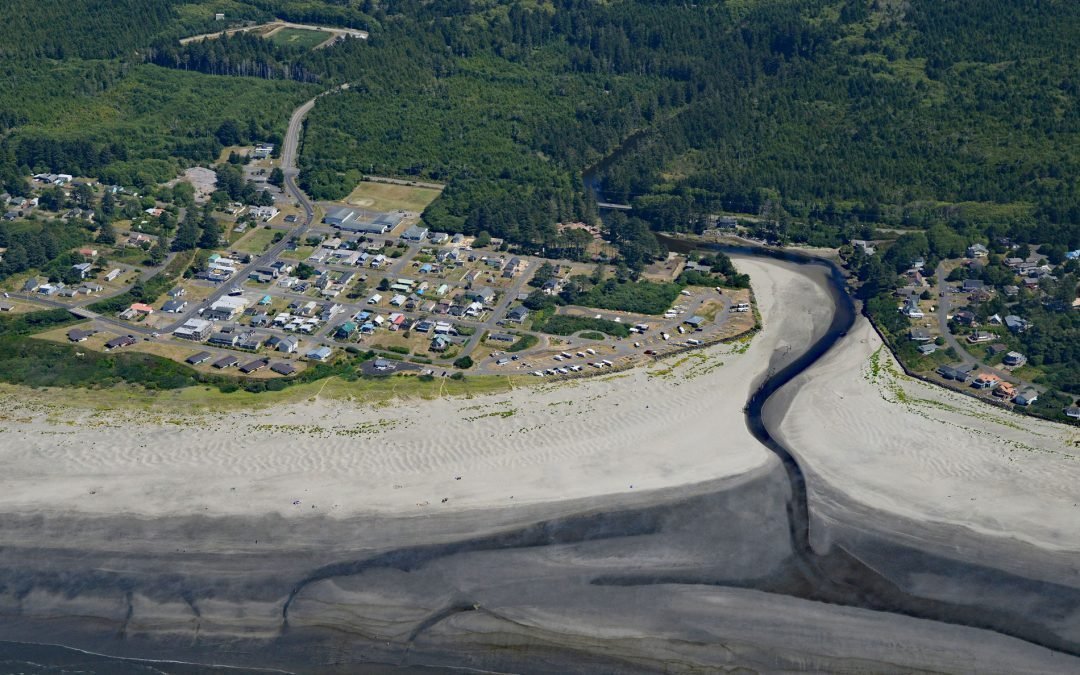
by CoastView | Aug 10, 2025 | 2025, Beaches, Coastal Features, Communities, Developments, Historical, Land Use, Natural History, Rivers, Washington
Listen to the article here https://coastview.org/wp-content/uploads/2025/07/Pacific-Beach.mp3 Pacific Beach is a community located at the mouth of Joe Creek, about 25 miles (40 km) northwest of Hoquiam and 11 miles (18 km) south of Moclips, Washington. Beach sands...

by CoastView | Aug 8, 2025 | 2025, Beaches, British Columbia, Coastal Features, Communities, Historical, Islands, Land Use, Parks, Rivers, Shipwrecks
Listen to the article here https://coastview.org/wp-content/uploads/2025/06/Pezuta.mp3 The Tlell River flows generally north-northeast for 28 miles (45 km) to Hecate Strait, near the wreck of the steamship SS Pezuta, about 29 miles (47 km) south-southeast of Masset...