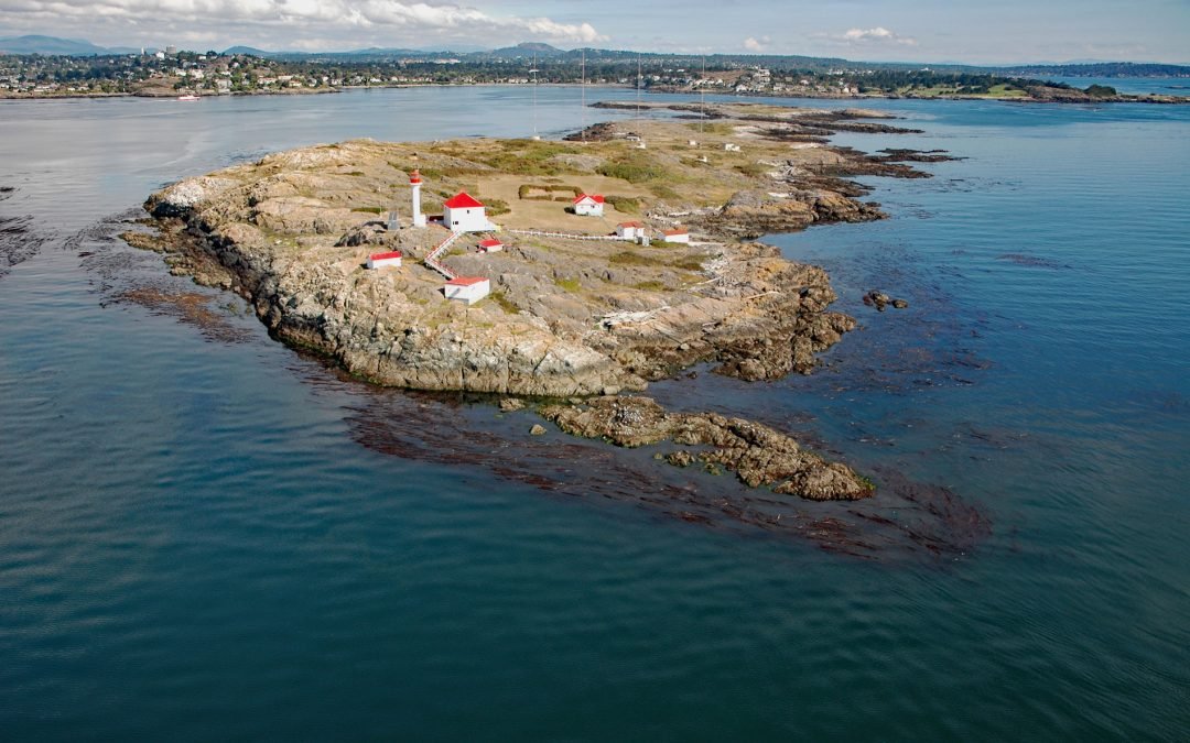
by CoastView | Feb 11, 2026 | 2026, Biodiversity, British Columbia, Coastal Features, Developments, Islands, Land Use, Lighthouses, Natural History
Listen to the article here https://coastview.org/wp-content/uploads/2026/01/StainesPoint.mp3 Staines Point is the southern tip of the Trial Islands, which comprise two islets separated by a narrow channel in the Strait of Juan de Fuca about 0.5 miles (0.8 km) offshore...
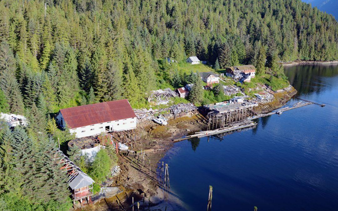
by CoastView | Feb 4, 2026 | 2026, British Columbia, Canneries, Coastal Features, Communities, Embayments, Historical, Land Use
Listen to the article here https://coastview.org/wp-content/uploads/2026/01/Butedale.mp3 Butedale is a historical salmon cannery and community located on a small embayment adjacent to Butedale Falls along the Inside Passage on the north-east side of Princess Royal...

by CoastView | Jan 29, 2026 | 2026, British Columbia, Coastal Features, Communities, Developments, Historical, Land Use, Parks
Listen to the article here https://coastview.org/wp-content/uploads/2026/01/SiwashRock.mp3 Siwash Rock is a sea stack on the western shoreline of Stanley Park on Burrard Inlet, between English Bay to the south and the entrance to Vancouver Harbour to the north, about...

by CoastView | Jan 22, 2026 | 2026, British Columbia, Coastal Features, Islands, Natural History
Listen to the article here https://coastview.org/wp-content/uploads/2026/01/DoddNarrows.mp3 Dodd Narrows is located at the northwest end of Mudge Island, separating it from Vancouver Island, approximately 33 miles (53 km) west-southwest of Vancouver and 6 miles (10...

by CoastView | Jan 17, 2026 | 2026, British Columbia, Coastal Features, Communities, Developments, Embayments, Historical, Land Use
Listen to the article here https://coastview.org/wp-content/uploads/2025/12/GonzalesBay.mp3 Gonzales Bay is located on Vancouver Island, along the northern shore of the Strait of Juan de Fuca between Ross Bay to the west and McNeill Bay to the east, approximately 1.4...

by CoastView | Jan 11, 2026 | 2026, British Columbia, Coastal Features, Developments, Islands, Land Use, Natural History
Listen to the article here https://coastview.org/wp-content/uploads/2025/12/JamesIsland.mp3 James Island is one of the Southern Gulf Islands located in Haro Strait, between Cordova Channel to the west and Sidney Channel to the east, about 12 miles (19 km) north of...