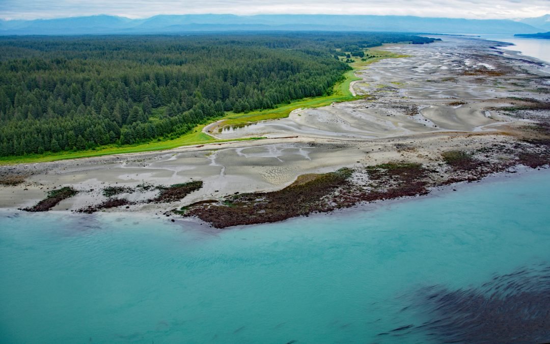
by CoastView | Feb 25, 2025 | 2025, Alaska, Beaches, Climate Change, Coastal Features, Embayments, Glaciers, Headlands, Historical, Land Use, Parks, Shipwrecks
Listen to the article here https://coastview.org/wp-content/uploads/2025/03/Ancon-Rock.mp3 Ancon Rock is a reef located about 0.5 miles (0.8 km) off Point Gustavus on the eastern shore, at the entrance to Glacier Bay within Glacier Bay National Park and Preserve,...
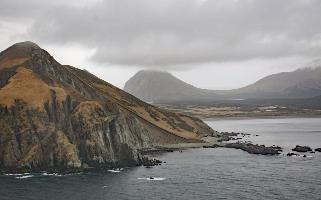
by CoastView | Feb 24, 2025 | 2025, Alaska, Biodiversity, Chemical Pollution, Climate Change, Coastal Features, Historical, Islands, Land Use
Listen to the article here https://coastview.org/wp-content/uploads/2025/03/Barren-Islands.mp3 Barren Islands are the northernmost of the Kodiak Archipelago, located near Lower Cook Inlet, between Stevenson Entrance to the south and Kennedy Entrance to the north,...
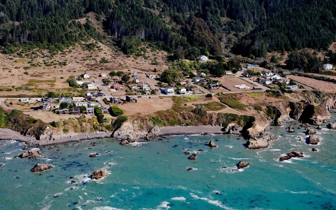
by CoastView | Feb 23, 2025 | 2025, Beaches, California, Climate Change, Coastal Features, Communities, Developments, Historical, Land Use
Listen to the article here https://coastview.org/wp-content/uploads/2025/03/Westport.mp3 Westport is a historic timber export community on the Mendocino coast, where lumber schooners were loaded using long chutes built across nearshore rocks, about 83 miles (134 km)...
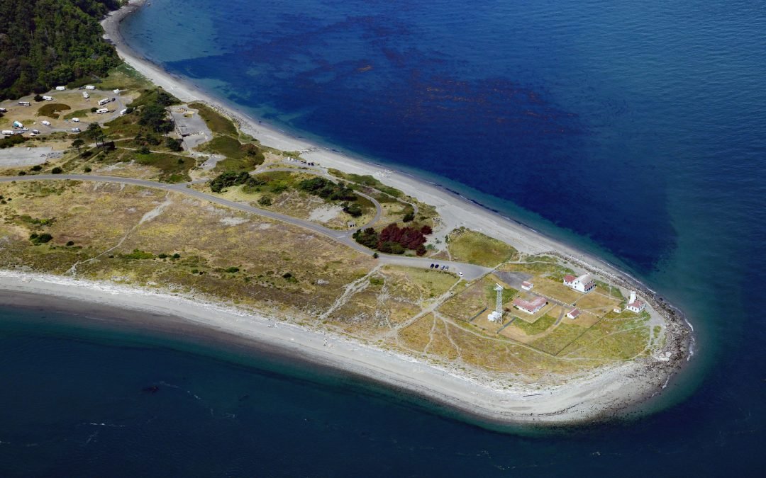
by CoastView | Feb 22, 2025 | 2025, Beaches, Climate Change, Coastal Features, Developments, Headlands, Historical, Land Use, Lighthouses, Parks, Washington
Listen to the article here https://coastview.org/wp-content/uploads/2025/03/Point-Wilson-1.mp3 Point Wilson is the site of a historic light station on the grounds of former Fort Worden, situated on a low, broad sand spit that extends northeast for 1.5 miles (0.8 km)...
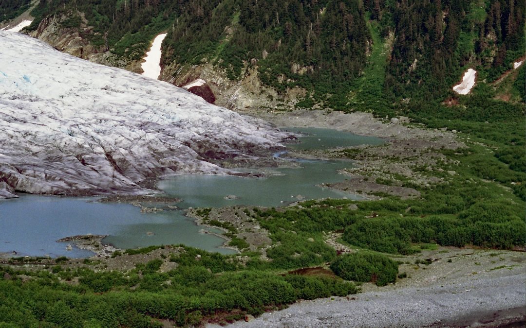
by CoastView | Feb 21, 2025 | 2025, Alaska, Climate Change, Coastal Features, Embayments, Glaciers, Historical
Listen to the article here https://coastview.org/wp-content/uploads/2025/03/Bainbridge-1.mp3 Bainbridge Glacier originates on Pinnacle Mountain at the edge of the Sargent Icefield on the Kenai Peninsula, and flows east for 10 miles (16 km) to Port Bainbridge, about 47...
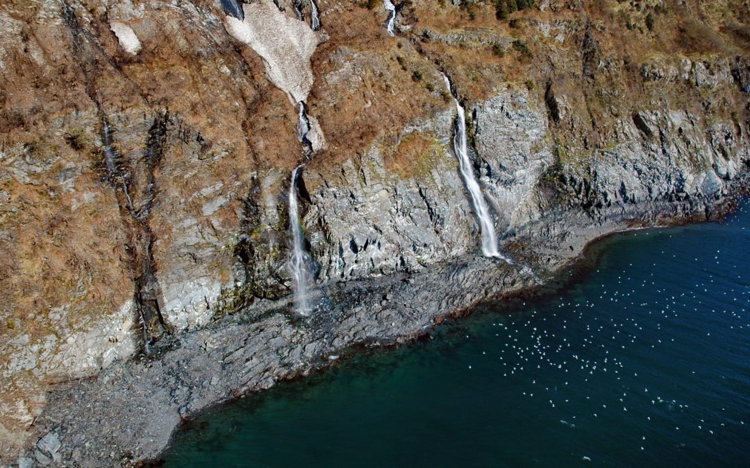
by CoastView | Feb 19, 2025 | 2025, Alaska, Biodiversity, Climate Change, Coastal Features, Embayments, Glaciers, Historical, Land Use, Waterfalls
Listen to the article here https://coastview.org/wp-content/uploads/2025/03/Rookery.mp3 Rookery Falls is on the northern shore of Passage Canal in Prince William Sound, about 50 miles (80 km) southeast of Anchorage and 1.7 miles (1.9 km) north-northeast of Whittier,...