by CoastView | Oct 3, 2025 | 2025, British Columbia, Coastal Features, Communities, Embayments, Historical, Islands, Land Use, October 2025, Rivers
Listen to the article here https://coastview.org/wp-content/uploads/2025/06/Osland.mp3 Osland was once an active fishing and boatbuilding community on the east coast of Smith Island at the mouth of the Skeena River, approximately 68 miles (109 km) southwest of Terrace...

by CoastView | Sep 30, 2025 | 2025, California, Coastal Features, Communities, Developments, Embayments, Historical, Land Use, Lighthouses
Listen to the article here https://coastview.org/wp-content/uploads/2025/06/Walton-Lighthouse.mp3 Walton Lighthouse is located on the west jetty at the entrance to Santa Cruz Harbor, adjacent to Seabright State Beach, approximately 25 miles (40 km) north-northwest of...

by CoastView | Sep 29, 2025 | 2025, Alaska, Coastal Features, Communities, Developments, Embayments, Historical, Land Use, Mines, Parks
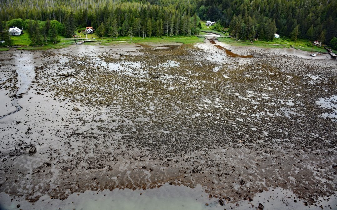
Listen to the article here https://coastview.org/wp-content/uploads/2025/06/Sumdum-Mine.mp3 Sumdum is a historical mine and community located at the head of Sanford Cove, an inlet on the southern shore of Endicott Arm, approximately 64 miles (103 km) north-northwest...

by CoastView | Sep 26, 2025 | 2025, British Columbia, Canneries, Coastal Features, Communities, Developments, Historical, Land Use, Rivers
Listen to the article here https://coastview.org/wp-content/uploads/2025/06/Carlisle-Cannery.mp3 Carlisle was a historical salmon cannery located on the east bank at the mouth of the Skeena River, about 66 miles (106 km) southwest of Terrace and 17 miles (27 km)...

by CoastView | Sep 19, 2025 | 2025, British Columbia, Communities, Islands
Listen to the article here https://coastview.org/wp-content/uploads/2025/06/Kitkatla.mp3 Kitkatla, also known as Lach Klan or Laxklan by the Tsimshian, is a small village on the north coast of Dolphin Island, approximately 28 miles (45 km) southwest of Prince Rupert,...

by CoastView | Sep 15, 2025 | 2025, Coastal Features, Communities, Historical, Land Use, Natural History, Oregon, Rivers
Listen to the article here https://coastview.org/wp-content/uploads/2025/06/Ophir.mp3 Ophir is a small community situated on Euchre Creek in Curry County, approximately 0.5 miles (0.8 km) upstream from the Pacific Ocean and about 4 miles (6.5 km) northeast of the...