
by CoastView | Aug 12, 2024 | 2024, Alaska, Beaches, Communities, Islands, Rivers
Tyonek is a historical Dena’ina Athabascan community situated on a bluff on the northwest shore of Cook Inlet, about 43 miles (69 km) west-southwest of Anchorage and 35 miles (56 km) north of Kenai, Alaska. The village name is derived from the word Tyone meaning...

by CoastView | Aug 9, 2024 | 2024, Alaska, Best of 2025, Coastal Features, Developments, Historical, Islands, Lighthouses
Cape Sarichef is located at the southwestern end of Unimak Island, at the northwestern entrance to Unimak Pass on the Bering Sea coast, and on the northwest flank of Pogromni Volcano, about 80 miles (129 km) northeast of Dutch Harbor and 63 miles (101 km)...

by CoastView | Aug 7, 2024 | 2024, Biodiversity, British Columbia, Coastal Features, Embayments, Historical, Islands
Whaler Bay is located on the southeast end of Galiano Island adjacent to Sturdies Bay and across the island from Montague Harbour, about 28 miles (45 km) south-southwest of Vancouver and 18 miles (29 km) north of Sidney, British Columbia. Galiano Island is one of the...

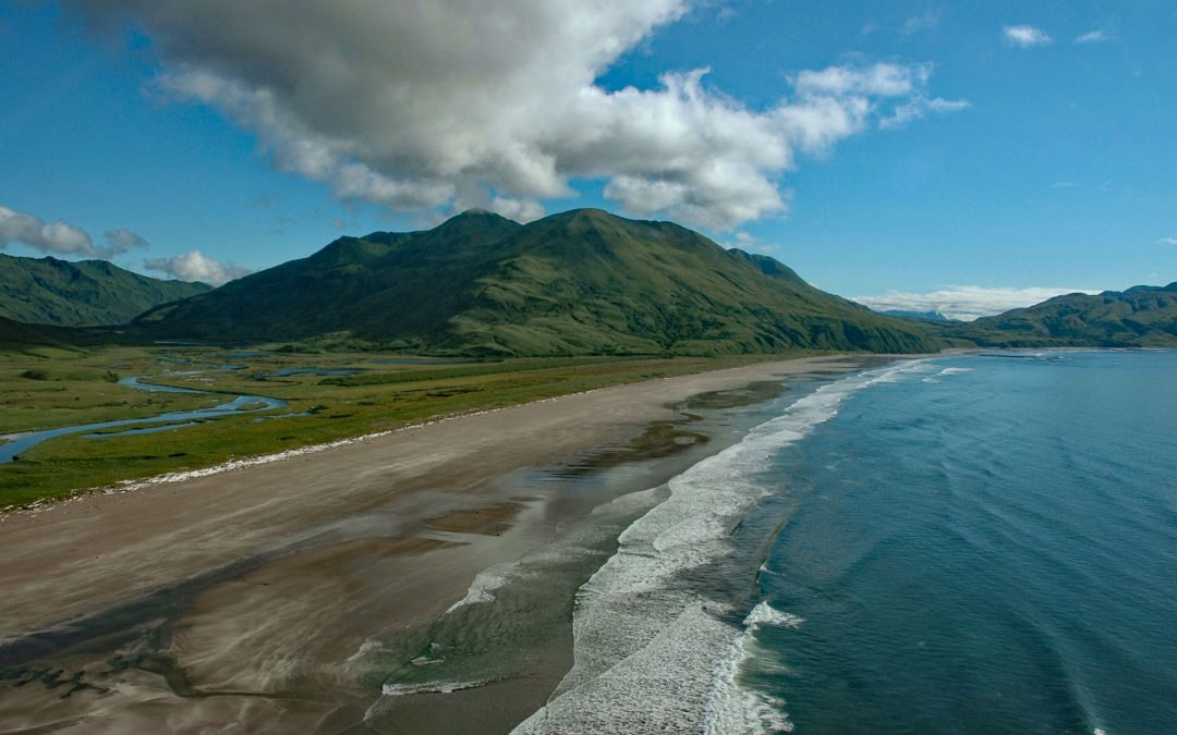
by CoastView | Aug 6, 2024 | 2024, Alaska, Beaches, Biodiversity, Climate Change, Coastal Features, Embayments, Islands
Stockdale Harbor is on the northwest coast of Montague Island in Prince William Sound, about 62 miles (100 km) southeast of Whittier and 54 miles (87 km) southwest of Cordova, Alaska. In 1776, Nathaniel Portlock joined HMS Discovery as master’s mate under the...
by CoastView | Aug 2, 2024 | 2024, Alaska, Beaches, Chemical Pollution, Embayments, Historical, Islands, Shipwrecks
Ocean Bay is on the southeast shore of Sitkalidak Island in the Kodiak Archipelago, about 56 miles (90 km) southwest of Kodiak and 9 miles (15 km) southeast of the village of Old Harbor, Alaska. The Kodiak Archipelago is in the western Gulf of Alaska and has about 32...
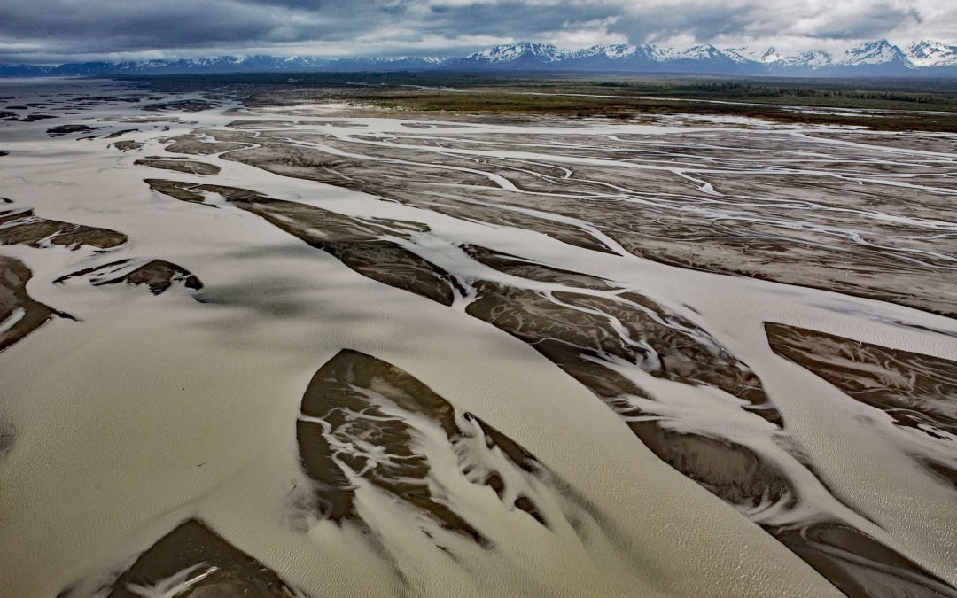
by CoastView | Jul 31, 2024 | 2024, Alaska, Coastal Features, Glaciers, Islands, Land Use, Mines, Natural History, Rivers
The Copper River watershed drains about 24,000 square miles (62,000 sq km) in the Wrangell, Chugach, and Saint Elias mountains and the mainstem flows for about 290 miles (470 km) to the Gulf of Alaska where it creates a wide delta, about 195 miles west-northwest of...