by CoastView | May 23, 2024 | 2024, Alaska, Embayments, Historical, Islands, Rivers
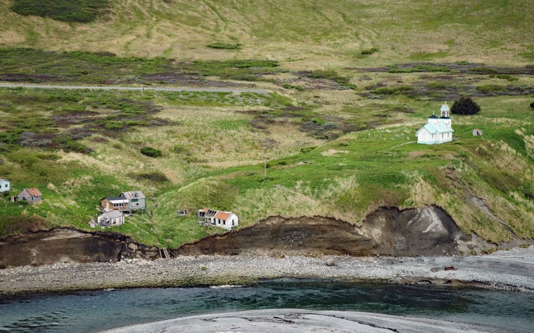
Karluk is a historical fishing community situated on a barrier spit at the mouth of Karluk Lagoon on the west coast of Kodiak Island, about 301 miles (485 km) southwest of Anchorage and 88 miles (142 km) southwest of Kodiak, Alaska. The Karluk River flows north and...

by CoastView | May 13, 2024 | 2024, Alaska, Glaciers, Parks, Rivers
Dangerous River starts at Harlequin Lake in the Brabazon Mountains of the Fairweather Range and flows southwest for 16 miles (26 km) to the Gulf of Alaska, about 102 miles (165 km) northwest of Gustavus and 50 miles (81 km) southeast of Yakutat, Alaska. The name was...

by CoastView | May 4, 2024 | 2024, Alaska, Coastal Features, Rivers
The Red River is a stream on Kodiak Island that flows south for about 4.5 miles (7 km) to Shelikof Strait, 2 miles (3.2 km) east of Bumble Bay, and about 80 miles (129 km) southwest of Kodiak and 6 miles (10 km) northwest of Ayakulik, Alaska. The name is a translation...
by CoastView | Apr 30, 2024 | 2024, Alaska, Coastal Features, Communities, Developments, Embayments, Land Use, Natural History, Rivers
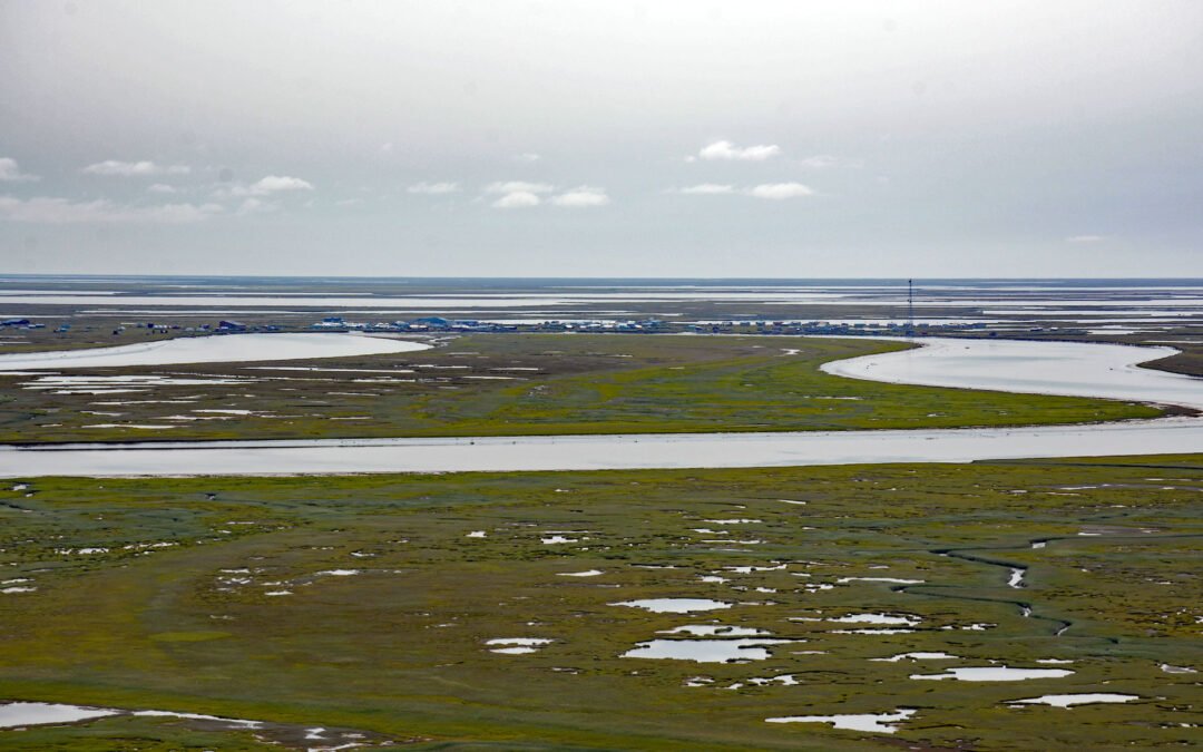
Kipnuk is a Central Yup’ik village situated on a sharp bend of the Kuguklik River, 5 miles (8 km) upstream from the estuary in Kinak Bay on the Bering Sea, about 98 miles (158 km) southwest of Bethel and 18 miles (29 km) south-southeast of Chefornak, Alaska. The...
by CoastView | Apr 28, 2024 | 2024, Alaska, Beaches, Coastal Features, Embayments, Historical, Land Use, Natural History, Rivers
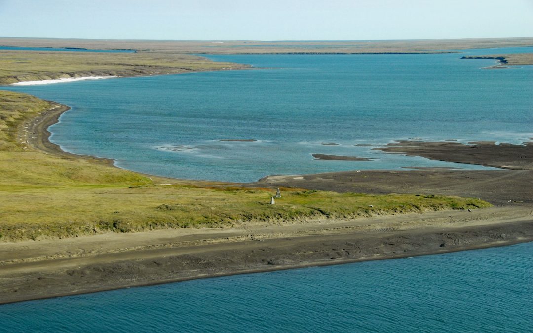
Will Rogers-Wiley Post Memorial is at Walakpa Bay, a coastal inlet that extends 6 miles (10 km) east from the Chukchi Sea and is fed by a watershed of 56,487 acres (22,860 ha), about 76 miles (123 km) northeast of Wainwright and 11 miles (18 km) southwest of...

by CoastView | Apr 26, 2024 | 2024, Alaska, Beaches, Coastal Features, Developments, Historical, Land Use, Natural History, Rivers
Marys Slough is a side channel about 5 miles (8 km) long at the mouth of the Unalakleet River formed by a barrier spit on Norton Sound that creates an extensive tidal wetland, about 46 miles (74 km) northeast of Saint Michael and 1.1 miles (1.8 km) south-southeast of...