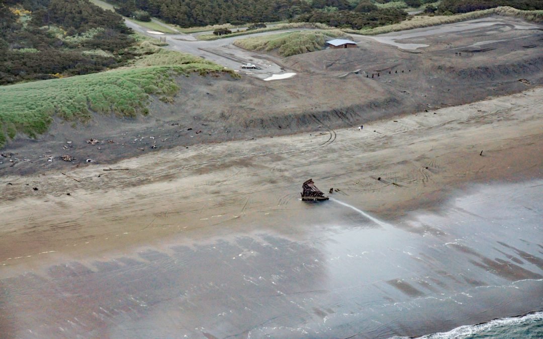
by CoastView | Feb 28, 2026 | 2026, Beaches, Historical, Land Use, March 2026, Oregon, Parks, Shipwrecks
Listen to the article here https://coastview.org/wp-content/uploads/2026/01/PeterIredale.mp3 Peter Iredale was a British four-masted bark that ran aground in 1906 on Clatsop Spit, about 7 miles (11 km) west of Astoria and 2 miles (3 km) south-west of Hammond, Oregon....
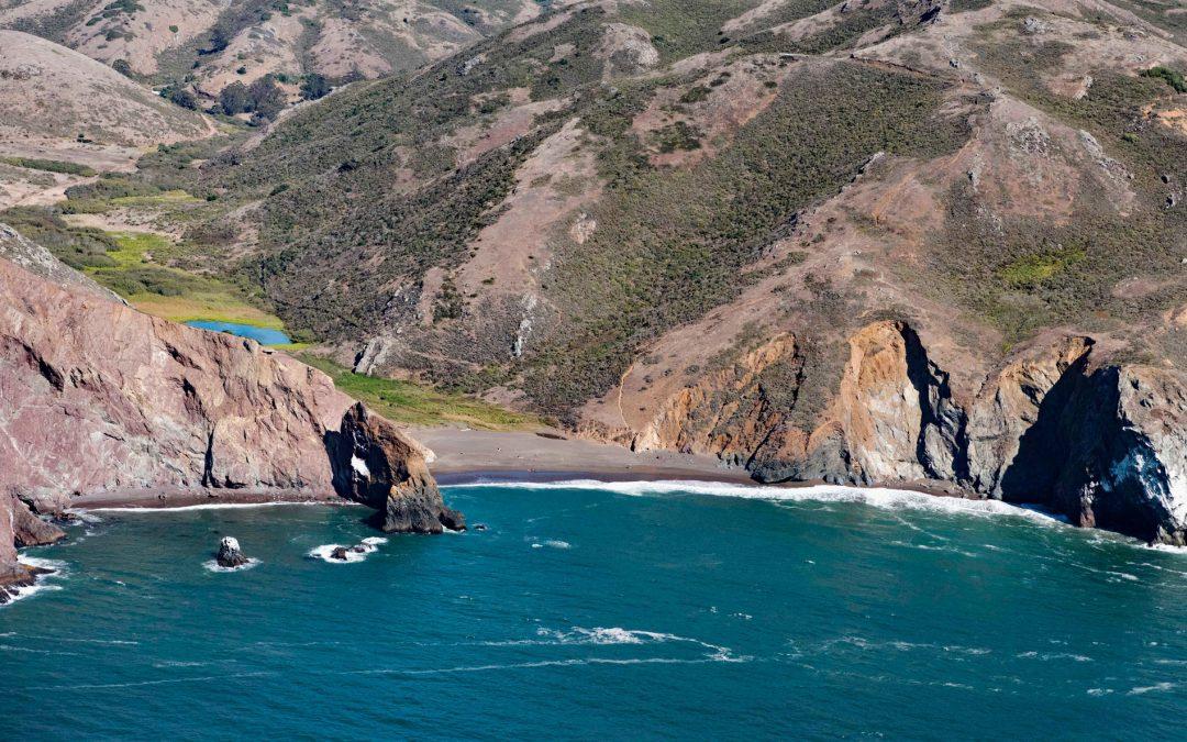
by CoastView | Feb 23, 2026 | 2026, Beaches, Best of 2023, California, Embayments, February 2026, Historical, Land Use, Parks, Shipwrecks
Listen to the article here https://coastview.org/wp-content/uploads/2026/01/TennesseeCove-1.mp3 Tennessee Cove is an embayment with a sandy beach roughly 600 feet (180 m) long on the Pacific Ocean, between Pirates Cove to the north and Rodeo Cove to the south, in the...
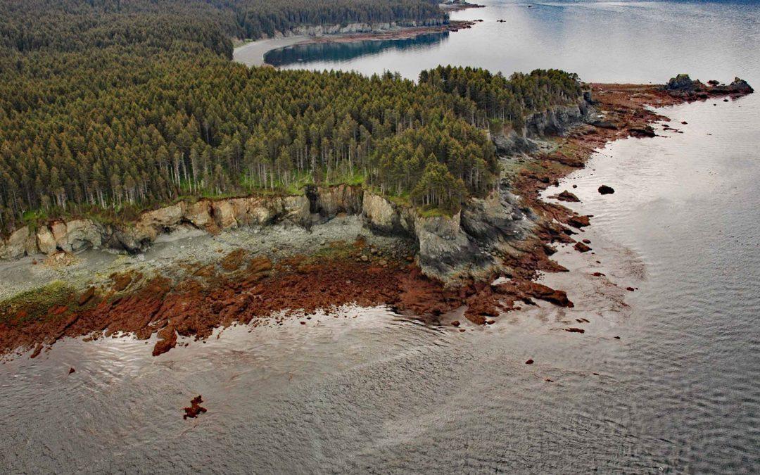
by CoastView | Feb 20, 2026 | 2026, Alaska, Coastal Features, February 2026, Headlands, Historical, Kachemak, Shipwrecks
Listen to the article here https://coastview.org/wp-content/uploads/2026/01/DangerousCape.mp3 Dangerous Cape is a headland rising 66 feet (20 m) on the southern Kenai Peninsula, at the northern entrance to Port Graham near the mouth of Kachemak Bay, about 22 miles (35...
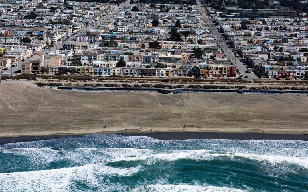
by CoastView | Feb 16, 2026 | 2026, Beaches, California, Coastal Features, February 2026, Historical, Shipwrecks
Listen to the article here https://coastview.org/wp-content/uploads/2026/01/KingPhilip.mp3 King Philip was a clipper ship that wrecked in 1878 on Ocean Beach, on the west coast of the San Francisco Peninsula in the Sunset District, about 1 mile (1.6 km) south of...
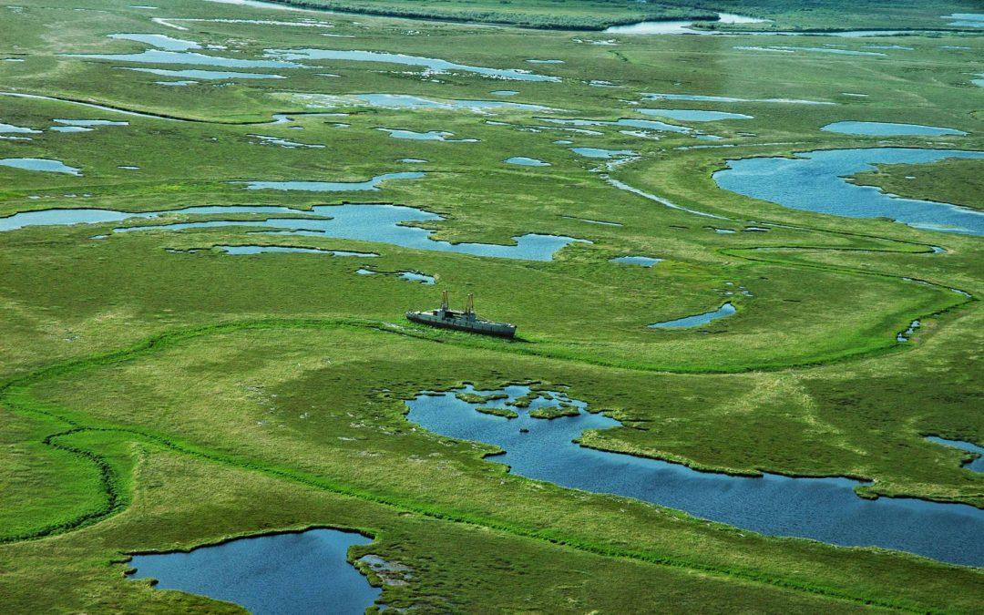
by CoastView | Feb 13, 2026 | 2026, Alaska, Biodiversity, Coastal Features, Communities, February 2026, Land Use, Natural History, Shipwrecks
Listen to the article here https://coastview.org/wp-content/uploads/2026/01/TwinHills.mp3 Twin Hills is a Yup’ik village on the left bank of the Togiak River at the head of Togiak Bay, about 130 miles (209 km) south-east of Bethel and 64 miles (103 km) west of...
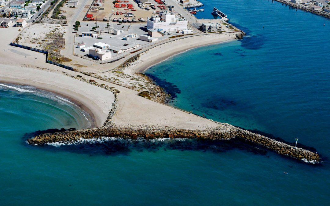
by CoastView | Feb 10, 2026 | 2026, Beaches, California, Coastal Features, February 2026, Historical, Land Use, Shipwrecks
Listen to the article here https://coastview.org/wp-content/uploads/2026/01/LaJenelle.mp3 La Jenelle was a passenger ship that went aground and wrecked in 1970 on Silver Strand at Port Hueneme, a sandy beach created partly from dredged harbor sand about 1 mile (1.6...