by CoastView | Feb 25, 2025 | 2025, Alaska, Beaches, Climate Change, Coastal Features, Embayments, Glaciers, Headlands, Historical, Land Use, Parks, Shipwrecks
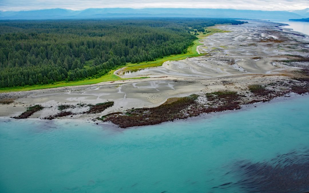
Listen to the article here https://coastview.org/wp-content/uploads/2025/03/Ancon-Rock.mp3 Ancon Rock is a reef located about 0.5 miles (0.8 km) off Point Gustavus on the eastern shore, at the entrance to Glacier Bay within Glacier Bay National Park and Preserve,...
by CoastView | Jan 23, 2025 | 2025, Alaska, Biodiversity, Coastal Features, Communities, Historical, Islands, Land Use, Parks, Shipwrecks
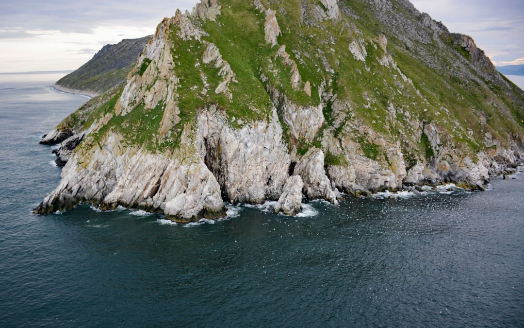
Listen to the article here https://coastview.org/wp-content/uploads/2025/03/Sledge-Island.mp3 Sledge Island, 1.5 miles (2.4 km) across, lies in the Bering Sea, 5 miles (8 km) off the Seward Peninsula’s south coast, about 95 miles (153 km) southeast of Wales and 25...
by CoastView | Jan 13, 2025 | 2025, Beaches, Biodiversity, Canneries, Coastal Features, Communities, Developments, Historical, Land Use, Oregon, Shipwrecks
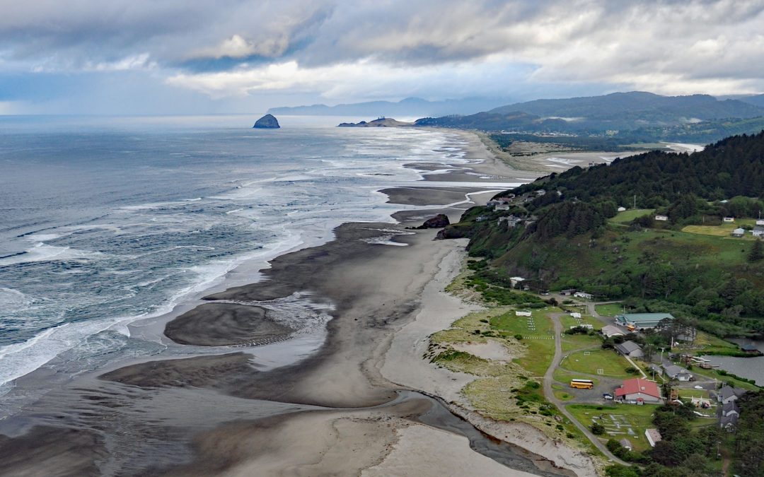
Listen to the article here https://coastview.org/wp-content/uploads/2025/03/Winema.mp3 Winema Beach, a coastal strip adjacent to Winema Lake, was once the site of a town platted as Wi‑Ne‑Ma near Oretown in southern Tillamook County, about 15 miles (24 km) north of...

by CoastView | Jan 8, 2025 | 2025, Biodiversity, California, Coastal Features, Developments, Headlands, Historical, Land Use, Parks, Shipwrecks
Listen to the article here https://coastview.org/wp-content/uploads/2025/03/Tomales-Point.mp3 Tomales Bluff is a headland forming the northern tip of Tomales Point in Point Reyes National Seashore National Seashore, about 45 miles (72 km) northwest of San Francisco...

by CoastView | Jan 5, 2025 | 2025, Beaches, Biodiversity, British Columbia, Coastal Features, Communities, Historical, Land Use, Parks, Rivers, Shipwrecks
Listen to the article here https://coastview.org/wp-content/uploads/2025/03/Clo-oose.mp3 Clo-oose is the site of an abandoned village of the Ditidaht First Nation on the southwest coast of Vancouver Island, above a beach 0.25 miles (0.4 km) west of the Cheewhat River...

by CoastView | Dec 13, 2024 | 2024, California, Coastal Features, Developments, Headlands, Historical, Land Use, Shipwrecks
La Honda Canyon is a valley formed by Cañada Honda Creek that enters the Pacific Ocean 0.4 miles (0.6 km) near Woodbury Rocks north of Point Pedernales, about 56 miles (90 km) west-northwest of Santa Barbara and 11 miles (18 km) west-southwest of Lompoc, California....