Historical Sites
Recent Articles
More Articles
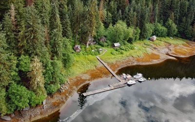
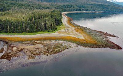
Windham, Windham Bay
Windham is a settlement that historically supported mining operations along Spruce Creek at the head of Windham Bay, about 63 miles (102 km) southeast of Juneau and 57 miles (92 km) north-northwest of Petersburg, Alaska.
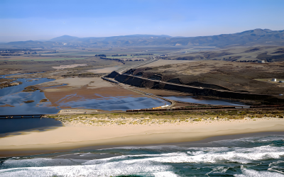
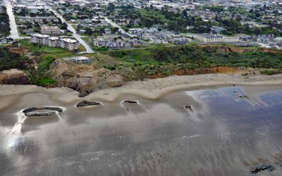
Surf Beach, Santa Ynez River
Surf Beach is within Vandenberg Space Force Base and extends south-southwest for about 4.5 miles (7.3 km) from the mouth of the Santa Ynez River estuary to Spring Canyon, about 31 miles (50 km) south of Pismo Beach and 9 miles (14.5 km) west-northwest of Lompoc, California.
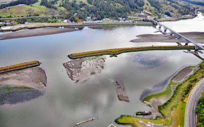
Mary D. Hume, Rogue River
Mary D. Hume sank in 1984 on the south bank of the Rogue River during a restoration effort to convert the vessel to a museum ship for the Curry County Historical Society and now rests on the bottom in shallow water with a portion of the hull and superstructure exposed at low tide near Gold Beach, Oregon.
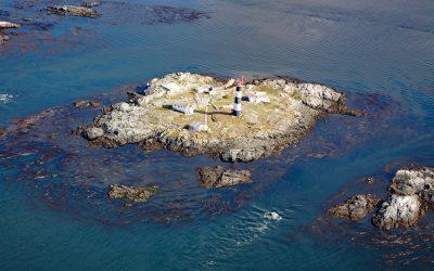
Race Rocks, Strait of Juan de Fuca
Race Rocks is a group of nine islets including North Rock, West Race, Great Race, and Rosedale Rock located about 1 mile (1.6 km) off Cape Calver on the southern tip of Vancouver Island in the Strait of Juan de Fuca, about 12 miles (19 km) southwest of Victoria and 11 miles (18 km) southeast of Sooke, British Columbia.
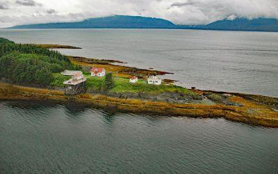
Sumdum, Endicott Arm
Sumdum is a historical Tlingit village of the S’awdaan Kwáan located north of Powers Creek at the northern end of Endicott Arm where it meets Holkham Bay in Tracy Arm-Fords Terror Wilderness, about 70 miles (113 km) north-northwest of Petersburg and 49 miles (79 km) southeast of Juneau, Alaska.
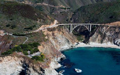
Bixby Creek, Big Sur
Bixby Creek starts at the confluence of Mill Creek and Turner Creek that flow from an elevation of 2,500 feet (762 m) on the west flank of Skinner Ridge for a total run of about 7 miles (11 km) through the Santa Lucia Mountains to the Big Sur coast, between Hurricane Point to the south and Division Knoll to the north, about 16 miles (26 km) south of Monterey and 9 miles (15 km) northwest of the community of Big Sur, California.
Nye Beach, Newport
Nye Beach is situated in Newport between Agate Beach to the north and Yaquina Beach to the south, and historically was demarcated at the north end by a rocky point with a sea stack known as Jump-Off Joe, about 22 miles (35 km) south of Lincoln City and 1.9 miles (3 km) north of Yaquina Bay, Oregon
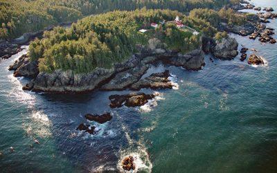
Cape Beale, Barkley Sound
Cape Beale is the site of a historic lighthouse marking the southern entrance to Barkley Sound on the west coast of Vancouver Island in Pacific Rim National Park Reserve, about 89 miles (143 km) west-northwest of Victoria and 4.7 miles (7.6 km) southwest of Bamfield, British Columbia.
Point Retreat, Admiralty Island
Point Retreat is a headland with a historic lighthouse on the Mansfield Peninsula at the northern tip of Admiralty Island, between Lynn Canal to the west and Saginaw Channel of Stephens Passage to the east, about 60 miles (97 km) south-southeast of Haines and 20 miles (32 km) northwest of Juneau, Alaska.
Daajing Giids, Graham Island
Daajing Giids was historically known as the village of Queen Charlotte and is situated on the northern shore of Skidegate Inlet on Graham Island in the Haida Gwaii archipelago, about 104 miles (167 km) southwest of Prince Rupert and 52 miles (84 km) south of Masset, British Columbia.
About the background graphic
This ‘warming stripe’ graphic is a visual representation of the change in global temperature from 1850 (top) to 2019 (bottom). Each stripe represents the average global temperature for one year. The average temperature from 1971-2000 is set as the boundary between blue and red. The colour scale goes from -0.7°C to +0.7°C. The data are from the UK Met Office HadCRUT4.6 dataset.
Click here for more information about the #warmingstripes.