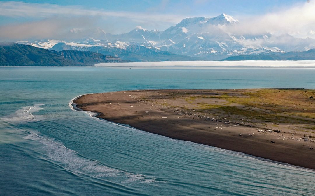
by CoastView | Aug 5, 2023 | 2023, Alaska, Embayments, Glaciers, Parks
Mount Saint Elias is located on the Alaska-Canada boundary in the Saint Elias Range, about 165 miles (266 km) east-southeast of Cordova and 67 miles 108 km) northwest of Yakutat, Alaska. Its name in Tlingit is Yasʼéitʼaa Shaa, meaning “mountain behind Icy...
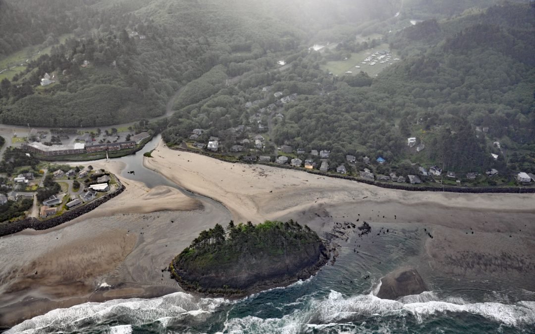
by CoastView | Aug 4, 2023 | 2023, Beaches, Islands, Oregon, Rivers
Proposal Rock is at the mouth of the Neskowin Creek, about 10 miles (16 km) north-northeast of Lincoln City and 0.5 miles (0.8 km) south-southwest of the community of Neskowin, Oregon. The rock is named for a local legend and is also located adjacent to the stumps of...

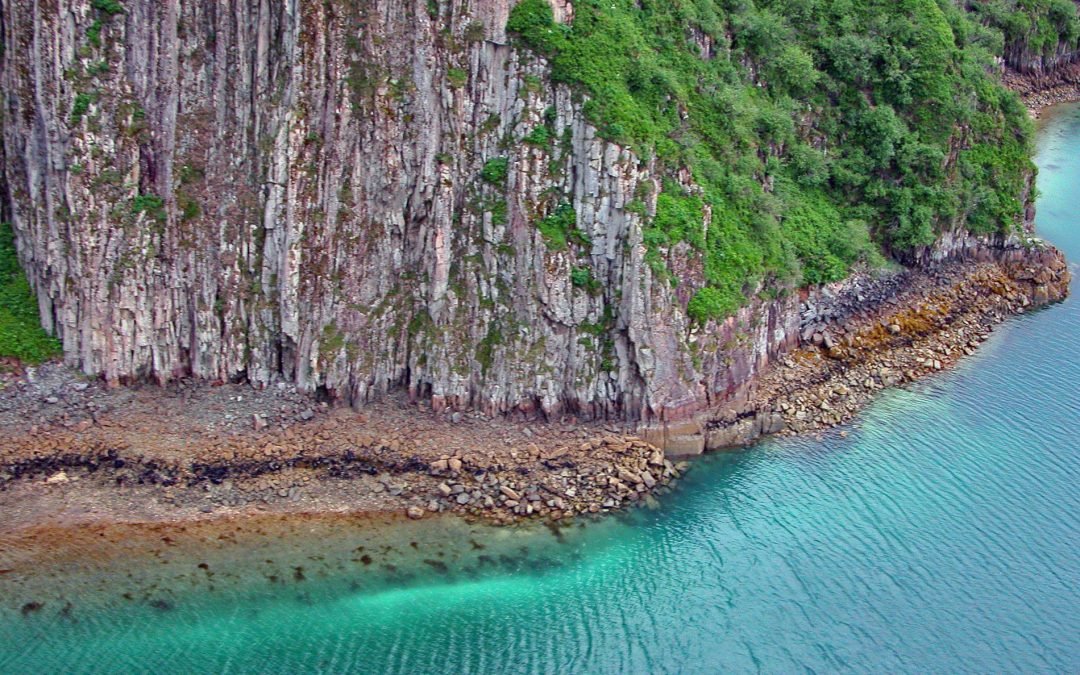
by CoastView | Aug 3, 2023 | 2023, Alaska, Coastal Features, Parks, Waterfalls
Mount Douglas is a stratovolcano with an elevation of 7,000 feet (2,134 m) located on Kamishak Bay, near the northern part of the Alaska Peninsula and within Katmai National Park and Preserve, about 113 miles (182 km) east of King Salmon and 91 miles (147 km)...
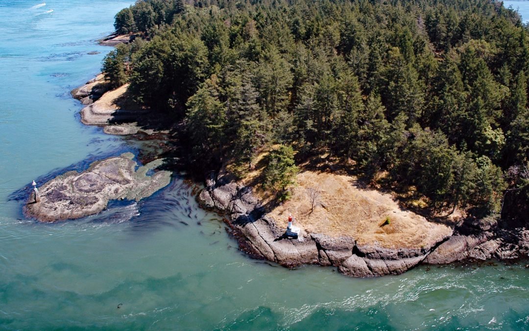
by CoastView | Aug 2, 2023 | 2023, British Columbia, Headlands, Islands, Lighthouses
Helen Point is located on the northwestern corner of Mayne Island and has a light and range marker to aid navigation through Active Pass, about 32 miles (52 km) southwest of Vancouver and 14.5 miles (23 km) north-northeast of Sidney, British Columbia. Helen Point...

by CoastView | Aug 1, 2023 | 2026, Alaska, Historical, July 2026, Shipwrecks
Listen to the article here https://coastview.org/wp-content/uploads/2026/04/MountEdgecumbe.mp3 In 1813, the Russian exploration ship Neva wrecked near Mount Edgecumbe on Kruzof Island, about 93 miles (150 km) southwest of Juneau and 10 miles (16 km) west of Sitka,...
by CoastView | Jul 31, 2023 | 2026, Alaska, Embayments, Historical, July 2026, Parks
Listen to the article here https://coastview.org/wp-content/uploads/2026/03/GeographicHarbor.mp3 Geographic Harbor lies within Katmai National Park and Preserve, formed by two large bays extending 3 miles (5 km) off Amalik Bay on Shelikof Strait, about 86 miles (139...
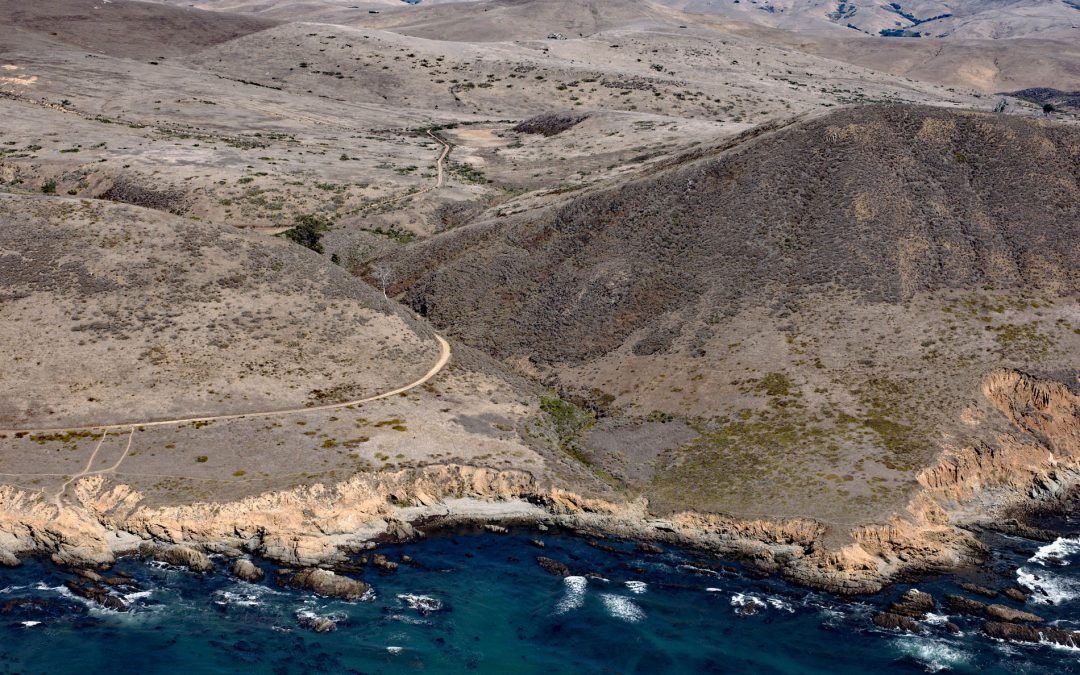
by CoastView | Jul 30, 2023 | 2026, California, Communities, Headlands, July 2026, Rivers
Listen to the article here https://coastview.org/wp-content/uploads/2026/03/HarmonyHeadlands.mp3 Harmony Headlands State Park preserves an undeveloped parcel of Pacific coastline between Point Estero to the south and Natalie’s Cove to the north, about 7 miles...
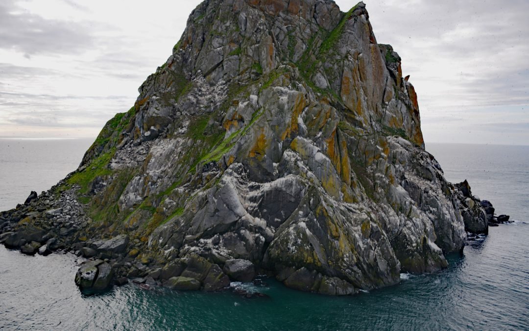
by CoastView | Jul 30, 2023 | 2026, Alaska, Historical, Islands, July 2026
Listen to the article here https://coastview.org/wp-content/uploads/2026/03/FairwayRock.mp3 Fairway Rock is located in the Bering Strait, 17 miles (27 km) offshore from Cape Prince of Wales at the western end of the Seward Peninsula, about 11 miles (18 km)...
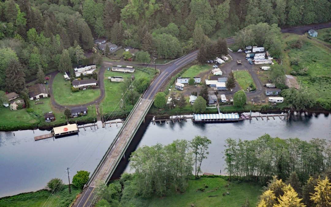
by CoastView | Jul 29, 2023 | 2026, Communities, July 2026, Oregon, Rivers
Listen to the article here https://coastview.org/wp-content/uploads/2026/03/TaylorsLanding.mp3 Taylors Landing is a boat landing and small community near the head of the tide on the Alsea River, in the Coast Range, about 17.4 miles (28 km) west of Alsea and 6.4 miles...
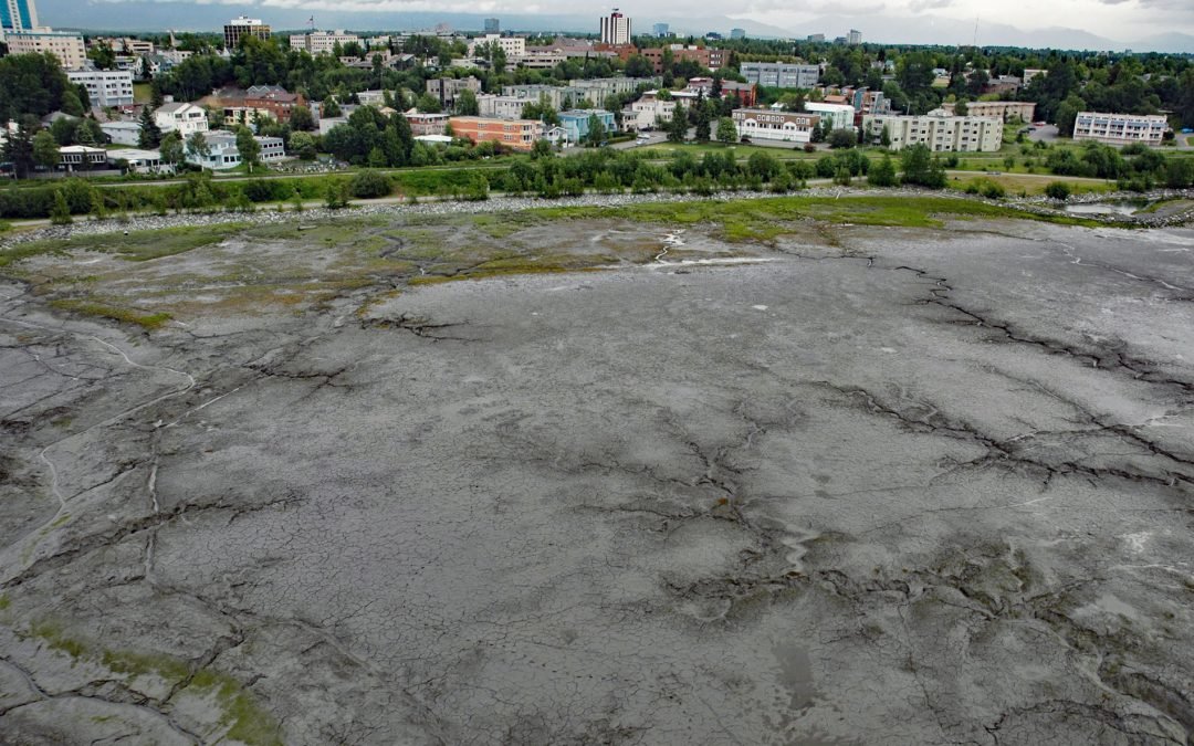
by CoastView | Jul 28, 2023 | 2026, Alaska, Communities, Historical, July 2026
Listen to the article here https://coastview.org/wp-content/uploads/2026/03/BootleggersCove.mp3 Bootleggers Cove is a coastal neighborhood along the tidal flats of Cook Inlet, about 0.73 miles (1.2 km) northeast of Westchester Lagoon and 0.5 miles (0.8 km)...