by CoastView | May 25, 2024 | 2024, Alaska, Coastal Features, Communities, Historical, Parks
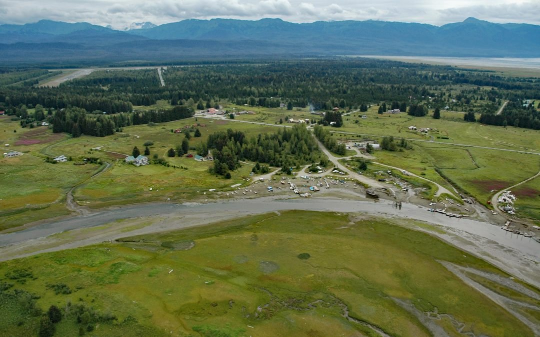
Gustavus is a community on the north shore of Icy Strait, at the mouth of the Salmon River and across from Pleasant Island, about 48 miles (77 km) west-northwest of Juneau, and 28 miles (45 km) northeast of Elfin Cove, Alaska. Gustavus is situated on a large plain...
by CoastView | May 24, 2024 | 2024, Communities, Headlands, Historical, Lighthouses, Oregon, Parks
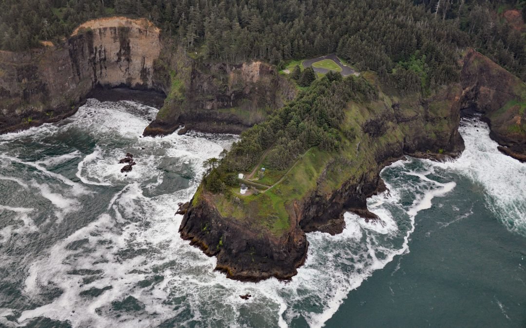
Cape Meares is the site of a historic lighthouse on a prominent headland that forms a high steep bluff near the southern entrance to Tillamook Bay, about 48 miles (77 km) south of Astoria and 7 miles (11 km) west-northwest of Tillamook, Oregon. A small community about...
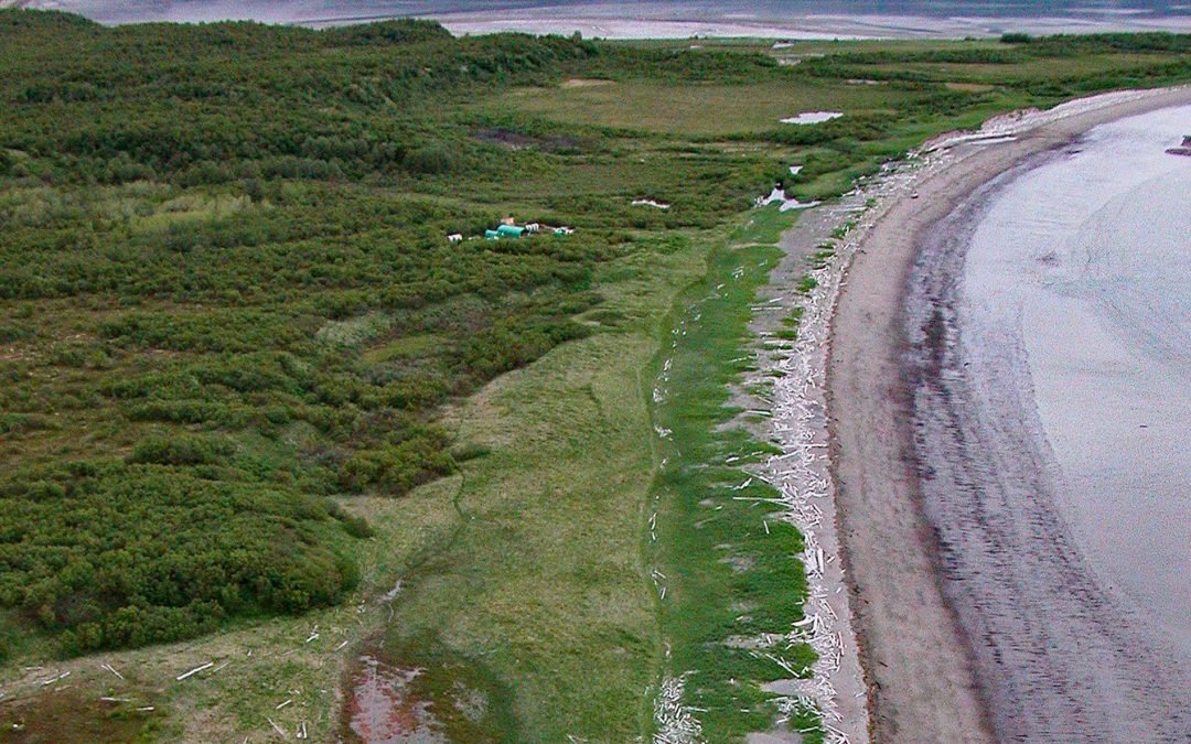
by CoastView | May 23, 2024 | 2024, Alaska, Embayments, Historical, Islands, Rivers
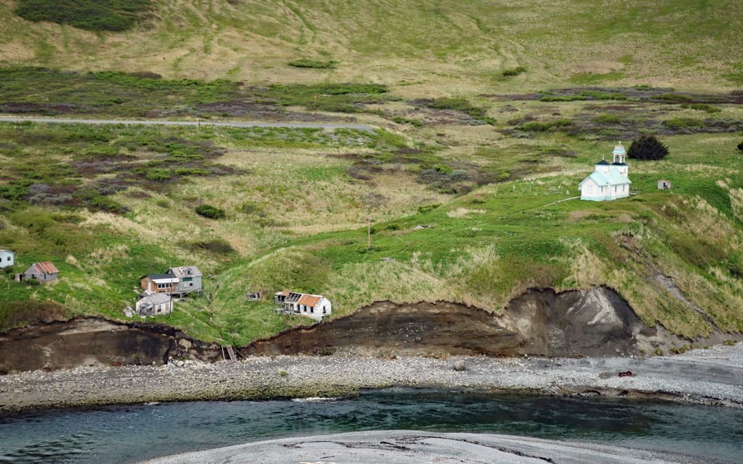
Karluk is a historical fishing community situated on a barrier spit at the mouth of Karluk Lagoon on the west coast of Kodiak Island, about 301 miles (485 km) southwest of Anchorage and 88 miles (142 km) southwest of Kodiak, Alaska. The Karluk River flows north and...
by CoastView | May 22, 2024 | 2024, Alaska, Communities, Developments, Embayments, Historical
Ellamar is a historical mining camp on Virgin Bay in Prince William Sound, at the base of Ellamar Mountain, about 20 miles (32 km) southwest of Valdez and 2 miles (3.2 km) northwest of Tatitlek, Alaska. A post office was established here in 1900. The mountain was...
by CoastView | May 21, 2024 | 2024, Alaska, Communities, Historical
Douglas is a historical village in Katmai National Park and Preserve, also called Kayayak, or Kaguyak but not to be confused with Kaguyak on Kodiak Island, situated on the Shelikof Strait coast of the Alaska Peninsula, about 112 miles (181 km) southwest of Homer and...
by CoastView | May 20, 2024 | 2024, Alaska, Coastal Features, Embayments, Natural History
Mount Pavlof is a stratovolcano in the Aleutian Range on the Alaska Peninsula near Pavlof Bay, about 57 miles (92 km) west of Sand Point and 34 miles (55 km) northeast of Cold Bay, Alaska. It has been one of the most active volcanoes in North America, and in the past...

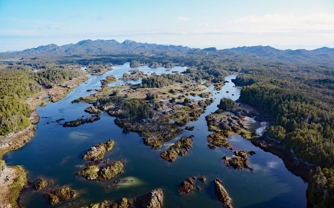
by CoastView | May 19, 2024 | 2024, Alaska, Embayments, Historical, Islands
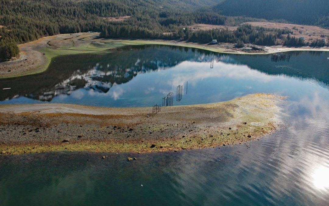
Winter Harbor is an embayment about 0.3 miles (0.5 km) wide on the west coast of Prince of Wales Island, near the south entrance to Tuxekan Passage, about 66 miles (106 km) northwest of Ketchikan and 15 miles (24 km) north-northwest of Klawock, Alaska. The name was...
by CoastView | May 18, 2024 | 2024, British Columbia, Islands, Natural History
Stephens Island is located in Hecate Strait and includes the Ksgaxl/Stephens Islands Conservancy in the Great Bear Rainforest, about 93 miles (150 km) south-southeast of Ketchikan and 19 miles (30 km) southwest of Prince Rupert, British Columbia. The island is part of...

by CoastView | May 17, 2024 | 2024, Beaches, Embayments, Oregon
Nestucca Bay is an estuary of about 1,000 acres (405 ha) formed by a sand spit located where the Nestucca River meets the Pacific Ocean, about 38 miles (61 km) west of McMinnville and at Pacific City, Oregon. The Nestucca Spit separates the estuary from the ocean and...

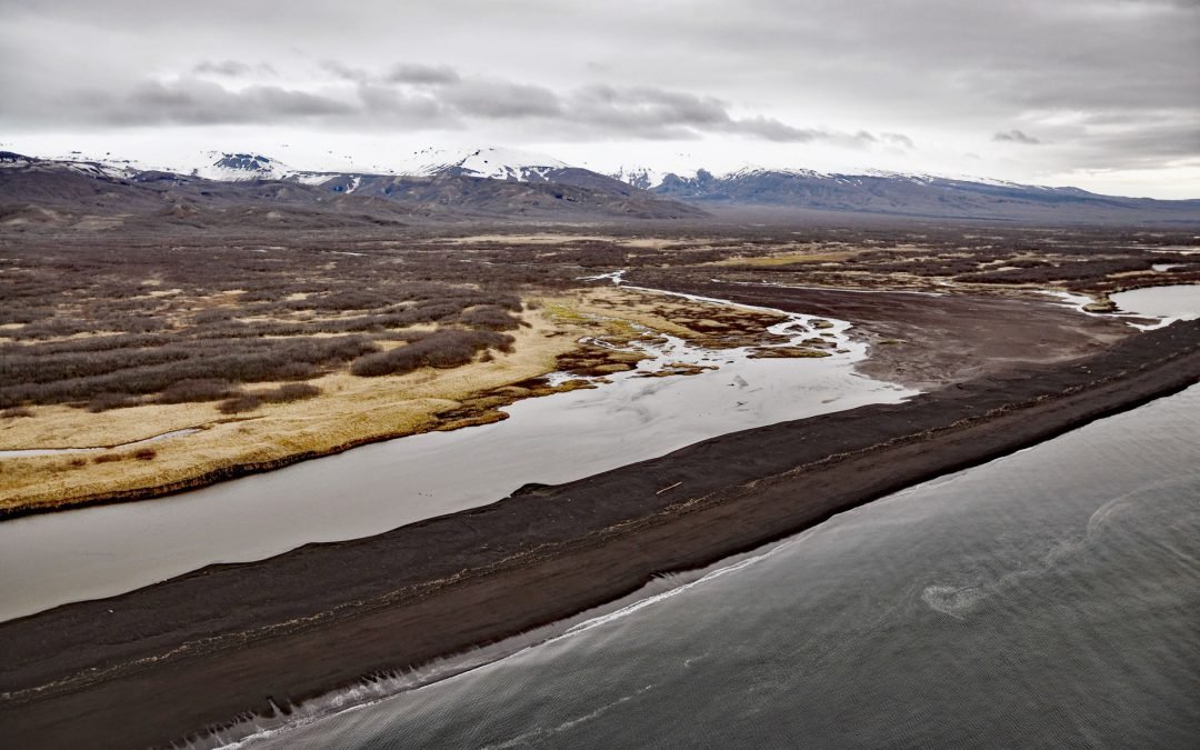
by CoastView | May 16, 2024 | 2024, Alaska, Beaches, Coastal Features
Patton Bay is about 4 miles (6.5 km) wide, located on the southeast coast of Montague Island, about 75 miles (121 km) southwest of Cordova and 70 miles (113 km) southeast of Seward, Alaska. The bay was named in 1937 by the U.S. Coast and Geodetic Survey for Rear...