
Parks
Recent Articles
More Articles

Rabbit Creek, Potter Marsh
Rabbit Creek starts at the outlet of Rabbit Lake, at the base of the west flank of North Yuyanq’ Ch’ex in the Chugach Mountains at an elevation of 3,082 feet (940 m), and flows generally west-northwest for 26 miles (42 km) draining a watershed of 9,152 acres (3,704 ha) to Potter Marsh where it merges with Little Rabbit Creek and discharges into Turnagain Arm, about 13 miles (21 km) northwest of Hope and 10 miles (16 km) south-southeast of downtown Anchorage, Alaska.

Devil’s Punchbowl, Russian Gulch State Park
Devil’s Punchbowl is a sinkhole formed by a collapsed sea cave over 70 feet (21 m) deep and 100 feet (30 m) in diameter near the mouth of Russian Gulch Creek in Russian Gulch State Park, about 8 miles (13 km) south of Fort Bragg and 1.6 miles (2.6 km) north-northwest of Mendocino, California.

Point Robinson, Maury Island
Point Robinson is the eastern point of Maury Island in Puget Sound and the site of a historic lighthouse, about 15 miles (24 km) south of Seattle and 10 miles (16 km) north-northeast of Tacoma, Washington.

Swanson River, Number Three Bay
Swanson River starts at an elevation of 224 feet (68 m) at the outlet of Gene Lake in the Swan Lake district on the Kenai Peninsula and flows generally southwest for 40 miles (64 km), draining a watershed of 162,496 acres (65,760 ha), to Number Three Bay on the southeastern shore of Cook Inlet, about 47 miles (76 km) southwest of Anchorage and 19 miles (31 km) north-northeast of Kenai, Alaska.

Ecstall River, Kitimat Ranges
Ecstall River starts from a cirque glacier at an elevation of roughly 3100 feet (945 m) in the Kitimat Ranges of the Coast Mountains and flows generally north-northwest for about 68 miles (110 km), draining a watershed of 207,568 acres (84,000 ha), to the lower tidal reach of the Skeena River, about 60 miles (97 km) west-southwest of Terrace and 18 miles (29 km) southeast of Prince Rupert, British Columbia.

Paint River, Akjemguiga Cove
Paint River starts at the confluence of the Middle and South Forks and flows generally east for 17 miles (27 km), draining a watershed of 40,854 acres (16,533 ha), to Akjemguiga Cove in Kamishak Bay between McNeil Cove to the south and Amakdedulia Cove to the north, about 101 miles (163 km) southwest of Homer and 94 miles (152 km) northeast of King Salmon, Alaska.
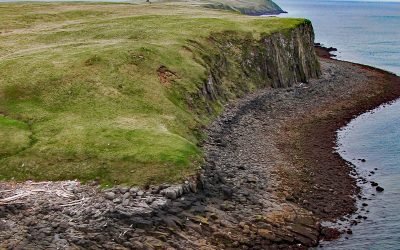
Kiukpalik Island, Shelikof Strait
Kiukpalik Island is 1.3 miles (2 km) long and 0.6 miles (1 km) wide and is part of Katmai National Park and Preserve, but situated 2 miles (3.2 km) offshore from the Alaska Peninsula in Shelikof Strait, about 112 miles (181 km) east of King Salmon and 72 miles (116 km) northwest of Kodiak, Alaska.
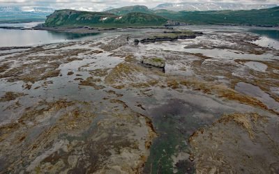
Amakdedulia Cove, Kamishak Bay
Amakdedulia Cove is an embayment about 2 miles (3.2 km) across on the western shore of Kamishak Bay in southwestern Cook Inlet, about 98 miles (158 km) northeast of King Salmon and 98 miles (158 km) southwest of Homer, Alaska.

Kitlope River, Gardner Canal
Kitlope River starts from the Kitimat Ranges and flows generally northwest to the head of Gardner Canal, about 125 miles (202 km) southeast of Prince Rupert and 75 miles (121 km) north of Bella Bella, British Columbia.
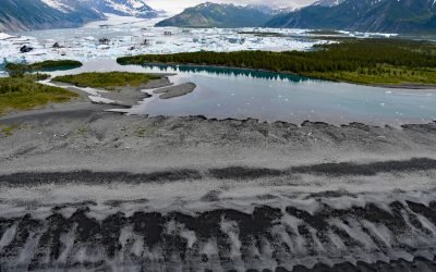
Bear Glacier, Aialik Peninsula
Bear Glacier starts from an elevation of roughly 4,000 feet (1,219 m) on the eastern flank of the Harding Icefield in Kenai Fjords National Park and descends generally southeast for 17 miles (27 km) to a proglacial lake dammed by a terminal moraine between Bear Glacier Point on the Aialik Peninsula to the south and Callisto Head to the north, about 72 miles (116 km) east-northeast of Homer and 13 miles (21 km) south of Seward, Alaska.
About the background graphic
This ‘warming stripe’ graphic is a visual representation of the change in global temperature from 1850 (top) to 2019 (bottom). Each stripe represents the average global temperature for one year. The average temperature from 1971-2000 is set as the boundary between blue and red. The colour scale goes from -0.7°C to +0.7°C. The data are from the UK Met Office HadCRUT4.6 dataset.
Click here for more information about the #warmingstripes.