
Rivers
Recent Articles
More Articles
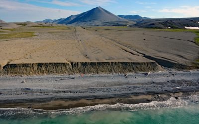
Lost River Mine, York Mountains
Lost River starts at an elevation of 1400 feet (427 m) on the south flank of the York Mountains on the Seward Peninsula and flows south for 9.5 miles (15 km) to the Bering Sea, about 86 miles (138 km) northwest of Nome and 31 miles (50 km) southeast of Wales, Alaska.
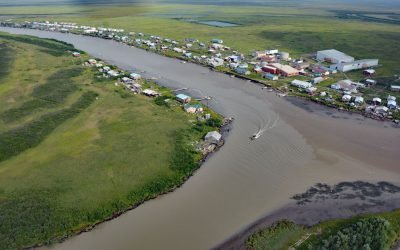
Kotlik, Apoon Pass
Kotlik is a Yup’ik community situated on Kotlik Slough, a side channel of Apoon Pass formed by the confluence of the Kotlik and Little Kotlik River in the Yukon River Delta, 6 miles (10 km) inland from Pastol Bay on the southern coast of Norton Sound, about 116 miles (187 km) southeast of Nome and 56 miles (90 km) southwest of Saint Michael, Alaska.
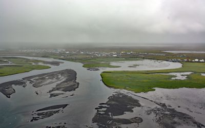
Quinhagak, Kanektok River
Quinhagak or Kwinhagak is a Central Yup’ik community situated on the Yukon-Kuskokwim Delta near the mouth of the Kanektok River, about 73 miles (118 km) south of Bethel and 45 miles (72 km) north of Goodnews Bay, Alaska.
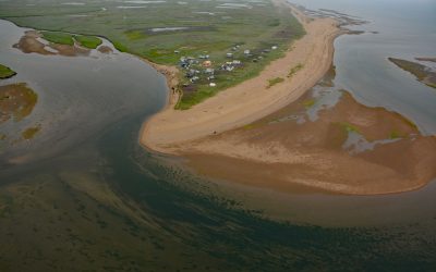
Moses Point, Kwiniuk River
Moses Point is a fish camp, used mostly by residents of Elim, situated at the mouth of the Kwiniuk River on the northern shore of Norton Bay, about 100 miles (160 km) east of Nome and 31 miles (50 km) southwest of Koyuk, Alaska.
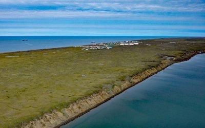
Wainwright, Kuk River
Wainwright is an Iñupiat community on the Chukchi Sea coastline situated on a barrier beach adjacent to Wainwright Inlet and the Kuk River, about 94 miles (151 km) northeast of Point Lay and 86 miles (138 km) southwest of Utqiaġvik, Alaska.
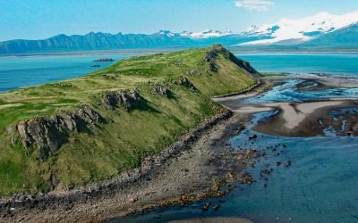
Ninagiak Island, Hallo Bay
Ninagiak Island is about 1.2 miles (2 km) long and 0.2 miles wide, located in Hallo Bay near the mouth of the Ninagiak River on the south coast of the Alaska Peninsula in Shelikof Strait, about 122 miles (197 km) southwest of Homer and 75 miles (121 km) northwest of Kodiak, Alaska.
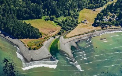
Lyre River, Low Point
Lyre River starts at the outlet of Lake Crescent in Olympic National Park and flows roughly northwest for 5 miles (8 km) to Low Point on the Strait of Juan de Fuca draining a watershed of 43,200 acres (17,482 ha), about 21 miles (34 km) southeast of Clallam Bay and 19 miles (31 km) west of Port Angeles, Washington.
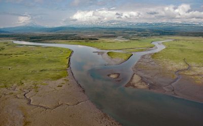
Kamishak River, Akumwarvik Bay
Kamishak River starts from an unnamed lake at an elevation of 2,700 feet (823 m) in a saddle between two peaks in the Aleutian Range and first flows southeast for 10 miles (16 km) and then north-northeast for 28 miles (45 km) through Katmai National Park and Preserve to Akumwarvik Bay, about 104 miles (168 km) southwest of Homer and 93 miles (150 km) east-northeast of King Salmon, Alaska.
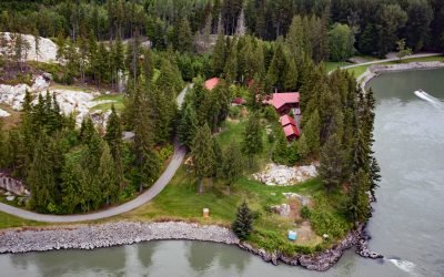
Graveyard Point, Skeena River
Graveyard Point is a historical steamboat landing and telegraph station near the confluence of the Shames River and the Skeena River, about 58 miles (94 km) east of Prince Rupert and 14 miles (23 km) southwest of Terrace, British Columbia.

Klamath River, Requa
Klamath River flows for 257 miles (415 km) from a broad patchwork of lakes and marshes at the edge of the Oregon high desert, through the Cascade Range and the Klamath Mountains, and enters the Pacific Ocean at the community of Requa, about 52 miles (84 km) north of Eureka and 16 miles (26 km) south-southeast of Crescent City, California.
About the background graphic
This ‘warming stripe’ graphic is a visual representation of the change in global temperature from 1850 (top) to 2019 (bottom). Each stripe represents the average global temperature for one year. The average temperature from 1971-2000 is set as the boundary between blue and red. The colour scale goes from -0.7°C to +0.7°C. The data are from the UK Met Office HadCRUT4.6 dataset.
Click here for more information about the #warmingstripes.