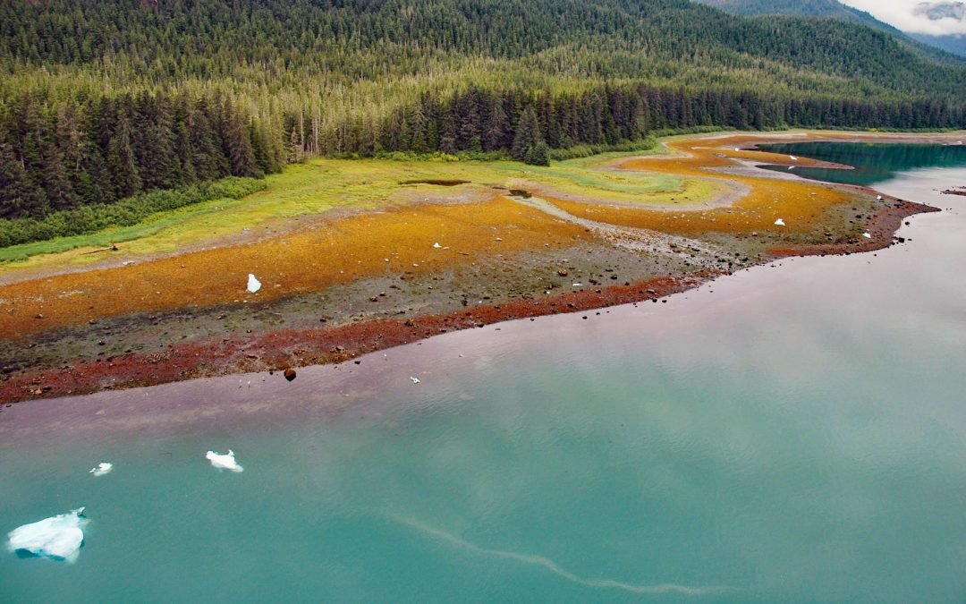
by CoastView | Jul 26, 2026 | 2026, Alaska, Biodiversity, Climate Change, Embayments, Glaciers, July 2026, Land Use, Natural History, Parks
Listen to the article here https://coastview.org/wp-content/uploads/2026/03/TracyArm.mp3 Tracy Arm is a glaciated fjord in the Tracy Arm–Fords Terror Wilderness of Tongass National Forest, about 85 miles (137 km) northeast of Sitka and 42 miles (68 km) southeast of...

by CoastView | Jul 25, 2026 | 2026, Biodiversity, California, Coastal Features, Developments, Headlands, Historical, July 2026, Land Use, Parks
Listen to the article here https://coastview.org/wp-content/uploads/2026/03/ChimneyRock.mp3 Chimney Rock is an islet off the eastern headland of the Point Reyes Peninsula, connected to it only at low tide, about 3 miles (4.8 km) east of the Point Reyes Light and 10...
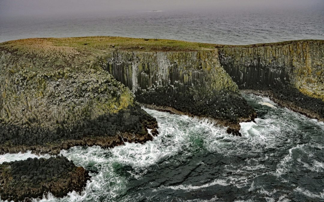
by CoastView | Jul 24, 2026 | 2026, Alaska, Biodiversity, Coastal Features, Islands, July 2026, Land Use, Natural History
Listen to the article here https://coastview.org/wp-content/uploads/2026/03/SandmanReefs.mp3 The Sandman Reefs are a group of islets, reefs, and wave-washed rocks in the Eastern Aleutian Islands near the western end of the Alaska Peninsula, about 78 miles (126 km)...
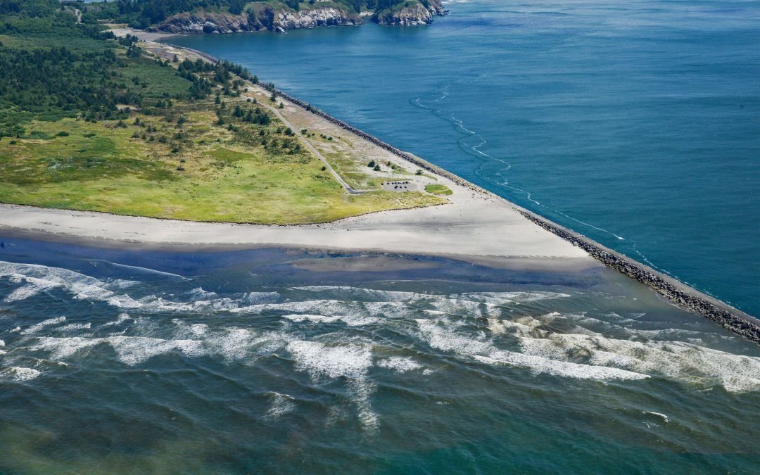
by CoastView | Jul 23, 2026 | 2026, Coastal Features, Developments, Historical, July 2026, Land Use, Natural History, Rivers, Washington
Listen to the article here https://coastview.org/wp-content/uploads/2026/03/PeacockSpit.mp3 Peacock Spit is the northern portion of a mostly submerged sand bar, generally called the Columbia Bar, at the mouth of the Columbia River, about 12 miles (19 km) northwest of...
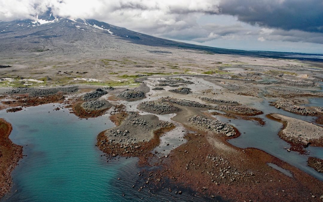
by CoastView | Jul 22, 2026 | 2026, Alaska, Coastal Features, Islands, July 2026, Natural History
Listen to the article here https://coastview.org/wp-content/uploads/2026/03/AugustineVolcano.mp3 Burr Point is a headland on Augustine Island in Kamishak Bay, on the western margin of lower Cook Inlet, about 108 miles (174 km) north-northwest of Kodiak and 69 miles...