
by CoastView | Jun 29, 2025 | 2025, Beaches, Coastal Features, Embayments, Headlands, Historical, Land Use, Lighthouses, Natural History, Parks, Washington
Listen to the article here https://coastview.org/wp-content/uploads/2025/05/Point-No-Point.mp3 Point No Point is a sand spit on the northern end of the Kitsap Peninsula, between Norwegian Point to the northwest and Pilot Point to the southeast, about 8 miles (13 km)...

by CoastView | Jun 27, 2025 | 2025, Alaska, Beaches, Biodiversity, Coastal Features, Embayments, Kachemak, Land Use, Natural History
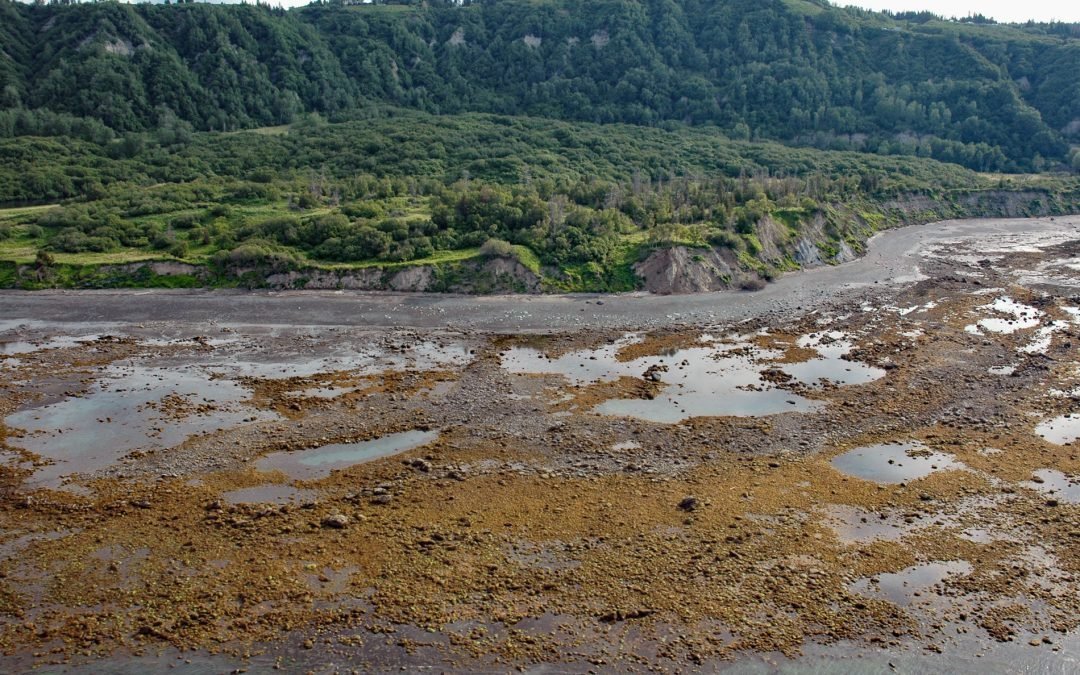
Listen to the article here https://coastview.org/wp-content/uploads/2025/05/Mud-Bay.mp3 Mud Bay is a tidal flat about 0.6 miles (1 km) wide, partially enclosed by sand spits at the sheltered base of the Homer Spit on the northwest shore of Kachemak Bay, about 2.7...
by CoastView | Jun 20, 2025 | 2025, Alaska, Beaches, Coastal Features, Headlands, Historical, Kachemak, Land Use, Natural History
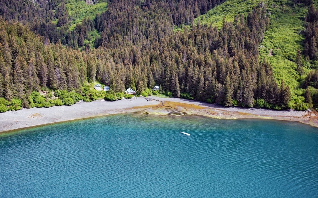
Listen to the article here https://coastview.org/wp-content/uploads/2025/05/Bluff-Point.mp3 Bluff Point is a prominent headland near the north shore entrance to Kachemak Bay with an elevation ranging from approximately 300 to 700 feet (100 to 215 m), about 12 miles...
by CoastView | Jun 19, 2025 | 2025, Alaska, Beaches, Biodiversity, Canneries, Coastal Features, Developments, Embayments, Historical, Land Use, Natural History
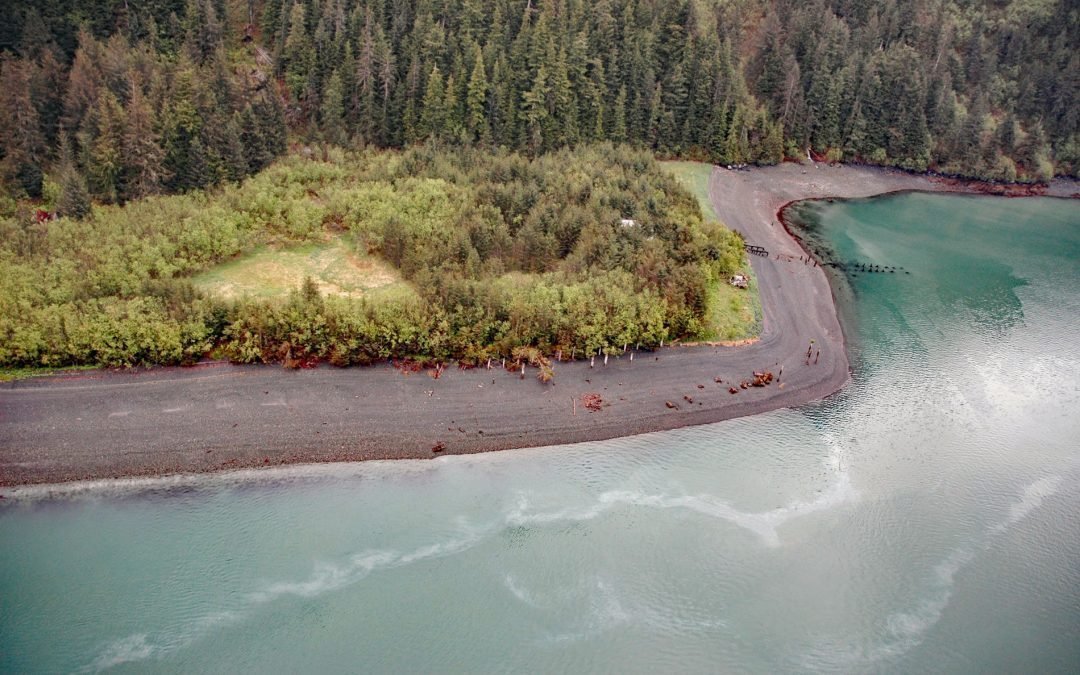
Listen to the article here https://coastview.org/wp-content/uploads/2025/05/Shepard-Point.mp3 Shepard Point is a mixed alluvial and colluvial fan on the eastern shore of Orca Inlet in Prince William Sound at Nelson Bay, which is an estuary mostly formed by the Rude...
by CoastView | Jun 13, 2025 | 2025, Alaska, Beaches, Biodiversity, Canneries, Coastal Features, Developments, Embayments, Historical, Kachemak, Land Use, Natural History, Parks
Listen to the article here https://coastview.org/wp-content/uploads/2025/05/San-Juan-Cove.mp3 San Juan Cove is a small embayment on the north shore of Tutka Bay, a deglaciated fjord on the southern shore of Kachemak Bay in the Kenai Mountains in Kachemak Bay State...
by CoastView | Jun 8, 2025 | 2025, Beaches, Coastal Features, Communities, Developments, Embayments, Historical, Land Use, Lighthouses, Washington
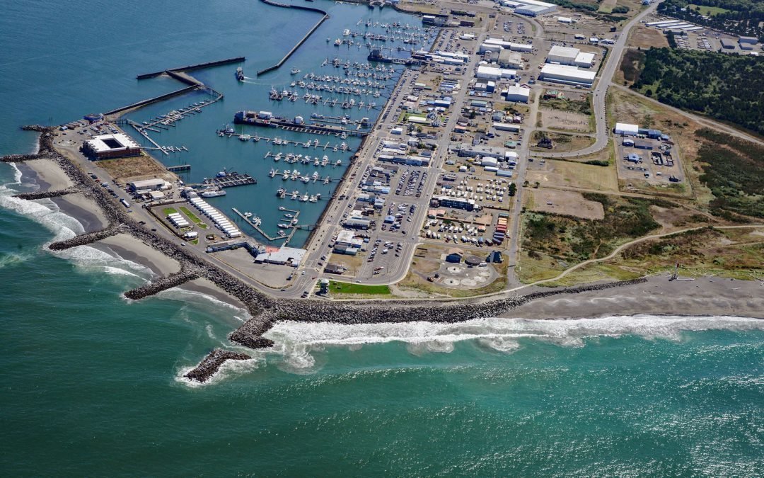
Listen to the article here https://coastview.org/wp-content/uploads/2025/05/Westport.mp3 Westport is a community located on Point Chehalis, a peninsula between South Bay and the Pacific Ocean that partially encloses Grays Harbor from the south, about 53 miles (85 km)...