by CoastView | May 16, 2025 | 2025, Alaska, Beaches, Biodiversity, Coastal Features, Embayments, Headlands, Historical, Kachemak, Land Use, Natural History, Rivers
Listen to the article here https://coastview.org/wp-content/uploads/2025/04/Barabara-Point.mp3 Barabara Point is on the Kenai Peninsula, between McDonald Spit to the east and Seldovia Point to the west, in Kachemak Bay, about 12 miles (19 km) south-southwest of Homer...
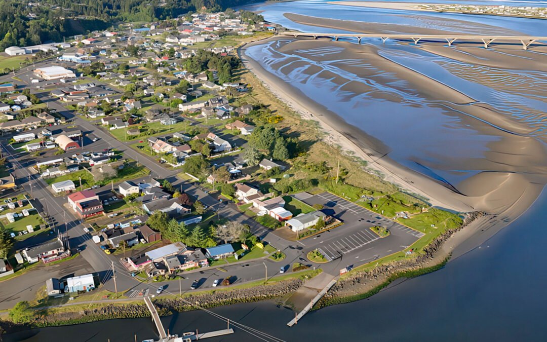
by CoastView | May 11, 2025 | 2025, Beaches, Coastal Features, Communities, Developments, Embayments, Historical, Land Use, Oregon, Rivers
Listen to the article here https://coastview.org/wp-content/uploads/2025/04/Waldport.mp3 Waldport is a community situated on the southern shore of Alsea Bay, an estuary of the Alsea River, about 15 miles (24 km) south of Newport and 8 miles (13 km) north of Yachats,...
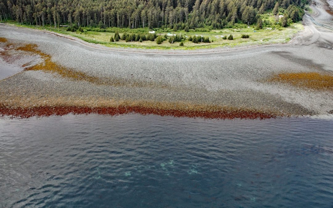
by CoastView | May 9, 2025 | 2025, Alaska, Beaches, Biodiversity, Coastal Features, Historical, Kachemak, Land Use, Natural History, Parks, Rivers
Listen to the article here https://coastview.org/wp-content/uploads/2025/04/Humpy-Creek.mp3 Humpy Creek drains a watershed of 6,912 acres (2,797 ha) and flows northwest for about 4.5 miles (7 km) from Emerald Lake in the Kenai Mountains to the southeastern shore of...

by CoastView | May 7, 2025 | 2025, Beaches, Biodiversity, California, Coastal Features, Communities, Developments, Embayments, Historical, Land Use, Natural History, Parks
Listen to the article here https://coastview.org/wp-content/uploads/2025/04/Morro-Dunes.mp3 Morro Dunes form a barrier spit that separates Morro Bay to the east from the Pacific Ocean to the west, about 6 miles (10 km) south-southwest of the community of Morro Bay and...

by CoastView | May 5, 2025 | 2025, Alaska, Beaches, Coastal Features, Communities, Developments, Embayments, Headlands, Historical, Islands, Land Use
Listen to the article here https://coastview.org/wp-content/uploads/2025/04/Dutch-Harbor.mp3 Dutch Harbor is an anchorage and fish-processing facility on the east coast of Amaknak Island, bordered by Mount Ballyhoo to the west and a gravel spit to the east that forms...

by CoastView | Apr 30, 2025 | 2025, Beaches, California, Chemical Pollution, Communities, Developments, Historical, Land Use, Rivers
Listen to the article here https://coastview.org/wp-content/uploads/2025/04/Long-Beach.mp3 The Los Angeles River begins at the confluence of Bell Creek and Arroyo Calabasas, which drain from the Simi Hills and Santa Monica Mountains respectively, and flows southeast...