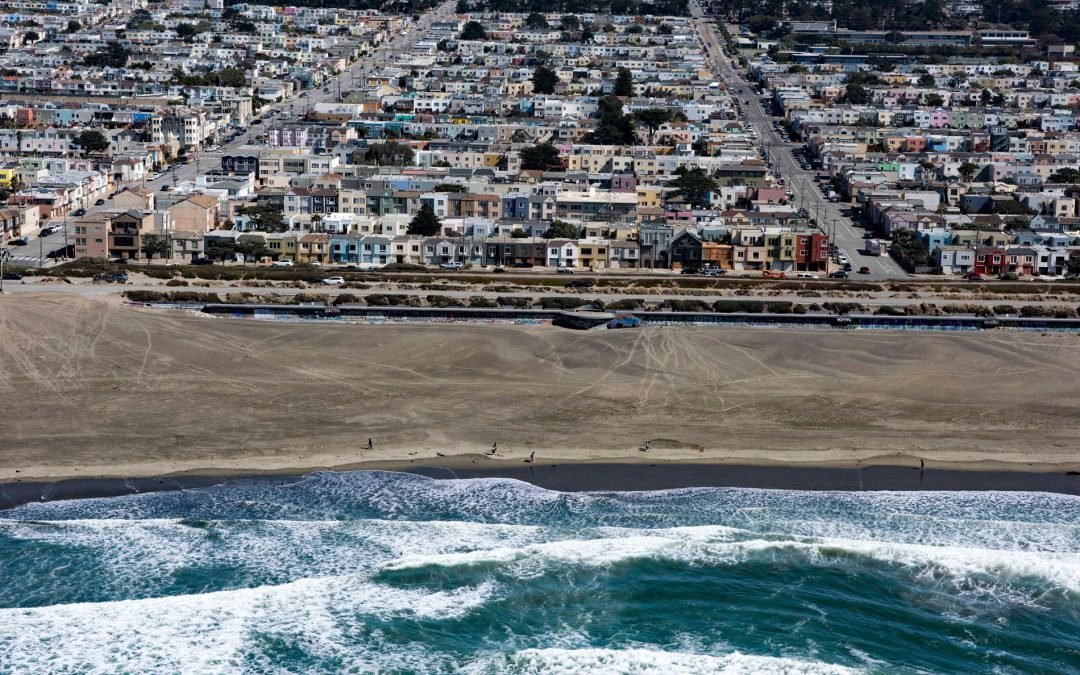
by CoastView | Feb 16, 2026 | 2026, Beaches, California, Coastal Features, February 2026, Historical, Shipwrecks
Listen to the article here https://coastview.org/wp-content/uploads/2026/01/KingPhilip.mp3 King Philip was a clipper ship that wrecked in 1878 on Ocean Beach, on the west coast of the San Francisco Peninsula in the Sunset District, about 1 mile (1.6 km) south of...
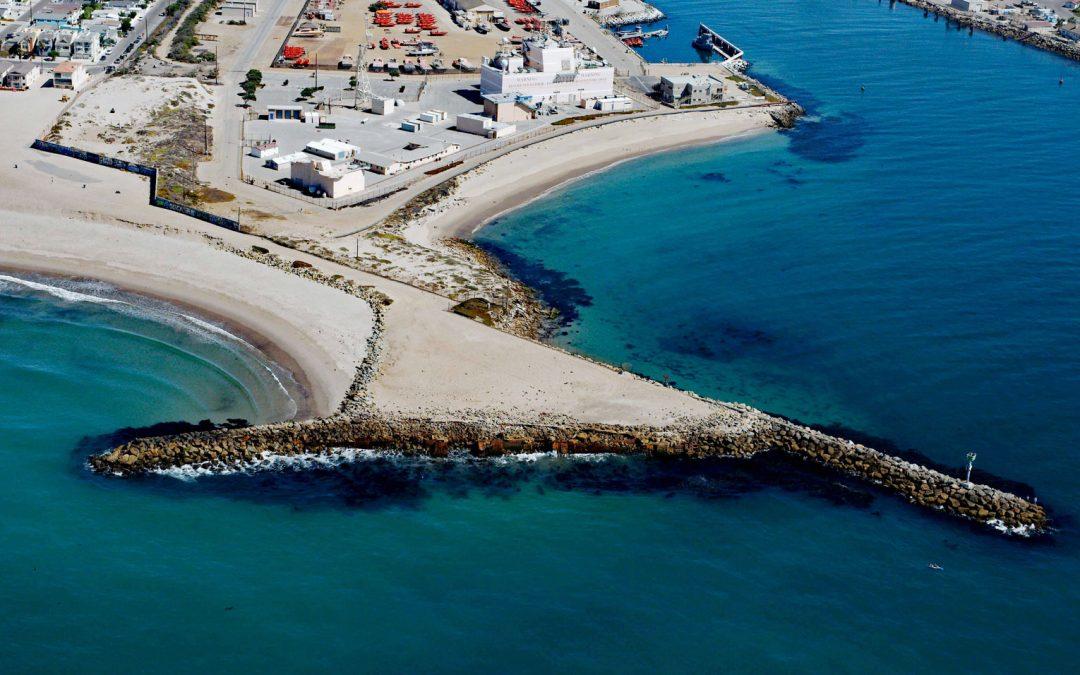
by CoastView | Feb 10, 2026 | 2026, Beaches, California, Coastal Features, February 2026, Historical, Land Use, Shipwrecks
Listen to the article here https://coastview.org/wp-content/uploads/2026/01/LaJenelle.mp3 La Jenelle was a passenger ship that went aground and wrecked in 1970 on Silver Strand at Port Hueneme, a sandy beach created partly from dredged harbor sand about 1 mile (1.6...
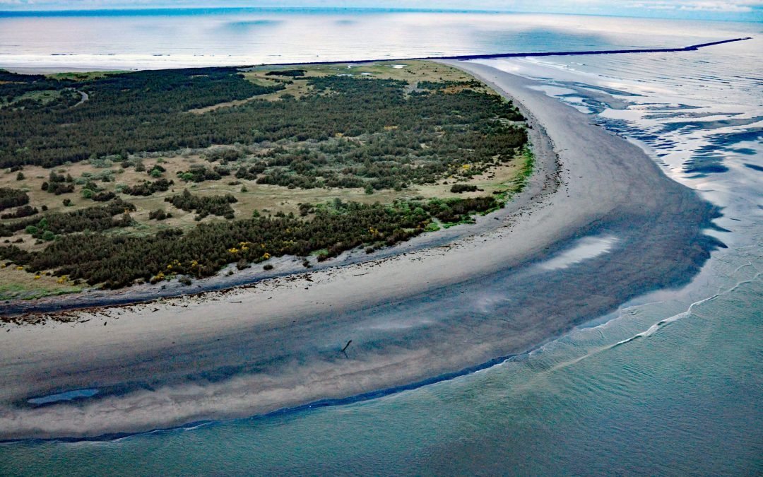
by CoastView | Feb 7, 2026 | 2026, Beaches, Coastal Features, February 2026, Land Use, Natural History, Oregon, Parks, Rivers
Listen to the article here https://coastview.org/wp-content/uploads/2026/01/ClatsopSpit.mp3 Clatsop Spit is part of Fort Stevens State Park that projects north from the south bank of the Columbia River and the submerged portion forms the Columbia River Bar, about 80...
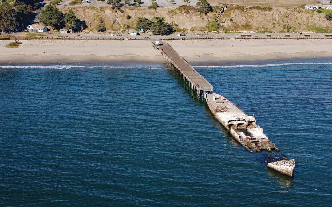
by CoastView | Feb 2, 2026 | 2026, Beaches, California, Communities, Developments, February 2026, Historical, Natural History, Shipwrecks
Listen to the article here https://coastview.org/wp-content/uploads/2026/01/SSPaloAlto.mp3 SS Palo Alto is a shipwreck now serving as an artificial reef located at Seacliff State Beach on the northern coast of Monterey Bay, approximately 6.4 miles (10.3 km) east of...
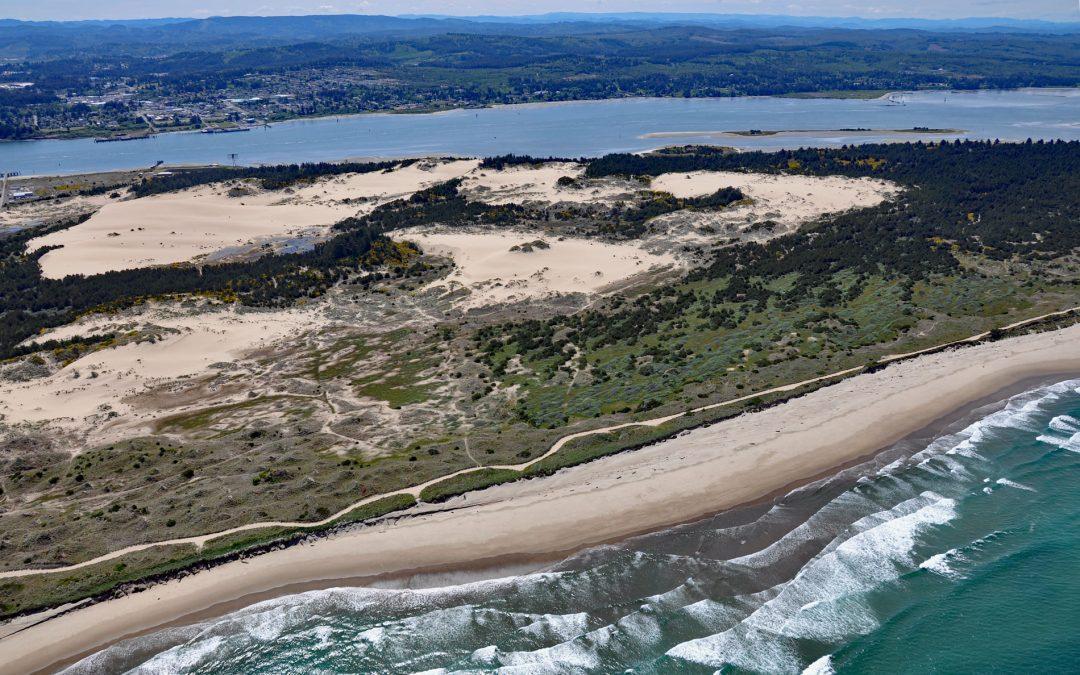
by CoastView | Jan 31, 2026 | 2026, Beaches, Coastal Features, February 2026, Historical, Land Use, Natural History, Oregon, Shipwrecks
Listen to the article here https://coastview.org/wp-content/uploads/2026/01/NewCarissa.mp3 New Carissa was a 639-foot (195 m) freighter that grounded on North Spit in 1999, causing an oil spill about 5 miles (8 km) north-west of Coos Bay and 4 miles (6.5 km) west of...

by CoastView | Jan 21, 2026 | 2026, Alaska, Beaches, Coastal Features, Glaciers, January 2026, Land Use, Natural History, Parks, Rivers
Listen to the article here https://coastview.org/wp-content/uploads/2025/12/RedRiver.mp3 The Red River begins at the terminus of the Red Glacier on the eastern flank of Mount Iliamna, and flows southeast through Lake Clark National Park and Preserve to the western...