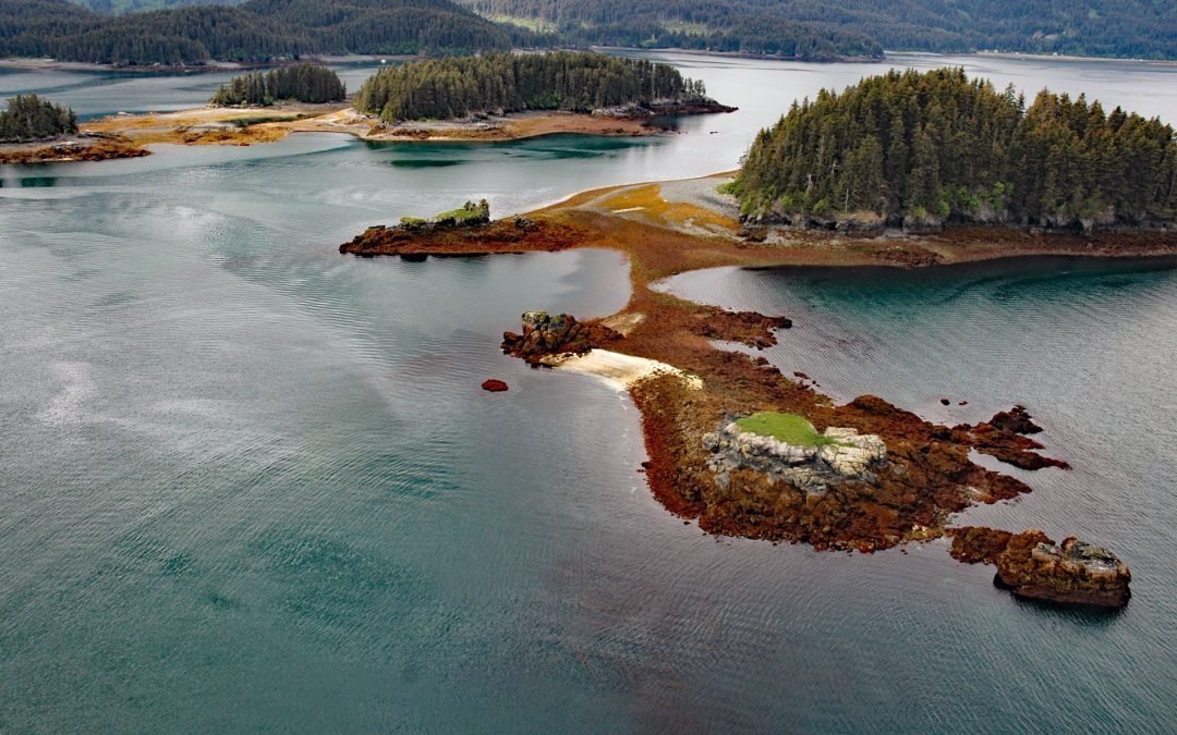
by CoastView | Dec 4, 2025 | 2025, Alaska, Biodiversity, Coastal Features, December 2025, Embayments, Islands, Kachemak, Natural History
Listen to the article here https://coastview.org/wp-content/uploads/2025/12/HerringIslands.mp3 The Herring Islands lie at the entrance to Tutka Bay on the southern shore of Kachemak Bay, about 11 miles (18 km) south of Homer and 8 miles (13 km) northeast of Seldovia,...
by CoastView | Dec 2, 2025 | 2025, Alaska, Biodiversity, Canneries, Coastal Features, December 2025, Developments, Embayments, Historical, Land Use
Listen to the article here https://coastview.org/wp-content/uploads/2025/12/ToddCannery.mp3 Todd Cannery is a historical settlement and abandoned fish processing facility located on Lindenberg Harbor in Peril Strait, on the southern coast of Chichagof Island, about 9...
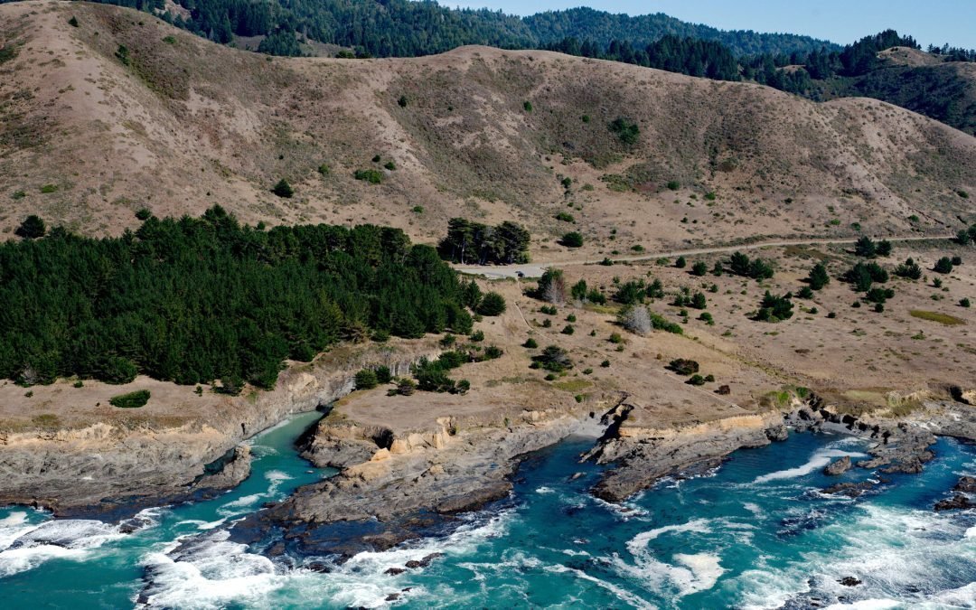
by CoastView | Nov 4, 2025 | 2025, Biodiversity, California, Coastal Features, Communities, Developments, Historical, Land Use, Natural History, November 2025
Listen to the article here https://coastview.org/wp-content/uploads/2025/07/Kibesillah.mp3 Kibesillah is the site of a historical lumber-loading chute and for a short time was one of the most important communities on the Mendocino Coast, about 10 miles (16 km) north...
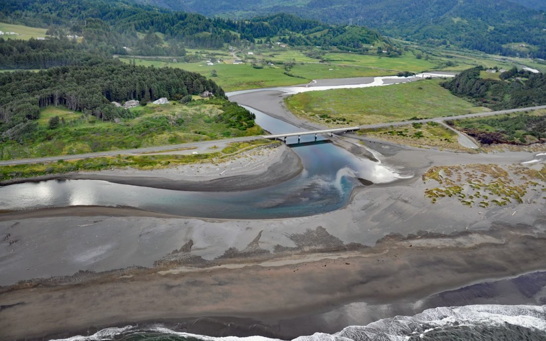
by CoastView | Nov 2, 2025 | 2025, Beaches, Biodiversity, Coastal Features, Historical, Land Use, Natural History, November 2025, Oregon, Parks, Rivers
Listen to the article here https://coastview.org/wp-content/uploads/2025/07/Pistol-River.mp3 Pistol River flows generally southwest for 21 miles (34 km) to the Pistol River State Scenic Viewpoint overlooking the Pacific Ocean near the community of Pistol River, about...

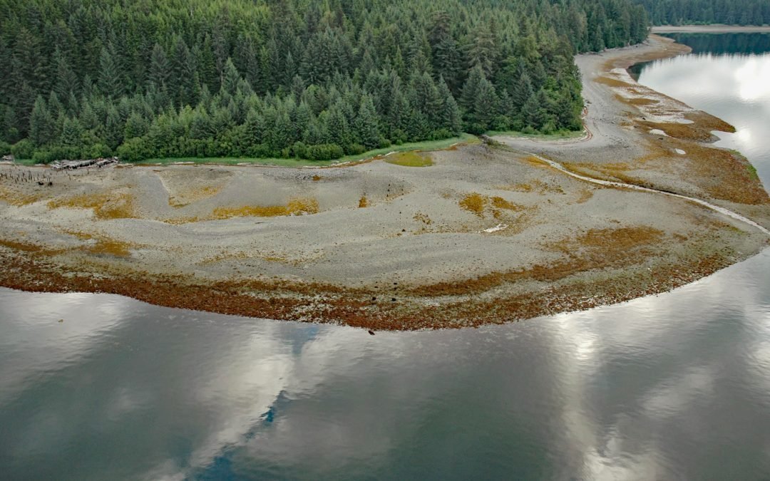
by CoastView | Nov 1, 2025 | 2025, Alaska, Biodiversity, Coastal Features, Embayments, Islands, Kachemak, Natural History, November 2025, Rivers
Listen to the article here https://coastview.org/wp-content/uploads/2025/07/Mermaid-Island.mp3 Mermaid Island is located on McKeon Flats, a tidal flat formed by the Wosnesenski River as it flows into Neptune Bay, about 13 miles (21 km) northeast of Seldovia and 8...

by CoastView | Oct 30, 2025 | 2025, Alaska, Biodiversity, Coastal Features, Embayments, Islands, Natural History, October 2025, Parks
Listen to the article here https://coastview.org/wp-content/uploads/2025/07/Shakun-Island.mp3 Shakun Islets is a group of grass-covered islands and submerged reefs extending 1.8 miles (2.9 km) north to south at the entrance of Swikshak Bay in Shelikof Strait, about...