by CoastView | Sep 6, 2025 | 2025, British Columbia, Communities, Embayments, Historical, Land Use, Natural History
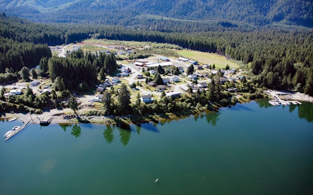
Listen to the article here https://coastview.org/wp-content/uploads/2025/06/Malachan.mp3 Malachan is a Ditidaht community situated at the northeastern end of Nitinat Lake on the west coast of Vancouver Island, about 37 miles (60 km) southeast of Bamfield and 93 miles...

by CoastView | Aug 30, 2025 | 2025, British Columbia, Coastal Features, Developments, Embayments, Historical, Land Use, Natural History, Rivers
Listen to the article here https://coastview.org/wp-content/uploads/2025/06/Seymour-River.mp3 The Seymour River flows from a large reservoir into Burrard Inlet in North Vancouver, British Columbia. It is named after Frederick Seymour, the governor of British Columbia...

by CoastView | Aug 22, 2025 | 2025, Biodiversity, British Columbia, Canneries, Coastal Features, Communities, Developments, Embayments, Historical, Islands, Land Use, Natural History
Listen to the article here https://coastview.org/wp-content/uploads/2025/06/Humpback.mp3 Humpback Bay is an embayment on the north coast of Porcher Island, off Malacca Passage, about 15 miles (24 km) south of Prince Rupert, British Columbia. The bay hosts a community...

by CoastView | Aug 15, 2025 | 2025, Biodiversity, British Columbia, Communities, Developments, Historical, Land Use, Natural History, Rivers
Listen to the article here https://coastview.org/wp-content/uploads/2025/06/Gingolx.mp3 Gingolx is located at the confluence of the Kincolith and Nass rivers on the northern shore of Nass Bay, approximately 70 miles (113 km) east-southeast of Ketchikan and 50 miles...

by CoastView | Aug 8, 2025 | 2025, Beaches, British Columbia, Coastal Features, Communities, Historical, Islands, Land Use, Parks, Rivers, Shipwrecks
Listen to the article here https://coastview.org/wp-content/uploads/2025/06/Pezuta.mp3 The Tlell River flows generally north-northeast for 28 miles (45 km) to Hecate Strait, near the wreck of the steamship SS Pezuta, about 29 miles (47 km) south-southeast of Masset...

by CoastView | Aug 1, 2025 | 2025, British Columbia, Coastal Features, Headlands, Historical, Islands, Land Use, Natural History, Parks
Listen to the article here https://coastview.org/wp-content/uploads/2025/06/Beaver-Point.mp3 Beaver Point is a prominent headland in Ruckle Provincial Park on the southeastern shore of Salt Spring Island in the Southern Gulf Islands, about 8 miles (13 km)...