by CoastView | Sep 25, 2024 | 2024, Alaska, Biodiversity, Climate Change, Coastal Features, Freshwater, Glaciers, Historical, Land Use, Parks, Rivers
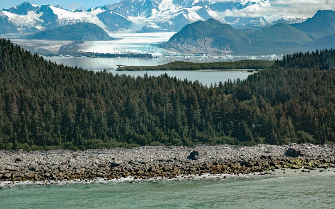
Grand Plateau Glacier starts on the north flank of Mount Fairweather in the Fairweather Range of the Saint Elias Mountains and flows generally northwest for 19 miles (31 km) where it splits into two terminal lobes, with the southern lobe flowing 6 miles (10 km) to...
by CoastView | Sep 23, 2024 | 2024, Alaska, Climate Change, Coastal Features, Embayments, Glaciers, Historical
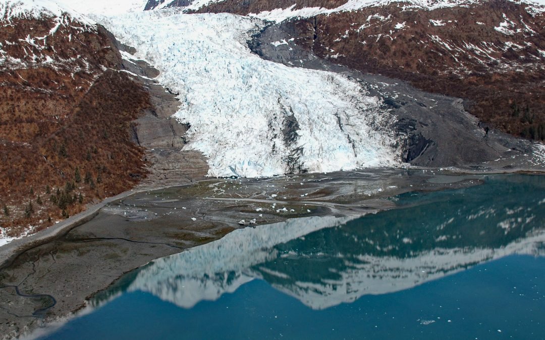
Wellesley Glacier flows for about 4.5 miles (7 km) from the Chugach Mountains and terminates at a lagoon on the west side of College Fjord, about 55 miles (89 km) west of Valdez and 40 miles (64 km) northeast of Whittier, Alaska. It was named for Wellesley College in...
by CoastView | Sep 14, 2024 | 2024, Alaska, Climate Change, Communities, Developments, Embayments, Glaciers, Historical, Land Use, Mines, Rivers
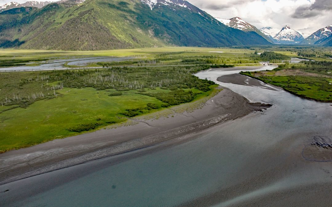
Portage is a historical community and railroad siding at milepost 64.2 on the Alaska Railroad at the head of Turnagain Arm in the Chugach National Forest, about 41 miles (66 km) south of Anchorage and 11 miles (18 km) northwest of Whittier, Alaska. Portage was once a...

by CoastView | Sep 9, 2024 | 2024, Beaches, Biodiversity, Climate Change, Coastal Features, Land Use, Natural History, Oregon, Parks
Strawberry Hill is part of Neptune State Park, situated between Nancy Creek and Bob Creek, about 19 miles (31 km) north of Florence and 5 miles (8 km) south of Yachats, Oregon. The Strawberry Hill Rocky Shore Area is a series of basalt outcrops along the base of Cape...

by CoastView | Sep 8, 2024 | 2024, British Columbia, Climate Change, Developments, Freshwater, Historical, Islands, Land Use
Fairfax Point is a point of land at the southern tip of Moresby Island, one of the Southern Gulf Islands, about 41 miles (66 km) south-southwest of Vancouver and 6 miles (10 km) northeast of Sidney, British Columbia. The island and the point are named after Rear...

by CoastView | Aug 17, 2024 | 2024, Alaska, Climate Change, Coastal Features, Communities, Embayments, Historical, Islands
Mueller Cove provides a protected landing for the village of Nikolski at the head of Nikolski Bay, on the northern shore and at the southwestern end of Umnak Island in the eastern Aleutian Islands, about 338 miles (544 km) east-northeast of Adak and 116 miles (187 km)...