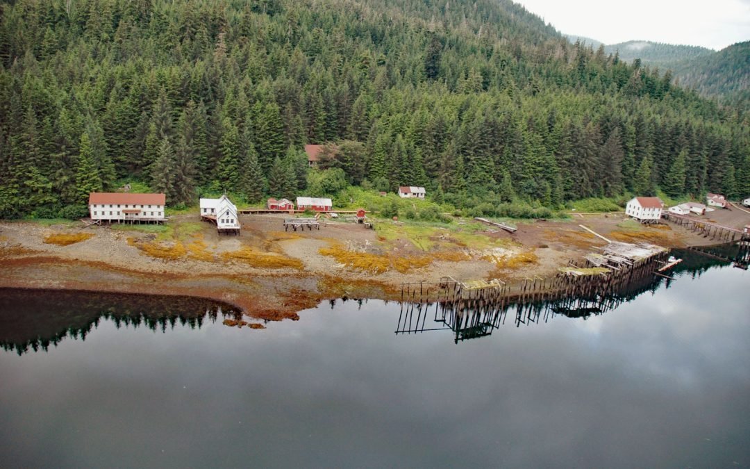
by CoastView | Jun 9, 2025 | 2025, Alaska, Biodiversity, Canneries, Coastal Features, Communities, Developments, Embayments, Historical, Islands, Land Use
Listen to the article here https://coastview.org/wp-content/uploads/2025/05/Chatham-Cannery.mp3 Chatham is a historic salmon cannery and village on the west shore of Sitkoh Bay on Chichagof Island in the Alexander Archipelago of Southeast Alaska, about 58 miles (93...
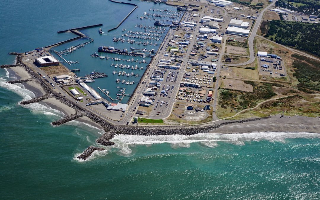
by CoastView | Jun 8, 2025 | 2025, Beaches, Coastal Features, Communities, Developments, Embayments, Historical, Land Use, Lighthouses, Washington
Listen to the article here https://coastview.org/wp-content/uploads/2025/05/Westport.mp3 Westport is a community located on Point Chehalis, a peninsula between South Bay and the Pacific Ocean that partially encloses Grays Harbor from the south, about 53 miles (85 km)...
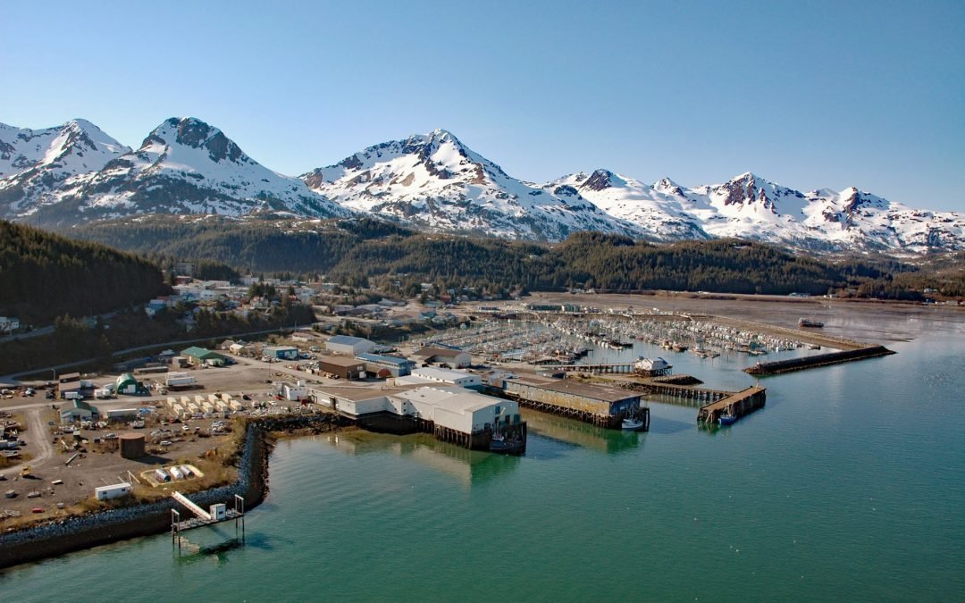
by CoastView | Jun 5, 2025 | 2025, Alaska, Canneries, Coastal Features, Communities, Developments, Embayments, Historical, Land Use
Listen to the article here https://coastview.org/wp-content/uploads/2025/05/Cordova.mp3 Cordova is a community on the southeastern shore of Orca Inlet across from Hawkins Island in eastern Prince William Sound, about 100 miles (160 km) east-southeast of Whittier and...

by CoastView | Jun 4, 2025 | 2025, Biodiversity, California, Coastal Features, Developments, Embayments, Headlands, Historical, Land Use
Listen to the article here https://coastview.org/wp-content/uploads/2025/05/Bodega-Labs.mp3 Bodega Marine Laboratory is located on Bodega Head, a prominent peninsula that partially encloses Bodega Harbor on the northwestern shore of Bodega Bay, about 10 miles (16km)...

by CoastView | Jun 3, 2025 | 2025, Alaska, Chemical Pollution, Climate Change, Coastal Features, Developments, Historical, Land Use, Natural History
Listen to the article here https://coastview.org/wp-content/uploads/2025/05/Point-Lonely.mp3 Originally a Cold War Distant Early Warning facility, Lonely was decommissioned in 2018 and is now an unattended airstrip on the Beaufort Sea coast at Pitt Point, about 83...

by CoastView | Jun 1, 2025 | 2025, Biodiversity, Coastal Features, Communities, Developments, Embayments, Historical, Land Use, Natural History, Rivers, Washington
Listen to the article here https://coastview.org/wp-content/uploads/2025/05/Blyn.mp3 Blyn is a small community where Jimmycomelately Creek flows into Sequim Bay on the northern coast of the Olympic Peninsula, about 13 miles (21 km) southwest of Port Townsend and 7...