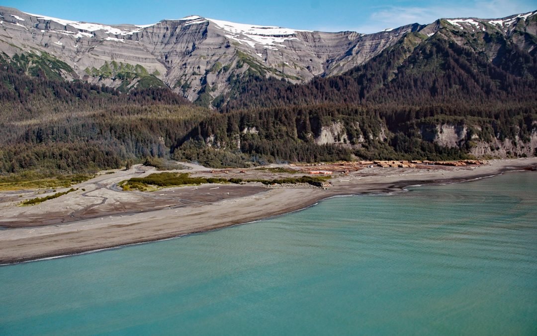
by CoastView | Aug 7, 2023 | 2023, Alaska, Developments, Headlands
Claybluff Point is a low headland at the base of the Robinson Mountains, 1 mile (1.6 km) east of Icy Cape, about 34 miles (55 km) east-southeast of Yakataga and 69 miles (111 km) northwest of Yakutat, Alaska. Icy Cape is a point of land at the northwest entrance...
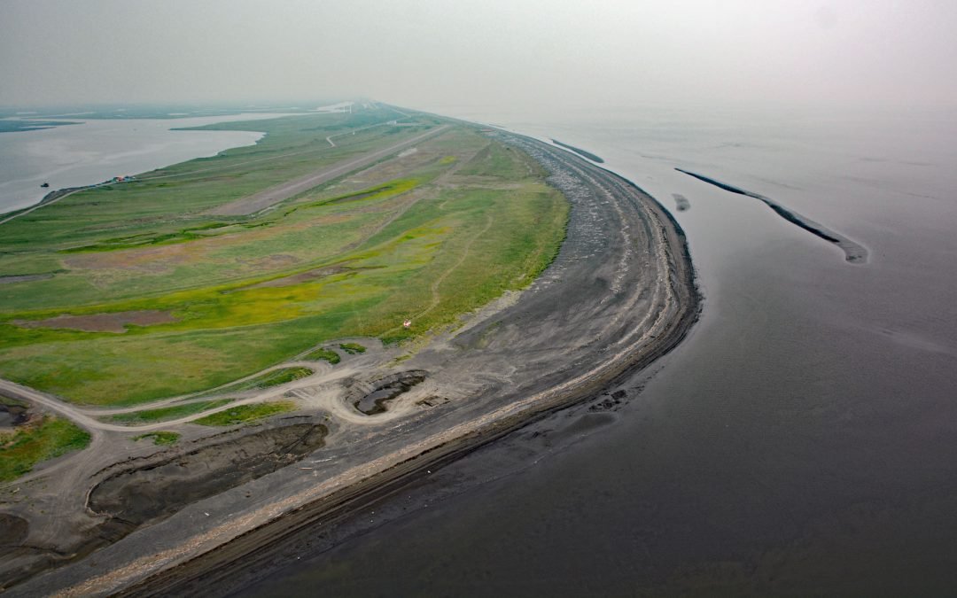
by CoastView | Jul 26, 2023 | 2026, Alaska, Communities, Developments, Embayments, Historical, July 2026, Land Use, Natural History
Listen to the article here https://coastview.org/wp-content/uploads/2026/03/Shaktoolik.mp3 Shaktoolik is a small community on a spit forming Shaktoolik Bay, on the eastern shore of Norton Sound, about 56 miles (90 km) southeast of Golovin and 35 miles (56 km)...

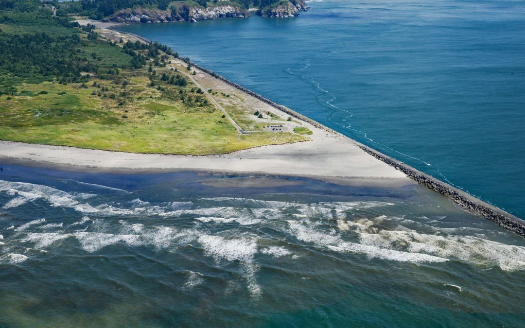
by CoastView | Jul 24, 2023 | 2026, Biodiversity, California, Coastal Features, Developments, Headlands, Historical, July 2026, Land Use, Parks
Listen to the article here https://coastview.org/wp-content/uploads/2026/03/ChimneyRock.mp3 Chimney Rock is an islet off the eastern headland of the Point Reyes Peninsula, connected to it only at low tide, about 3 miles (4.8 km) east of the Point Reyes Light and 10...
by CoastView | Jul 23, 2023 | 2026, Coastal Features, Developments, Historical, July 2026, Land Use, Natural History, Rivers, Washington
Listen to the article here https://coastview.org/wp-content/uploads/2026/03/PeacockSpit.mp3 Peacock Spit is the northern portion of a mostly submerged sand bar, generally called the Columbia Bar, at the mouth of the Columbia River, about 12 miles (19 km) northwest of...
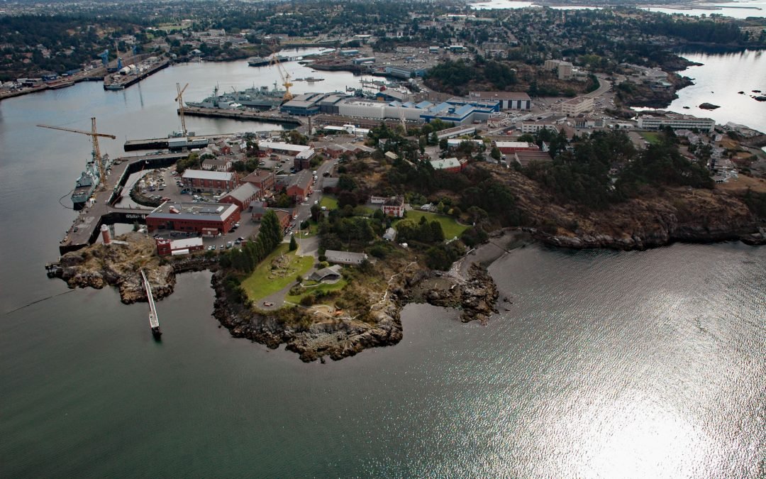
by CoastView | Jul 21, 2023 | 2026, British Columbia, Developments, Embayments, Historical, July 2026, Land Use
Listen to the article here https://coastview.org/wp-content/uploads/2026/03/EsquimaltHarbour-1.mp3 Esquimalt Harbour is a sheltered embayment on the southern tip of Vancouver Island, about 21 miles (34 km) north of Port Angeles, Washington, and 3 miles (4.8 km)...
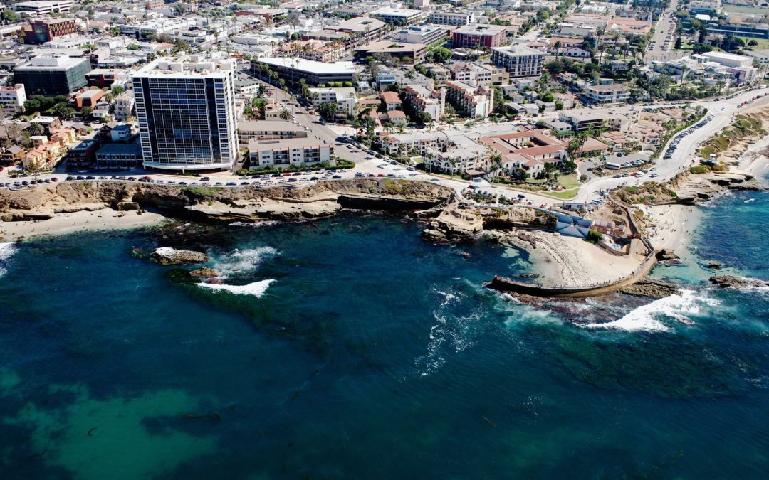
by CoastView | Jul 19, 2023 | 2026, Beaches, Biodiversity, California, Coastal Features, Communities, Developments, July 2026, Land Use, Natural History
Listen to the article here https://coastview.org/wp-content/uploads/2026/03/ChildrensPool.mp3 Children’s Pool is a rocky cove partially enclosed by a seawall, located in La Jolla, about 13 miles (21 km) south of Encinitas and 11 miles (18 km) northwest of...