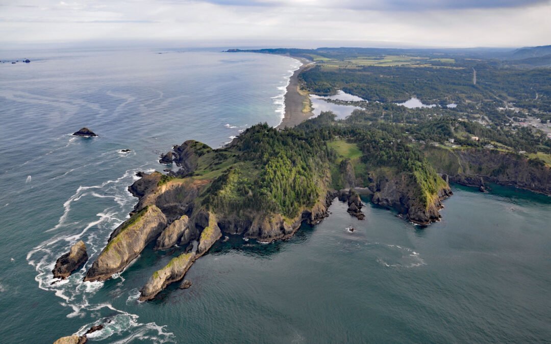
by CoastView | Apr 13, 2024 | 2024, Biodiversity, Coastal Features, Developments, Headlands, Land Use, Natural History, Oregon, Parks
Nellies Cove is situated on the south side of a rocky headland known as The Heads, between Agate Beach to the north and Port Orford to the south, and is the site of a historic lifeboat station in Port Orford Heads State Park, about 23 miles (37 km) north of Gold Beach...
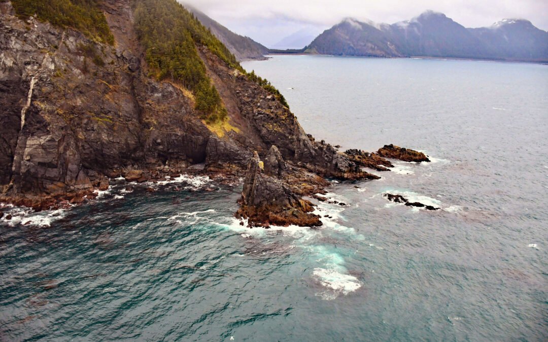
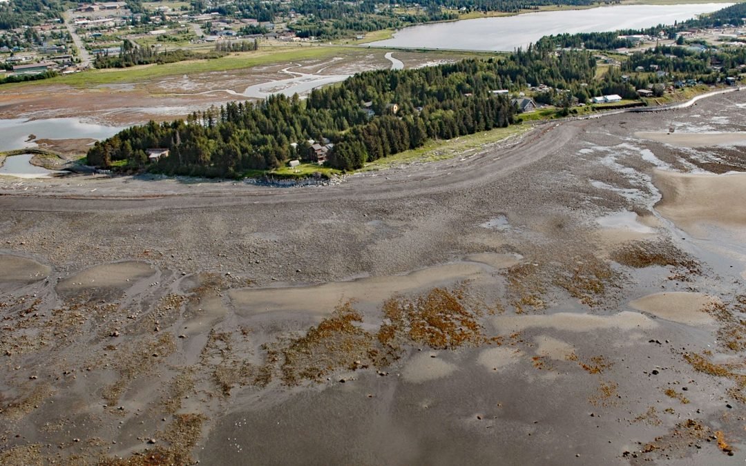
by CoastView | Apr 8, 2024 | 2024, Alaska, Beaches, Chemical Pollution, Coastal Features, Headlands, Natural History
Gore Point is a major headland with a summit elevation of 1411 feet (430 m) on the outer coast of the Kenai Peninsula that extends 2.5 miles (4 km) into the Gulf of Alaska, about 83 miles (134 km) south-southwest of Seward and 37 miles (60 km) south-southeast of...
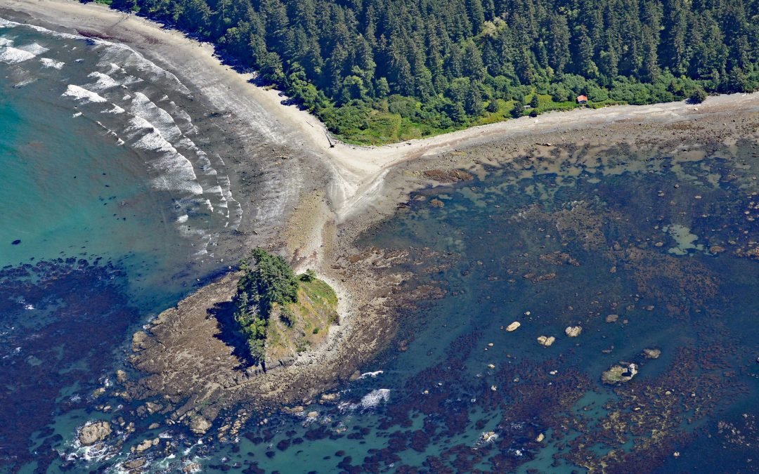
by CoastView | Apr 4, 2024 | 2024, Beaches, Coastal Features, Headlands, Historical, Land Use, Natural History, Parks, Shipwrecks, Washington
Cape Alava is a point of land on the outer coast of the Olympic Peninsula in Olympic National Park, and bordering the Olympic Coast National Marine Sanctuary, about 22 miles (35 km) northwest of Forks and 15 miles (24 km) southwest of Neah Bay, Washington. The cape is...
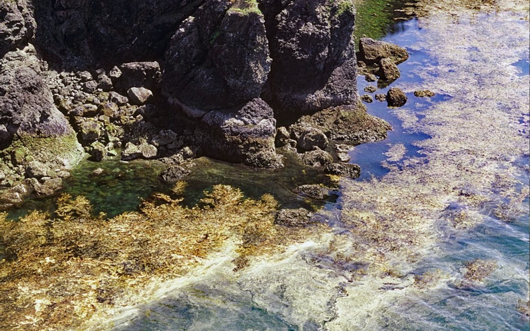
by CoastView | Apr 3, 2024 | 2024, Alaska, Biodiversity, Coastal Features, Embayments, Headlands, Islands, Natural History
Devils Bay is a bight about 0.5 miles (0.8 km) wide on the north shore of Black Cape, a prominent headland on the northwest coast of Afognak Island in the Kodiak Island Archipelago, about 97 miles (156 km) southwest of Homer and 48 miles (77 km) northwest of the...
by CoastView | Apr 2, 2024 | 2024, Alaska, Beaches, Coastal Features, Communities, Developments, Embayments, Headlands, Kachemak, Land Use, Natural History
Munson Point is a peninsula formed by an ancient lateral moraine located on the northern shore of Kachemak Bay between Beluga Slough to the west and Mariner Lagoon to the east, about 15 miles (24 km) northeast of Seldovia and 1 mile (1.6 km) south of Homer, Alaska....
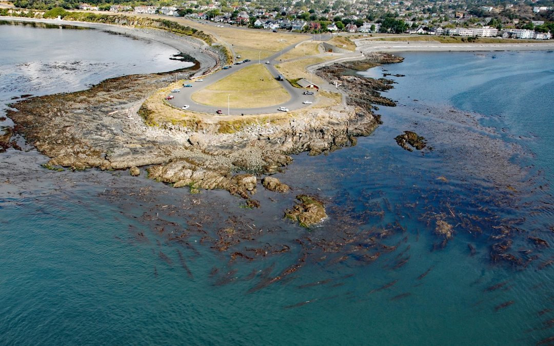
by CoastView | Mar 31, 2024 | 2024, British Columbia, Coastal Features, Communities, Developments, Headlands, Historical, Land Use, Natural History, Parks
Clover Point is a park of about 10 acres (4 ha) owned by the City of Victoria located between Ross Bay to the east and Finlayson Bay to the west at the southern tip of Vancouver Island, about 2.5 miles (4 km) southwest of Oak Bay and 1.6 miles (2.6 km) southeast of...