
by CoastView | Dec 8, 2025 | 2025, Alaska, Canneries, Communities, December 2025, Developments, Historical, Land Use, Natural History
Listen to the article here https://coastview.org/wp-content/uploads/2025/12/PilotPoint.mp3 Pilot Point is a community on the eastern shore of Ugashik Bay, on the north coast of the Alaska Peninsula, about 83 miles (134 km) south-southwest of King Salmon and 7 miles...
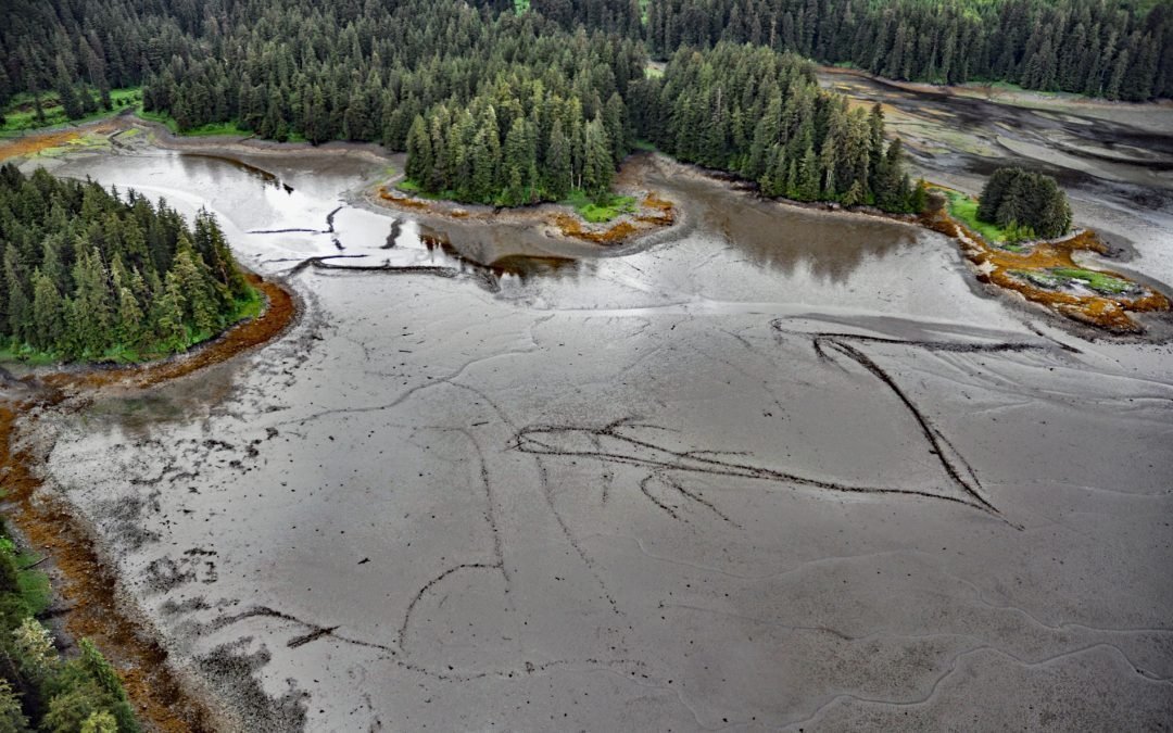
by CoastView | Dec 6, 2025 | 2025, Alaska, Biodiversity, Coastal Features, December 2025, Embayments, Historical, Islands, Land Use, Natural History
Listen to the article here https://coastview.org/wp-content/uploads/2025/12/PortCamden.mp3 Port Camden is an embayment on the northeast coast of Kuiu Island, approximately 36 miles (58 km) south-southwest of Petersburg and 61 miles (98 km) northwest of Wrangell,...
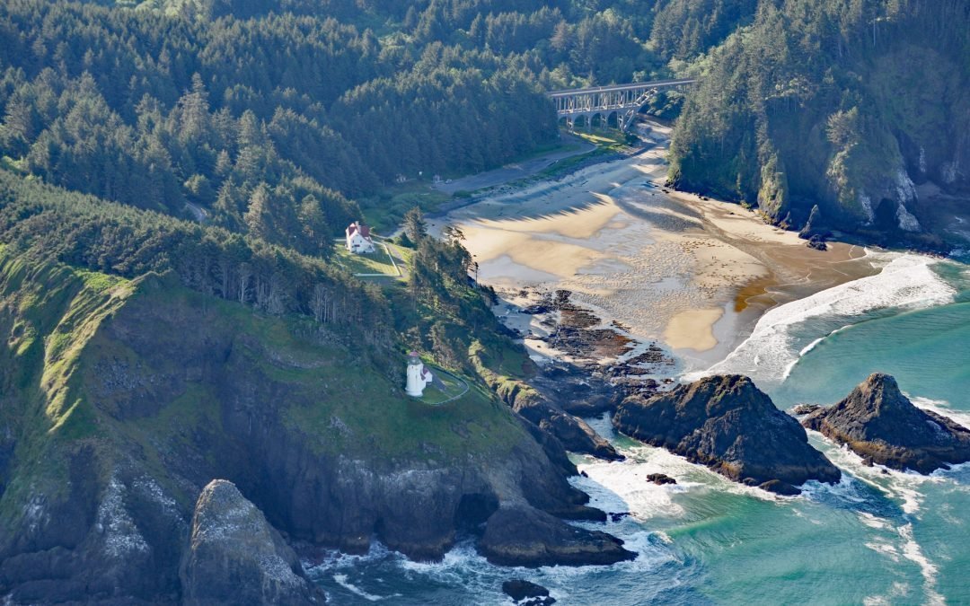
by CoastView | Dec 5, 2025 | 2025, Beaches, Coastal Features, December 2025, Headlands, Historical, Land Use, Lighthouses, Oregon, Parks
Listen to the article here https://coastview.org/wp-content/uploads/2025/12/HecetaHead.mp3 Heceta Head Lighthouse, located on the Heceta headland at an elevation of 205 feet (62 m), is approximately 13 miles (21 km) north of Florence and 13 miles (21 km) south of...
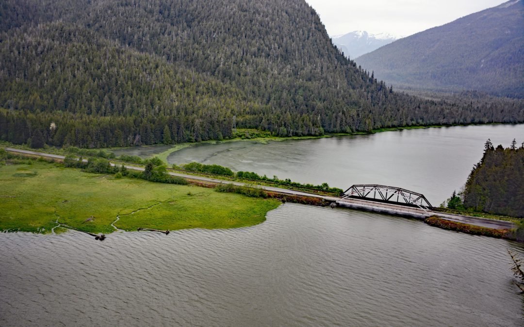
by CoastView | Dec 3, 2025 | 2025, British Columbia, Communities, December 2025, Developments, Historical, Land Use, Natural History, Rivers
Listen to the article here https://coastview.org/wp-content/uploads/2025/12/SkeenaCity.mp3 Skeena City is an abandoned community on the north shore of the Skeena River at the mouth of the Khyex River, about 22 miles (35 km) south-southeast of Prince Rupert and 52...
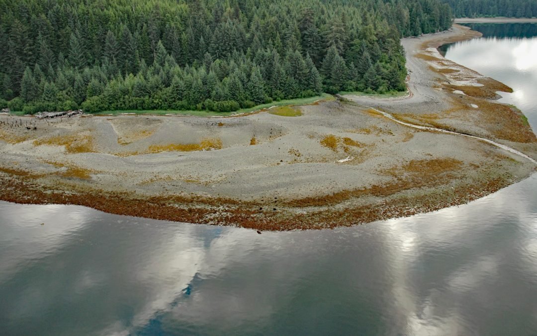
by CoastView | Dec 2, 2025 | 2025, Alaska, Biodiversity, Canneries, Coastal Features, December 2025, Developments, Embayments, Historical, Land Use
Listen to the article here https://coastview.org/wp-content/uploads/2025/12/ToddCannery.mp3 Todd Cannery is a historical settlement and abandoned fish processing facility located on Lindenberg Harbor in Peril Strait, on the southern coast of Chichagof Island, about 9...

by CoastView | Nov 26, 2025 | 2025, British Columbia, Embayments, Historical, November 2025
Listen to the article here https://coastview.org/wp-content/uploads/2025/11/DaykinsBay.mp3 Daykins Bay is located on the southeastern shore of Nitinat Lake, approximately 7 miles (11 km) northeast of the outlet at Whyac and 6 miles (10 km) southwest of the Ditidaht...