
by CoastView | Dec 16, 2023 | 2023, British Columbia, Coastal Features, Communities, Embayments, Historical, Islands, Land Use, Natural History
Lawson Harbour was a historical community on Lewis Island between Chismore Passage to the west and Arthur Passage to the east near the mouth of the Skeena River, about 75 miles (121 km) southwest of Terrace and 20 miles (32 km) south of Prince Rupert, British...

by CoastView | Dec 14, 2023 | 2023, Alaska, Biodiversity, Coastal Features, Communities, Embayments, Historical, Islands, Land Use, Natural History
Stebbins is a community in southern Norton Sound situated on a small sand spit along the northern shore of Saint Michael Island at Cape Stephens, which is in the lee of Stuart Island to the northwest and separated by a channel 1 mile (1.6 km) wide named Stephens Pass,...
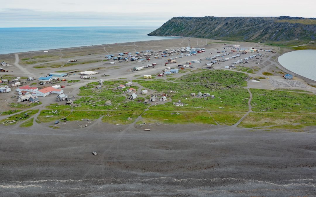
by CoastView | Dec 11, 2023 | 2023, Alaska, Beaches, Coastal Features, Communities, Headlands, Islands, Land Use, Natural History
Gambell is a community on Saint Lawrence Island at Northwest Cape in the northern Bering Sea on a broad, shallow-water continental shelf that extends from western Alaska to northeastern Russia, about 196 miles (316 km) southwest of Nome, Alaska, and 62 miles (100 km)...
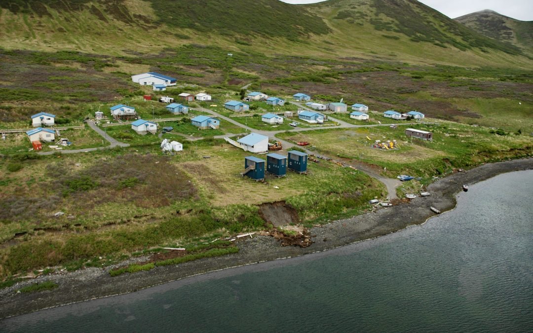
by CoastView | Dec 9, 2023 | 2023, Alaska, Biodiversity, Coastal Features, Communities, Embayments, Islands, Land Use, Natural History, Rivers
Karluk Village is situated on the southern shore of Karluk Lagoon, an embayment formed by a barrier spit that partially encloses the mouth of the Karluk River, on the Shelikof Strait coast of Kodiak Island, about 77 miles (124 km) west-southwest of Kodiak and 44 miles...
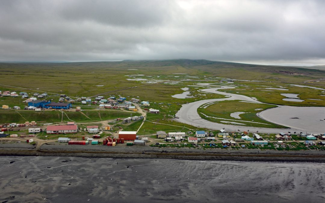
by CoastView | Dec 8, 2023 | 2023, Alaska, Beaches, Biodiversity, Coastal Features, Communities, Embayments, Islands, Land Use, Natural History, Rivers
Tununak is a traditional Central Yup’ik community located on the northwest coast of Nelson Island on a narrow barrier spit between the Bering Sea and the mouth of the Tununak River, about 119 miles (192 km) west-southwest of Bethel and 71 miles (114 km)...

by CoastView | Dec 7, 2023 | 2023, Beaches, Biodiversity, Coastal Features, Embayments, Islands, Land Use, Natural History, Oregon, Parks, Rivers
Whalen Island is located in Sand Lake which is the estuary of Sand Creek that starts at an elevation of 770 feet (235 m) in the Oregon Coast Range and flows generally south-southwest for 8 miles (13 km) to the Pacific Ocean draining a watershed of 10,880 acres (4,403...