
by CoastView | Apr 25, 2025 | 2025, Alaska, Biodiversity, Climate Change, Coastal Features, Communities, Embayments, Historical, Kachemak, Land Use, Natural History
Listen to the article here https://coastview.org/wp-content/uploads/2025/04/Bear-Cove.mp3 Bear Cove is a small embayment on the Kenai Peninsula that extends 1.5 miles (2.4 km) southeast from Kachemak Bay, between Bear Island to the south and Chugachik Island to the...

by CoastView | Apr 18, 2025 | 2025, Alaska, Beaches, Coastal Features, Embayments, Historical, Kachemak, Land Use, Mines, Natural History, Rivers
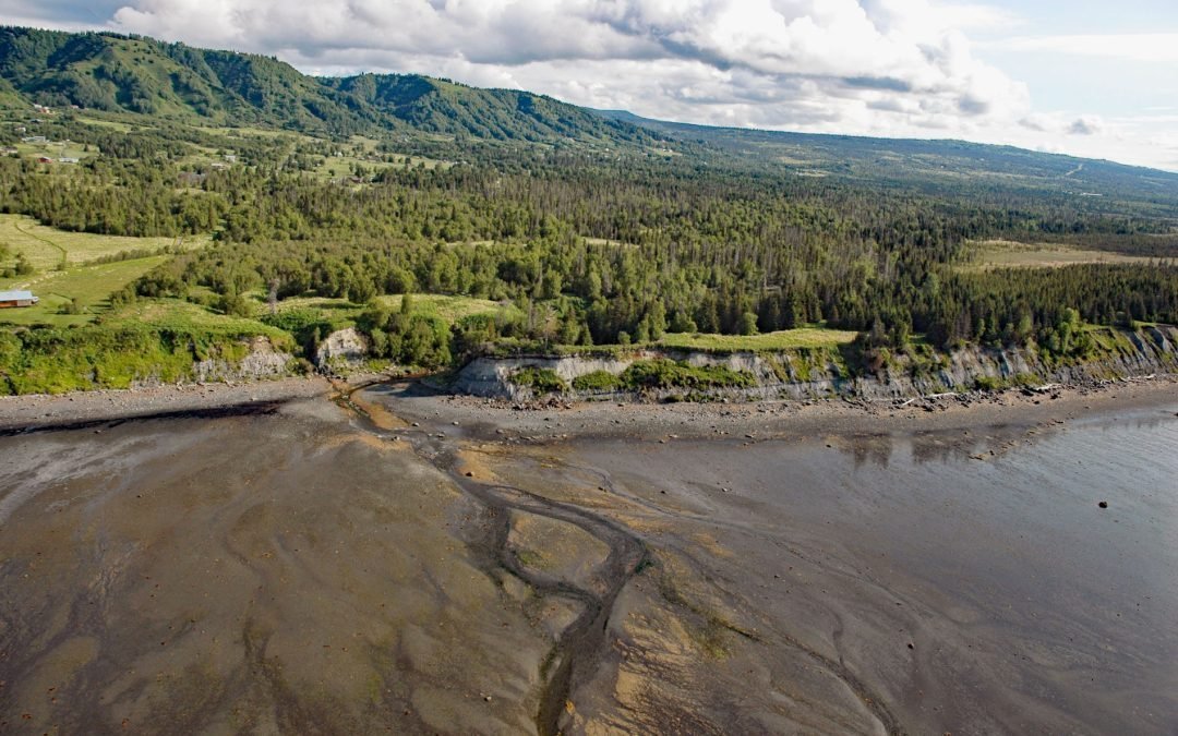
Listen to the article here https://coastview.org/wp-content/uploads/2025/04/McNeil-Canyon.mp3 McNeil Canyon is located on the Kenai Peninsula, along the northern shore of Kachemak Bay, and trends south for about 2 miles (3.2 km) along the lower course of McNeil Creek,...

by CoastView | Apr 11, 2025 | 2025, Alaska, Coastal Features, Embayments, Historical, Islands, Kachemak, Land Use, Natural History
Listen to the article here https://coastview.org/wp-content/uploads/2025/04/Little-Tutka.mp3 Little Tutka Bay, a tidal lagoon on the south side of Kachemak Bay and the southern entrance to Tutka Bay, lies about 12 miles (19 km) south of Homer and 7 miles (11 km)...
by CoastView | Apr 4, 2025 | 2025, Alaska, Biodiversity, Coastal Features, Communities, Embayments, Historical, Kachemak, Land Use, Mines, Natural History, Rivers
Listen to the article here https://coastview.org/wp-content/uploads/2025/05/Fritz-Creek.mp3 Fritz Creek is a stream on the Kenai Peninsula that starts from a watershed divide between Lookout Mountain to the south and Bald Mountain to the north and flows generally...

by CoastView | Mar 21, 2025 | 2025, Alaska, Biodiversity, Canneries, Coastal Features, Embayments, Historical, Kachemak, Natural History, Parks
Listen to the article here https://coastview.org/wp-content/uploads/2025/03/Halibut-Cove-Lagoon-1.mp3 Halibut Cove Lagoon is a semi‐enclosed embayment 0.7 miles (1 km) wide at the head of Halibut Cove on Kachemak Bay’s southeast shore, on the Kenai Peninsula, about 20...

by CoastView | Mar 18, 2025 | 2025, Alaska, Coastal Features, Headlands, Kachemak, Natural History
Listen to the article here https://coastview.org/wp-content/uploads/2025/03/Bruin-Bay.mp3 Bruin Bay Fault is exposed at Contact Point, a headland on the southern shore of Bruin Bay along the western side of Cook Inlet, about 123 miles (198 km) northwest of Kodiak and...