by CoastView | Jul 4, 2026 | 2026, Beaches, Best of 2023, Biodiversity, California, Communities, July 2026, Land Use, Natural History, Parks, Rivers
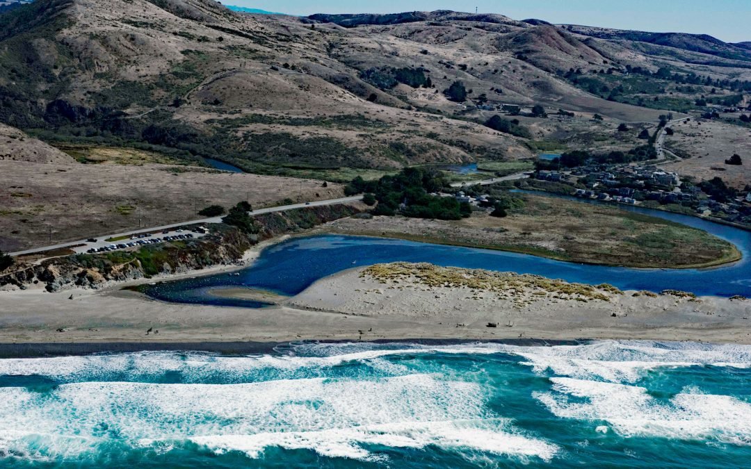
Listen to the article here https://coastview.org/wp-content/uploads/2026/03/SalmonCreek.mp3 Salmon Creek starts at an elevation of 570 feet (174 m) and flows generally southwest for 19 miles (31 km), draining a watershed of 22,487 acres (9,100 ha) between the Northern...
by CoastView | Jul 3, 2026 | 2026, Alaska, Climate Change, Coastal Features, Embayments, Glaciers, July 2026, Land Use, Natural History, Parks
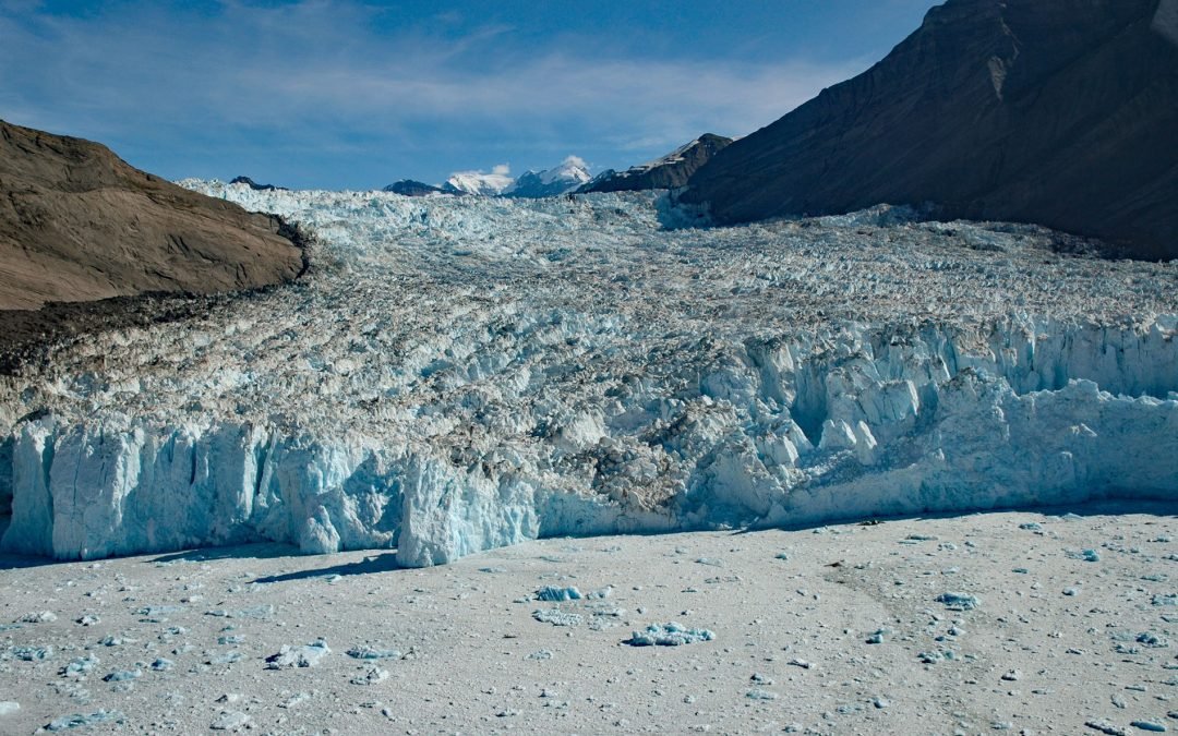
Listen to the article here https://coastview.org/wp-content/uploads/2026/03/YahtseGlacier.mp3 Yahtse Glacier flows to a tidewater terminus in Icy Bay between Guyot Hills to the west and Karr Hills to the east, about 152 miles (245 km) east-southeast of Cordova and 71...
by CoastView | Jul 2, 2026 | 2026, Beaches, Coastal Features, Embayments, Headlands, July 2026, Land Use, Natural History, Oregon
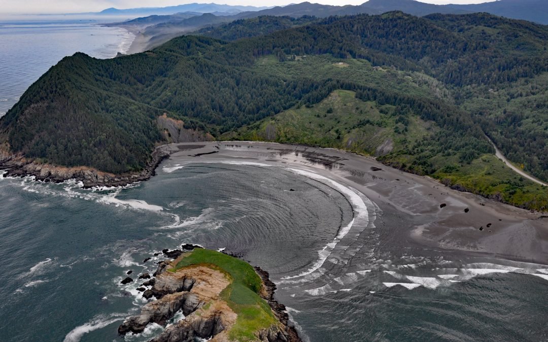
Listen to the article here https://coastview.org/wp-content/uploads/2026/03/HuntersCove.mp3 Hunters Cove lies on the south side of Cape Sebastian, a prominent headland in Cape Sebastian State Scenic Corridor, about 20 miles (32 km) north-northwest of Brookings and 6.3...
by CoastView | Jul 1, 2026 | 2026, Alaska, Coastal Features, Embayments, Headlands, July 2026, Land Use, Natural History
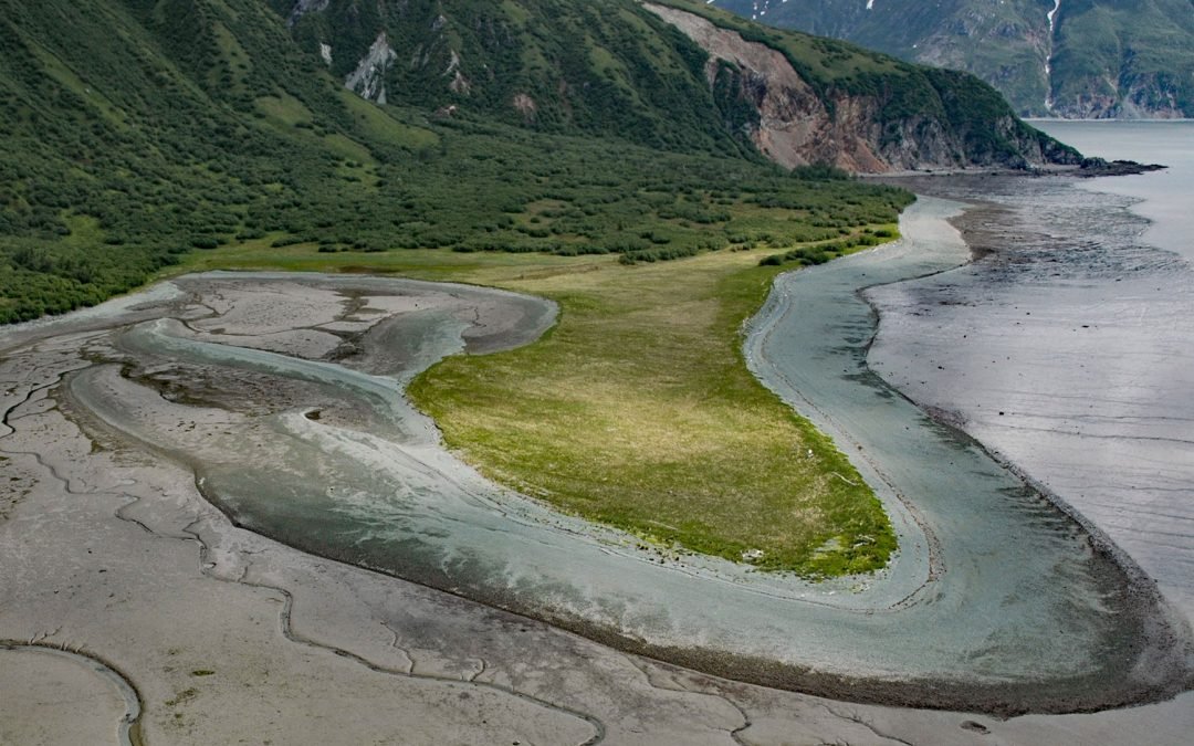
Listen to the article here https://coastview.org/wp-content/uploads/2026/03/DiamondPoint.mp3 Diamond Point is a prominent headland situated between Iliamna Bay to the north and Cottonwood Bay to the south, about 126 miles (203 km) northeast of King Salmon and 75 miles...
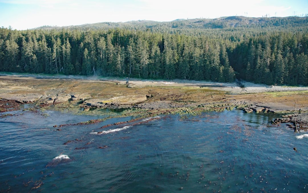
by CoastView | Jun 30, 2026 | 2026, British Columbia, Coastal Features, Historical, July 2026, Land Use, Natural History, Parks, Rivers, Shipwrecks
Listen to the article here https://coastview.org/wp-content/uploads/2026/03/MichiganCreek.mp3 Michigan Creek starts at an elevation of 1,400 feet (427 m) and flows generally south for 4 miles (6.4 km) through the Coast Mountains on Vancouver Island, entering the...
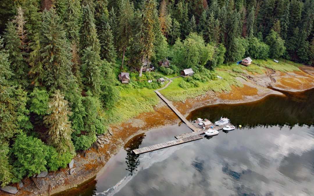
by CoastView | Jun 28, 2026 | 2026, Alaska, Communities, Developments, Embayments, Historical, June 2026, Land Use, Mines, Natural History
Listen to the article here https://coastview.org/wp-content/uploads/2026/03/WindhamBay.mp3 Windham is a settlement that historically supported mining operations along Spruce Creek at the head of Windham Bay, about 63 miles (102 km) southeast of Juneau and 57 miles (92...