
by CoastView | Oct 27, 2025 | 2025, Alaska, Coastal Features, Communities, Developments, Historical, Land Use, Mines, October 2025, Parks, Rivers
Listen to the article here https://coastview.org/wp-content/uploads/2025/07/Rainbow-Valley.mp3 Rainbow Valley is a watershed located on Turnagain Arm between Rainbow Peak to the west and Indianhouse Mountain to the east, approximately 17 miles (27 km) south-southeast...

by CoastView | Sep 29, 2025 | 2025, Alaska, Coastal Features, Communities, Developments, Embayments, Historical, Land Use, Mines, Parks
Listen to the article here https://coastview.org/wp-content/uploads/2025/06/Sumdum-Mine.mp3 Sumdum is a historical mine and community located at the head of Sanford Cove, an inlet on the southern shore of Endicott Arm, approximately 64 miles (103 km) north-northwest...
by CoastView | Sep 5, 2025 | 2025, Alaska, Coastal Features, Communities, Developments, Embayments, Historical, Land Use, Mines
Listen to the article here https://coastview.org/wp-content/uploads/2025/06/Copper-City.mp3 Copper City is an abandoned mining community located on the eastern shore of Hetta Inlet, on the southwest coast of Prince of Wales Island, about 5.5 miles (9 km) north of Lime...

by CoastView | Jul 31, 2025 | 2025, Alaska, Biodiversity, Coastal Features, Embayments, Hatcheries, Historical, Land Use, Mines, Natural History, Rivers
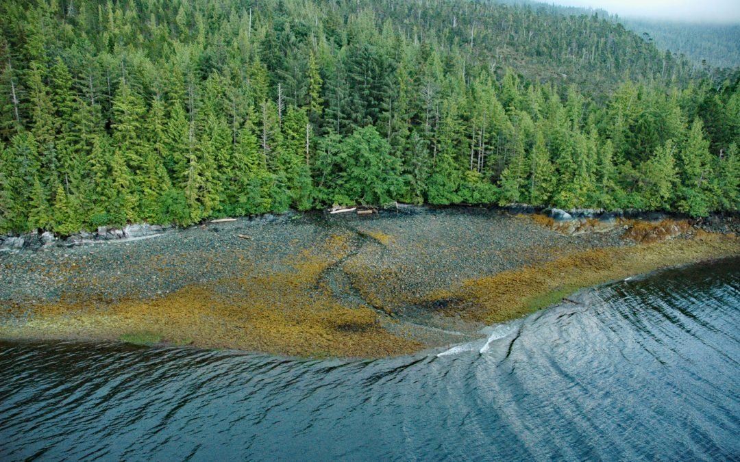
Listen to the article here https://coastview.org/wp-content/uploads/2025/06/Limestone.mp3 Limestone Inlet, 0.25 miles (0.4 km) wide, extends about 2 miles (3.2 km) into the mainland from the eastern shore of Stephens Passage, approximately 84 miles (135 km) northeast...

by CoastView | Jul 30, 2025 | 2025, Alaska, Biodiversity, Canneries, Coastal Features, Developments, Embayments, Historical, Islands, Land Use, Mines, Natural History
Listen to the article here https://coastview.org/wp-content/uploads/2025/06/Copper-Harbor.mp3 Copper Harbor is an embayment on Prince of Wales Island on the eastern shore of Hetta Inlet, near the historical Coppermount mine, about 38 miles (61 km) west-southwest of...
by CoastView | Jul 24, 2025 | 2025, Alaska, Coastal Features, Developments, Historical, Land Use, Mines, Rivers
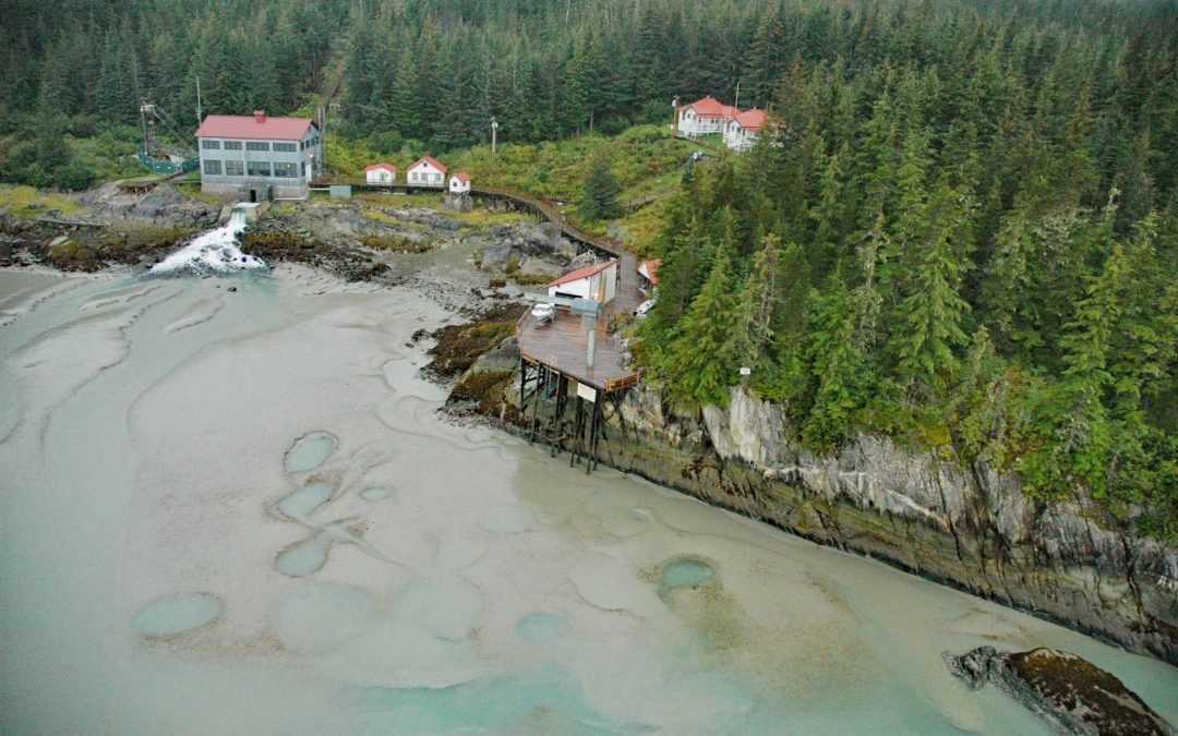
Listen to the article here https://coastview.org/wp-content/uploads/2025/06/Annex-Creek.mp3 Annex Creek flows southeast for 5 miles (8 km) through the Annex Lakes to Taku Inlet, about 0.35 miles (0.6 km) southwest of the Annex Creek hydroelectric power facility and 12...