
by CoastView | Jul 4, 2025 | 2025, Biodiversity, British Columbia, Coastal Features, Embayments, Historical, Land Use, Mines, Natural History, Parks, Rivers
Listen to the article here https://coastview.org/wp-content/uploads/2025/05/Foch-Lagoon.mp3 Foch Lagoon is approximately 1 mile (1.6 km) wide and extends 5 miles (8 km) northwest from the western shore of Douglas Channel in Foch-Gilttoyees Provincial Park and...

by CoastView | Jul 2, 2025 | 2025, Beaches, California, Coastal Features, Historical, Land Use, Natural History, Parks, Rivers, Waterfalls
Listen to the article here https://coastview.org/wp-content/uploads/2025/05/Alamere-Falls.mp3 Alamere Falls is located in the Phillip Burton Wilderness of Point Reyes National Seashore, about 6 miles (10 km) south of Olema and 6.4 miles (10.3 km) northwest of Bolinas,...

by CoastView | Jun 30, 2025 | 2025, Alaska, Biodiversity, Coastal Features, Embayments, Headlands, Historical, Land Use, Natural History, Parks
Listen to the article here https://coastview.org/wp-content/uploads/2025/05/Fossil-Point.mp3 Fossil Point is a prominent landmark in Lake Clark National Park and Preserve on the southern shore of Tuxedni Bay, at the north end of Tuxedni Channel and west of Chisik...

by CoastView | Jun 29, 2025 | 2025, Beaches, Coastal Features, Embayments, Headlands, Historical, Land Use, Lighthouses, Natural History, Parks, Washington
Listen to the article here https://coastview.org/wp-content/uploads/2025/05/Point-No-Point.mp3 Point No Point is a sand spit on the northern end of the Kitsap Peninsula, between Norwegian Point to the northwest and Pilot Point to the southeast, about 8 miles (13 km)...

by CoastView | Jun 26, 2025 | 2025, Alaska, Climate Change, Coastal Features, Embayments, Glaciers, Historical, Natural History, Parks
Listen to the article here https://coastview.org/wp-content/uploads/2025/05/Valerie-Glacier.mp3 Valerie Glacier is formed by several tributary glaciers that merge and flow southeast for about 14 miles (22.5 km) to join the Hubbard Glacier and terminate in...
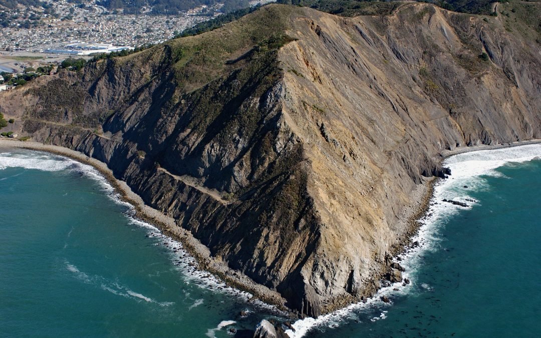
by CoastView | Jun 25, 2025 | 2025, Biodiversity, California, Coastal Features, Communities, Headlands, Historical, Land Use, Natural History, Parks
Listen to the article here https://coastview.org/wp-content/uploads/2025/05/Point-San-Pedro.mp3 Point San Pedro forms the northwestern extent of Pedro Point Headland on San Pedro Mountain, about 3.6 miles (5.8 km) north of Montara and the southern boundary of...