
by CoastView | Jul 21, 2025 | 2025, Alaska, Biodiversity, Coastal Features, Embayments, Historical, Land Use, Natural History, Rivers, Waterfalls
Listen to the article here https://coastview.org/wp-content/uploads/2025/05/Cascade-Bay.mp3 Cascade Falls descends to Cascade Bay, an estuary extending 1.5 miles (2.4 km) northwest from Eaglek Bay in northern Prince William Sound, about 52 miles (84 km) west-southwest...

by CoastView | Jul 18, 2025 | 2025, British Columbia, Coastal Features, Communities, Embayments, Historical, Land Use, Natural History, Rivers
Listen to the article here https://coastview.org/wp-content/uploads/2025/05/Oona-River-1.mp3 Oona River is a community situated at the mouth of the namesake river that drains a watershed on the southeastern shore of Porcher Island, approximately 25 miles (40 km) south...
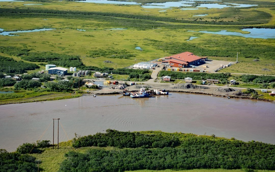
by CoastView | Jul 17, 2025 | 2025, Alaska, Biodiversity, Coastal Features, Communities, Historical, Land Use, Natural History, Rivers
Listen to the article here https://coastview.org/wp-content/uploads/2025/05/Alakanuk.mp3 Alakanuk is a Yup’ik community located at the eastern entrance of Alakanuk Pass, a major distributary channel of the Yukon River, approximately 162 miles (261 km) northwest...
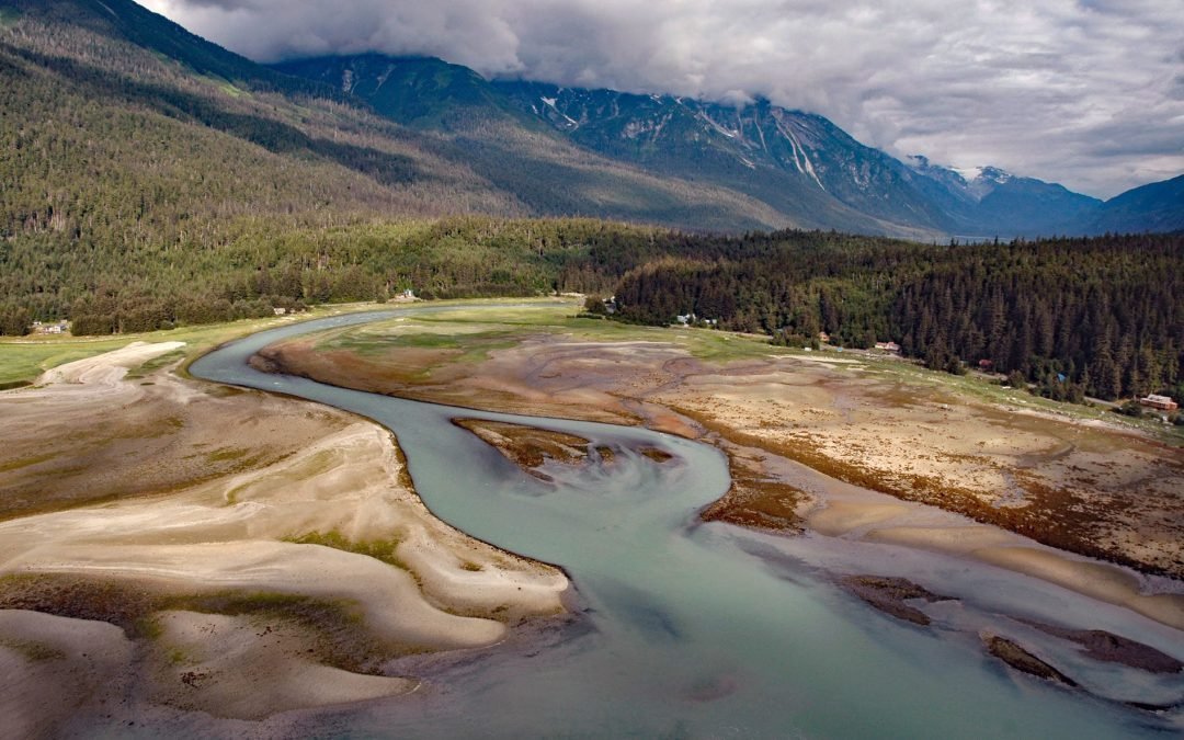
by CoastView | Jul 14, 2025 | 2025, Alaska, Biodiversity, Coastal Features, Communities, Embayments, Historical, Land Use, Natural History, Parks, Rivers
Listen to the article here https://coastview.org/wp-content/uploads/2025/05/Chilkoot.mp3 Chilkoot is a historical Tlingit village located on the Chilkoot River between Lutak Inlet to the south and Chilkoot Lake to the north, about 83 miles (134 km) north-northwest of...
by CoastView | Jul 13, 2025 | 2025, Beaches, Biodiversity, Communities, Developments, Embayments, Historical, Land Use, Natural History, Rivers, Washington
Listen to the article here https://coastview.org/wp-content/uploads/2025/05/Allyn.mp3 Allyn is a community at the mouth of Sherwood Creek on the western shore of Case Inlet in the North Bay region of South Puget Sound, about 21 miles (34 km) northwest of Tacoma and 17...

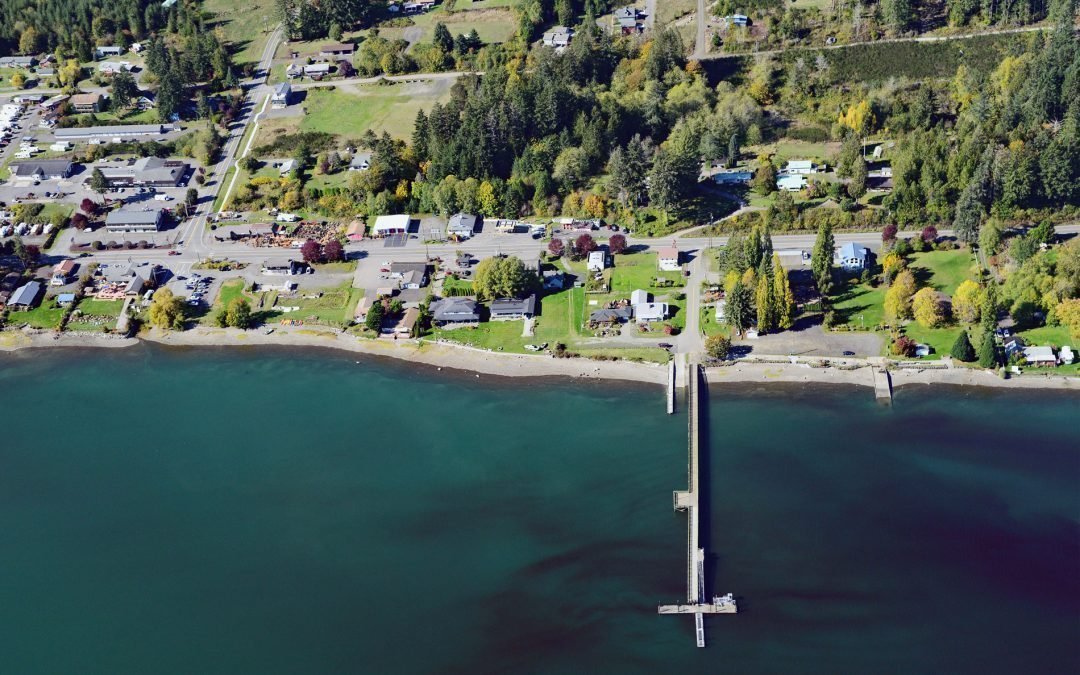
by CoastView | Jul 9, 2025 | 2025, Alaska, Biodiversity, Canneries, Coastal Features, Developments, Embayments, Historical, Land Use, Natural History, Rivers
Listen to the article here https://coastview.org/wp-content/uploads/2025/05/Letnikof-Cove.mp3 Letnikof Cove is a small embayment about 0.5 miles (0.8 km) across on the eastern shore of Chilkat Inlet, approximately 70 miles (113 km) north-northwest of Juneau and 5...