
by CoastView | Sep 26, 2025 | 2025, British Columbia, Canneries, Coastal Features, Communities, Developments, Historical, Land Use, Rivers
Listen to the article here https://coastview.org/wp-content/uploads/2025/06/Carlisle-Cannery.mp3 Carlisle was a historical salmon cannery located on the east bank at the mouth of the Skeena River, about 66 miles (106 km) southwest of Terrace and 17 miles (27 km)...

by CoastView | Sep 15, 2025 | 2025, Coastal Features, Communities, Historical, Land Use, Natural History, Oregon, Rivers
Listen to the article here https://coastview.org/wp-content/uploads/2025/06/Ophir.mp3 Ophir is a small community situated on Euchre Creek in Curry County, approximately 0.5 miles (0.8 km) upstream from the Pacific Ocean and about 4 miles (6.5 km) northeast of the...
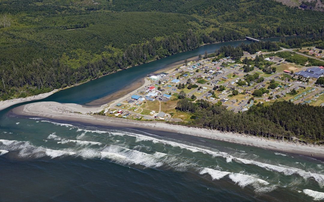
by CoastView | Sep 8, 2025 | 2025, Beaches, Coastal Features, Communities, Historical, Land Use, Natural History, Rivers, Washington
Listen to the article here https://coastview.org/wp-content/uploads/2025/06/Taholah.mp3 Taholah is a community located on the Olympic Peninsula at the mouth of the Quinault River on the Quinault Nation’s lands, approximately 9 miles (14 km) north of Moclips and...
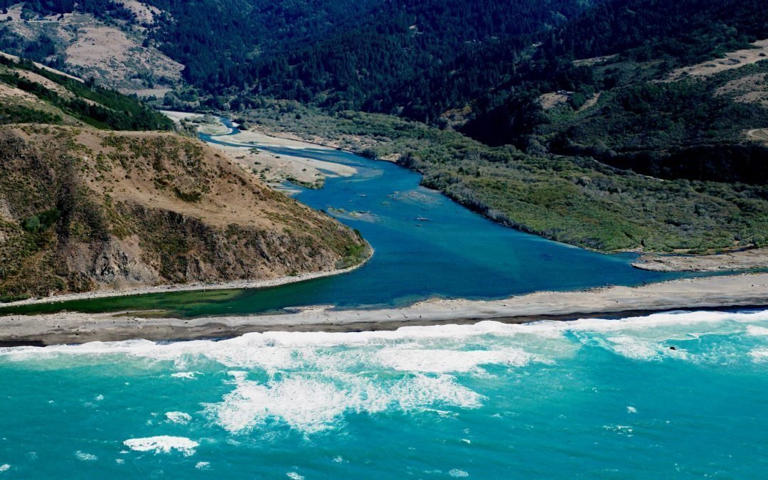
by CoastView | Sep 3, 2025 | 2025, Beaches, California, Coastal Features, Historical, Land Use, Natural History, Rivers
Listen to the article here https://coastview.org/wp-content/uploads/2025/06/Mattole-River.mp3 The Mattole River flows approximately 62 miles (100 km) through the King Range to the Lost Coast at the Punta Gorda State Marine Reserve, about 10 miles (16 km) south of Cape...
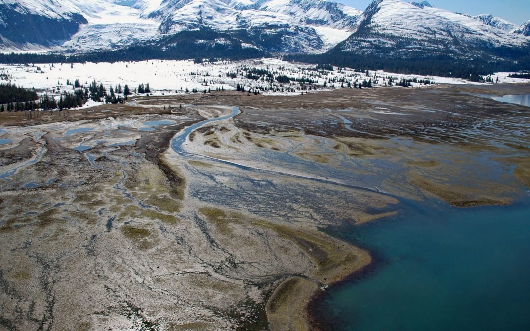
by CoastView | Sep 2, 2025 | 2025, Alaska, Coastal Features, Embayments, Glaciers, Historical, Land Use, Natural History, Rivers
Listen to the article here https://coastview.org/wp-content/uploads/2025/06/Amherst-Glacier.mp3 Amherst Glacier flows northwest for 4 miles (6.5 km) from the Chugach Mountains to a terminus lake, located 5.5 miles (9 km) northeast of Point Pakenham in College Fjord,...

by CoastView | Sep 1, 2025 | 2025, Beaches, Coastal Features, Communities, Historical, Land Use, Natural History, Oregon, Parks, Rivers
Listen to the article here https://coastview.org/wp-content/uploads/2025/06/Cannon-Beach.mp3 Ecola Creek flows into the Pacific Ocean at the northern edge of Cannon Beach, a small resort community approximately 30 miles (48 km) north of Tillamook and 8 miles (12 km)...