
by CoastView | Aug 28, 2024 | 2024, Alaska, Canneries, Communities, Developments, Embayments, Historical, Land Use, Parks, Shelter Cabins
Taku Harbor is a historical community and the site of an abandoned cannery in a small embayment on the eastern shore of Stephens Passage near Taku Inlet, about 86 miles (138 km) northeast of Sitka and 22 miles (35 km) southeast of Juneau, Alaska. Taku Harbor is named...

by CoastView | Aug 18, 2024 | 2024, Alaska, Coastal Features, Historical, Land Use, Natural History, Parks, Rivers, Shelter Cabins
Mount Susitna is a prominent mountain and landmark in northern Cook Inlet, with an elevation of 4,396 feet (1,340 m) rising from the Susitna Flats on the west bank of the Susitna River, about 65 miles (105 km) north-northeast of Kenai and 33 miles (53 km) northwest of...
by CoastView | Mar 27, 2024 | 2024, Alaska, Beaches, Biodiversity, Coastal Features, Headlands, Historical, Land Use, Natural History, Parks, Rivers, Shelter Cabins
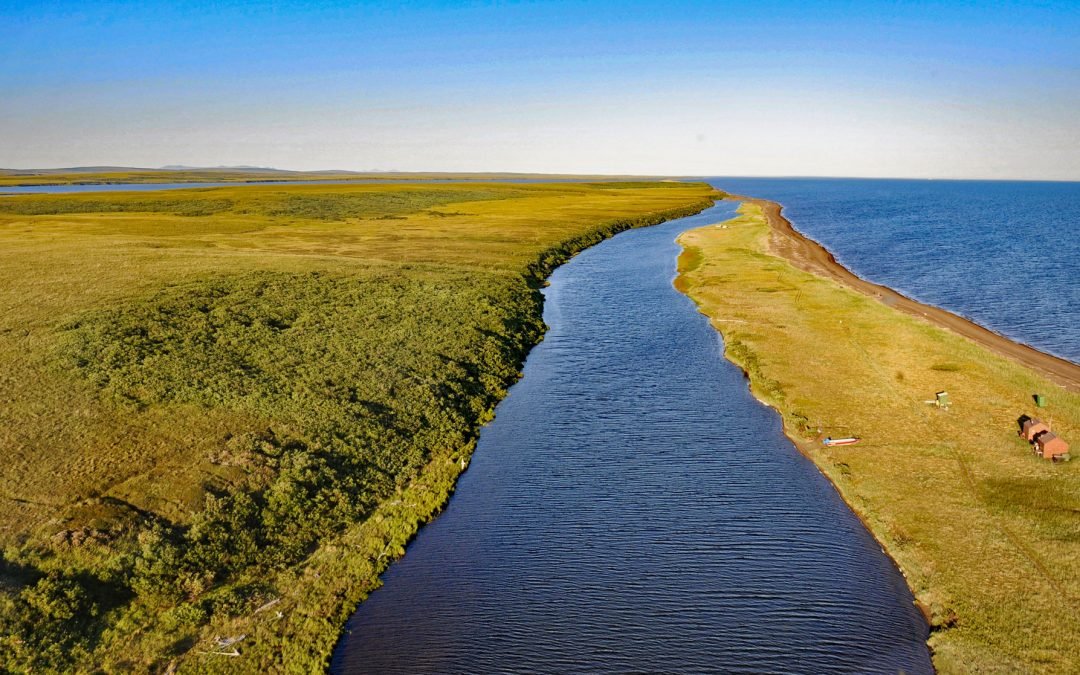
Tukrok River flows generally east-southeast for 7 miles (11 km) from Krusenstern Lagoon to Kotzebue Sound in Cape Krusenstern National Monument, about 166 miles (268 km) northeast of Wales and 23 miles (37 km) northwest of Kotzebue, Alaska. In the Iñupiat language,...
by CoastView | Jan 31, 2024 | 2024, Alaska, Coastal Features, Historical, Islands, Land Use, Natural History, Shelter Cabins
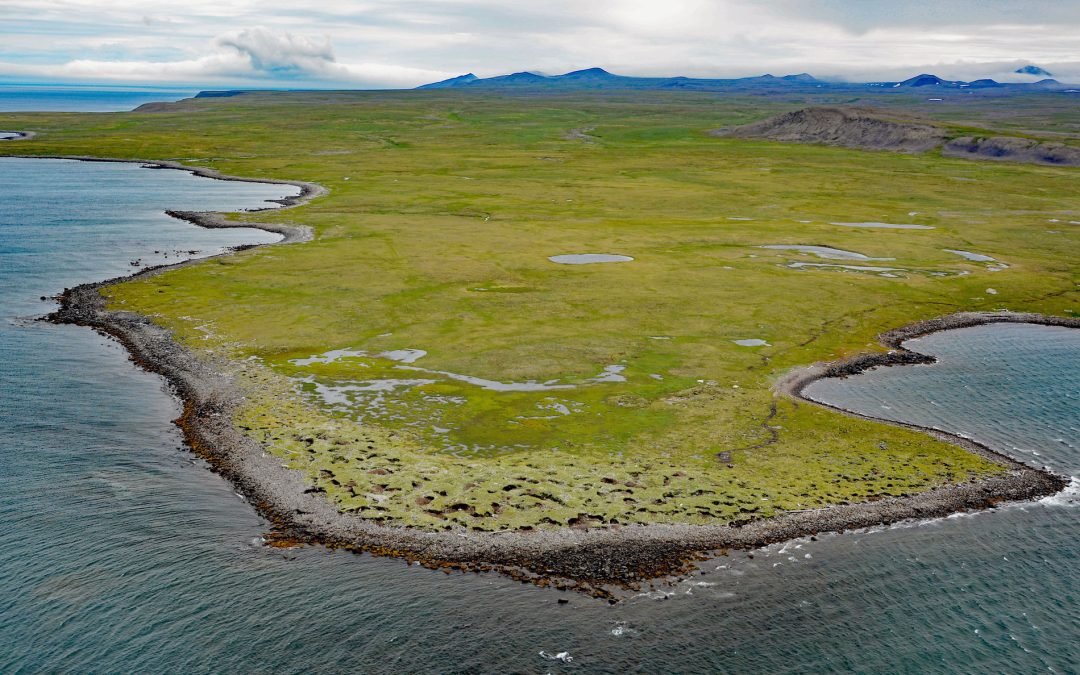
Kookoolik is a historical community, also known as Kukulik, located on Cape Kookoolik on the northern coast of Saint Lawrence Island, about 160 miles (258 km) southwest of Nome and 4 miles (6.5 km) east of Savoonga, Alaska. Kookoolik was one of several Saint Lawrence...
by CoastView | Nov 29, 2023 | 2023, Alaska, Biodiversity, Coastal Features, Embayments, Land Use, Natural History, Parks, Shelter Cabins
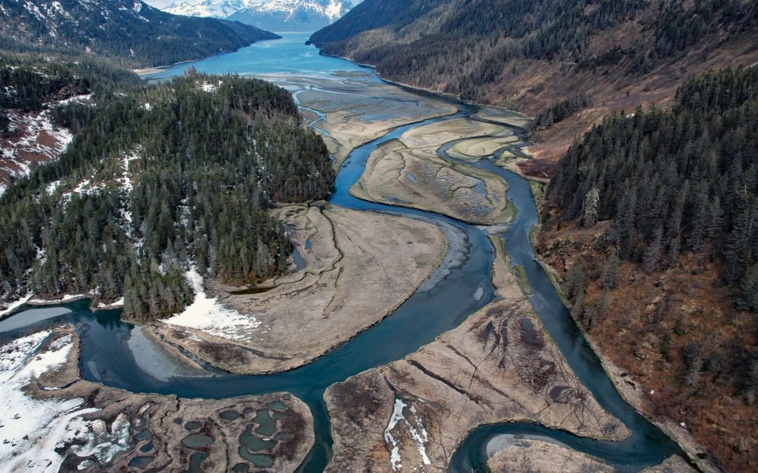
Jack Bay is an estuary surrounded by the Chugach Mountains that extends southeast for 6 miles (10 km) from Valdez Arm in Prince William Sound, about 70 miles (113 km) northeast of Whittier and 12 miles (19 km) southwest of Valdez, Alaska. In 1898, the bay was named by...

by CoastView | Oct 10, 2023 | 2023, Alaska, Beaches, Biodiversity, Coastal Features, Land Use, Natural History, Parks, Rivers, Shelter Cabins
Rabbit Creek starts in the Mulgrave Hills and flows southwest for 23 miles (37 km) through the File Mountains, also known as the Tahinichok Mountains, to the Chukchi Sea at the southern end of Imik Lagoon in Cape Krusenstern National Monument, about 96 miles (155 km)...