
Climate Change
Recent Articles
More Articles

Stinson Beach, Bolinas Bay
Stinson Beach is a community on Bolinas Bay developed on a crescent-shaped sand spit partially enclosing Bolinas Lagoon between Duxbury Point to the northwest and Rocky Point to the south, about 15 miles (24 km) northwest of San Francisco and 14 miles (23 km) south-southeast of Point Reyes Station, California.

Leffingwell Camp, Flaxman Island
Leffingwell Camp is situated on Flaxman Island, a shape-shifting barrier island separating the Beaufort Sea to the north and Lion Bay to the south, about 58 miles (94 km) east of Deadhorse and 58 miles (94 km) west of Kaktovik, Alaska.

Dinglestadt Glacier, Kenai Fjords National Park
Dinglestadt Glacier has two land terminating lobes that straddle a watershed divide in the Kenai Mountains, with a minor lobe descending southeast for 4 miles (6 km) from an elevation of roughly 3300 feet (1006 m) to a tidal delta on the western shore of McCarty Glacier in Kenai Fjords National Park, about 44 miles (71 km) south-southwest of Seward and 42 miles (68 km) east of Homer, Alaska.
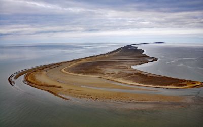
Solivik Island, Utukok Pass
Solivik Island is an Arctic barrier island that extends southwest for 16.5 miles (27 km) from Icy Cape Pass in the north to Utukok Pass in the south and forms the northern portion of Kasegaluk Lagoon, about 69 miles (111 km) southwest of Wainwright and 28 miles (45 km) north-northeast of Point Lay, Alaska.
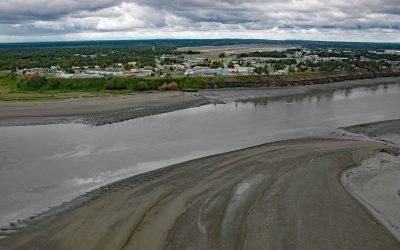
Kenai, Cook Inlet
Kenai is a community situated at the site of Shk’ituk’t, a historical Dena’ina village located on the west coast of the Kenai Peninsula, on the eastern shore of Cook Inlet at the mouth of the Kenai River, about 65 miles (15 km) southwest of Anchorage and 64 miles (103 km) north of Homer, Alaska.
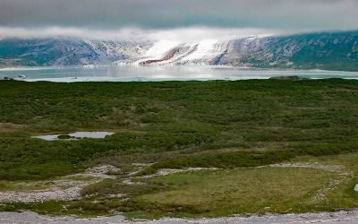
Fourpeaked Glacier, Shelikof Strait
Fourpeaked Glacier starts from the eastern flank of Fourpeaked Mountain with a summit elevation of 6771 feet (2,064 m) and flows generally east for 6 miles (10 km) to a proglacial lake about 2.5 miles (4 km) long that is drained by a river that flows another 0.8 miles (1.3 km) to Shelikof Strait in Katmai National Park and Preserve, about 90 miles (145 km) southwest of Homer and 77 miles (124 km) northwest of Kodiak, Alaska.
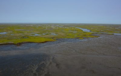
Kwigillingok, Kuskokwim Bay
Kwigillingok is a Central Yup’ik community situated on the west bank of the Kwigillingok River about 2 miles (3.2 km) inland from the northern shore of Kuskokwim Bay, about 80 miles (129 km) south-southwest of Bethel and 45 miles (72 km) west-northwest of Quinhagak, Alaska.
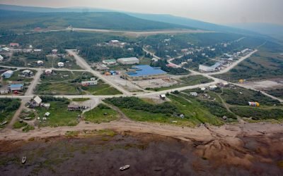
Koyuk, Norton Bay
Koyuk is an Iñupiaq community situated at the head of Norton Bay on the right bank of the Koyuk River estuary on the Seward Peninsula, about 129 miles (208 km) east-northeast of Nome and 40 miles (64 km) north of Shaktoolik, Alaska.
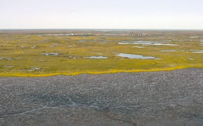
Kongiganak, Kuskokwim Bay
Kongiganak is a Central Yup’ik community situated on the eastern bank of the Kongnignanohk River that flows generally south for 40 miles (64 km) through a watershed of 29,718 acres (12,026 ha) in the Yukon Delta National Wildlife Refuge to the western shore of Kuskokwim Bay, about 69 miles (111 km) southwest of Bethel and 11 miles (18 km) east-northeast of Kwigillingok, Alaska.
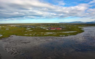
Hooper Bay, Bering Sea
Hooper Bay is a Central Yup’ik community located on the northern shore of an embayment also named Hooper Bay in the Bering Sea, between Dall Point to the north and Nuok Spit to the south, about 154 miles (248 km) west-northwest of Bethel and 28 miles (45 km) south-southwest of Scammon Bay, Alaska.
About the background graphic
This ‘warming stripe’ graphic is a visual representation of the change in global temperature from 1850 (top) to 2019 (bottom). Each stripe represents the average global temperature for one year. The average temperature from 1971-2000 is set as the boundary between blue and red. The colour scale goes from -0.7°C to +0.7°C. The data are from the UK Met Office HadCRUT4.6 dataset.
Click here for more information about the #warmingstripes.