Communities
Recent Articles
More Articles
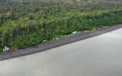
Point Possession, Cook Inlet
Point Possession is a headland on the northern shore of the Kenai Peninsula near the confluence of Cook Inlet and Turnagain Arm, about 44 miles (71 km) northeast of Kenai and 20 miles (32 km) southwest of Anchorage, Alaska.
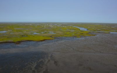
Elephant Point, Eschscholtz Bay
Elephant Point is a headland and the site of a fish camp near a historical reindeer station in Eschscholtz Bay at the head of Kotzebue Sound, about 56 miles (90 km) southeast of Kotzebue and 20 miles (32 km) north-northwest of Buckland, Alaska.
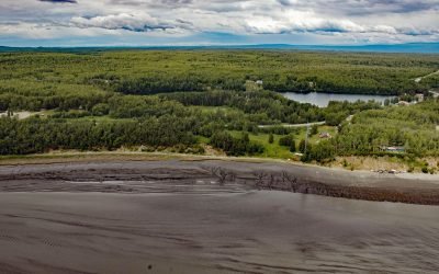
Knik Village, Knik Arm
Knik village is a historic Dena’ina community situated between the northwest shore of Knik Arm in Cook Inlet to the east and Knik Lake to the west, about 18 miles (29 km) north-northeast of Anchorage and 13 miles (21 km) southwest of Wasilla, Alaska.

Cape Pole, Kosciusko Island
Cape Pole is a historical logging community at Cape Pole on the eastern shore of Fishermans Harbor on Kosciusko Island, about 92 miles (148 km) northwest of Ketchikan and 6.7 miles (11 km) west of Edna Bay, Alaska.
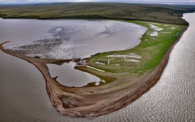
Nash Harbor, Nunivak Island
Nash Harbor is a historic settlement situated at the outlet of a lagoon on the south shore of an embayment also named Nash Harbor bounded by Cape Algonquin to the west and Chingeeruk Point to the east, on the north coast of Nunivak Island, about 96 miles (155 km) south-southwest of Hooper Bay and 30 miles (48 km) southwest of Mekoryuk, Alaska.
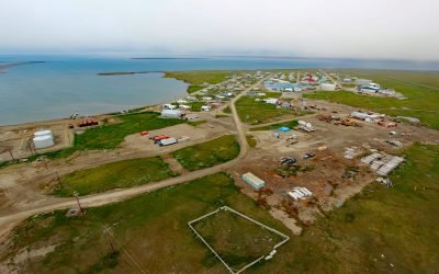
Kaktovik, Barter Island
Kaktovik is a community on Barter Island and historically was a major trading center for the Iñupiat from Alaska and Inuit from Canada, situated between the Arctic Coastal Plain and the Beaufort Sea with Arey Lagoon to the west and Kaktovik Lagoon to the east, about 113 miles (182 km) east of Deadhorse and 66 miles (106 km) west-northwest of Gordon, Alaska.
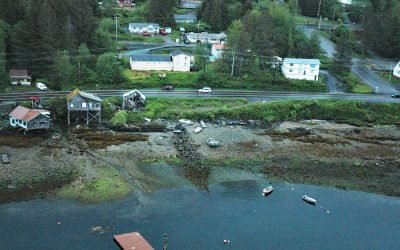
Saxman, Revillagigedo Island
Saxman is a community on the west coast of Revillagigedo Island on Tongass Narrows across from Pennock Island, about 86 miles (138 km) northwest of Prince Rupert and 3 miles (5 km) southwest of Ketchikan, Alaska.
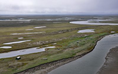
Cape Espenberg, Seward Peninsula
Espenberg is a historic Iñupiaq settlement and present-day fish camp at Cape Espenberg, a peninsula composed of a series of dune-covered beach ridges on the Chukchi Sea coast of the Seward Peninsula that extends eastward into Kotzebue Sound, about 63 miles (101 km) east-northeast of Shishmaref and 43 miles (69 km) southwest of Kotzebue, Alaska.
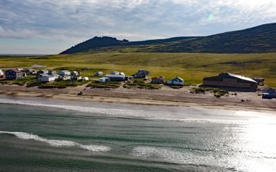
Kingigin, Cape Prince of Wales
Kingigin is an Iñupiat village, also known as Wales, situated at the mouth of Village Creek, on a series of ancient beach ridges separating Lopp Lagoon to the east from the Bering Strait to the west, on the Seward Peninsula at Cape Prince of Wales, about 73 miles (118 km) southwest of Shishmaref and 27 miles (44 km) southeast of Diomede, Alaska.
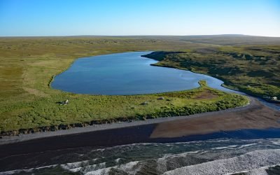
Kwigillingok, Kuskokwim Bay
Kwigillingok is a Central Yup’ik community situated on the west bank of the Kwigillingok River about 2 miles (3.2 km) inland from the northern shore of Kuskokwim Bay, about 80 miles (129 km) south-southwest of Bethel and 45 miles (72 km) west-northwest of Quinhagak, Alaska.
About the background graphic
This ‘warming stripe’ graphic is a visual representation of the change in global temperature from 1850 (top) to 2019 (bottom). Each stripe represents the average global temperature for one year. The average temperature from 1971-2000 is set as the boundary between blue and red. The colour scale goes from -0.7°C to +0.7°C. The data are from the UK Met Office HadCRUT4.6 dataset.
Click here for more information about the #warmingstripes.