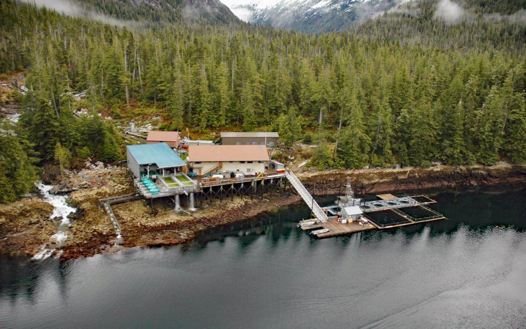
by CoastView | Mar 11, 2025 | 2025, Alaska, Biodiversity, Coastal Features, Developments, Embayments, Hatcheries, Historical, Islands, Land Use, Natural History
Listen to the article here https://coastview.org/wp-content/uploads/2025/03/Burnett-Bay.mp3 Burnett Inlet is a narrow, estuarine fjord that extends about 9 miles (15 km) north from Clarence Strait into the southwest coast of Etolin Island, roughly 63 miles (101 km)...
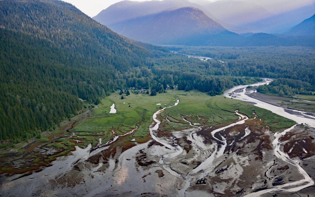
by CoastView | Mar 10, 2025 | 2025, Biodiversity, British Columbia, Chemical Pollution, Climate Change, Communities, Developments, Embayments, Historical, Land Use, Mines, Rivers
Listen to the article here https://coastview.org/wp-content/uploads/2025/03/Alice-Arm.mp3 Kitsault River drains a watershed of about 113,668 acres (46,000 ha), that includes the Kitsault Glacier and several smaller glaciers that flow out of the Cambria Icefield, and...
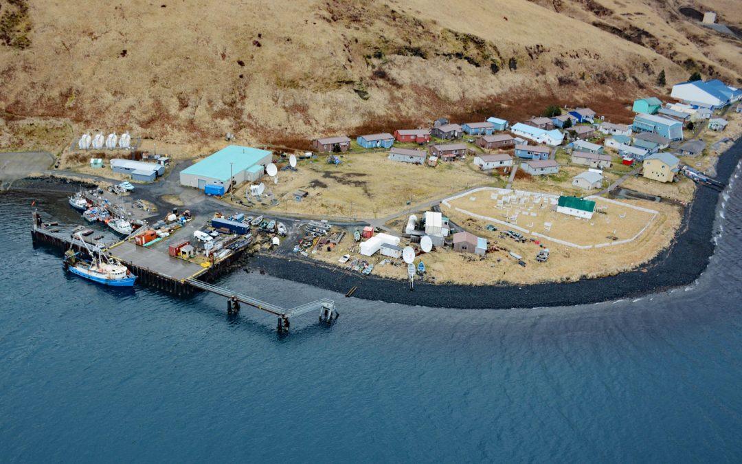
by CoastView | Mar 9, 2025 | 2025, Alaska, Biodiversity, Canneries, Climate Change, Coastal Features, Communities, Developments, Embayments, Historical, Islands, Land Use, Natural History
Listen to the article here https://coastview.org/wp-content/uploads/2025/03/Akutan.mp3 Akutan is a community on the northern shore of Akutan Harbor, on Akutan Island, one of the Krenitzin Islands in the Fox Islands group of the Eastern Aleutians, about 766 miles...
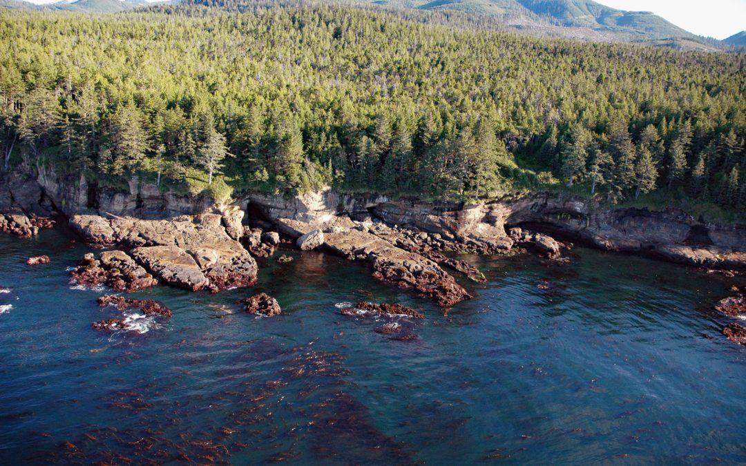
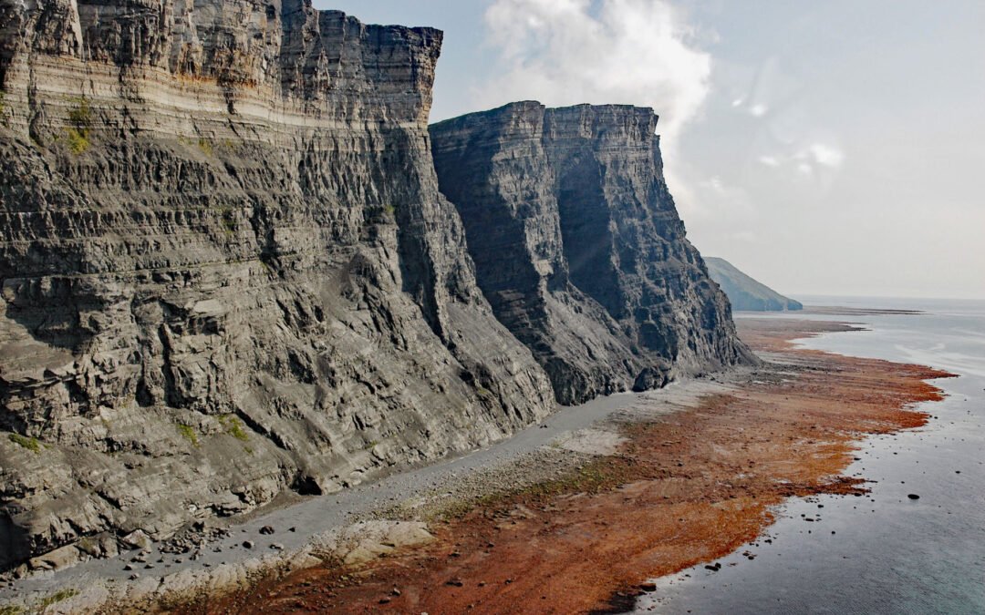
by CoastView | Mar 8, 2025 | 2025, British Columbia, Coastal Features, Historical, Islands, Land Use, Lighthouses, Natural History, Parks, Shipwrecks
Listen to the article here https://coastview.org/wp-content/uploads/2025/03/Valencia.mp3 Valencia Bluffs are sea cliffs along the West Coast Trail in Pacific Rim National Park Reserve on Vancouver Island’s southwest shore, about 29 miles (47 km) northwest of Port...
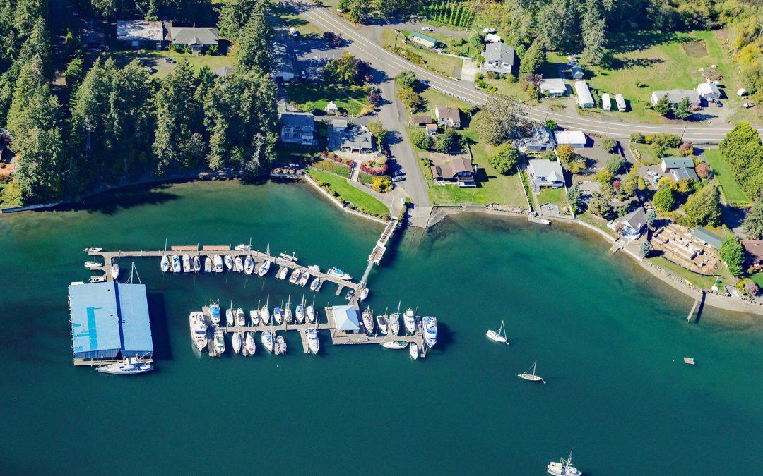
by CoastView | Mar 7, 2025 | 2025, Coastal Features, Communities, Developments, Embayments, Glaciers, Historical, Islands, Land Use, Washington
Listen to the article here https://coastview.org/wp-content/uploads/2025/03/Grapeview.mp3 Grapeview is a community comprising Allyn, Stretch Island, and Reach Island on the western shore at the head of Case Inlet in South Puget Sound, about 19 miles (31 km)...
by CoastView | Mar 6, 2025 | 2025, Alaska, Biodiversity, Climate Change, Coastal Features, Embayments, Headlands, Historical, Land Use, Natural History, Parks
Listen to the article here https://coastview.org/wp-content/uploads/2025/03/Newenham.mp3 Cape Newenham is a massive headland on the eastern shore of the Bering Sea, situated between Kuskokwim Bay to the north and Togiak Bay to the south, about 149 miles (240 km) south...
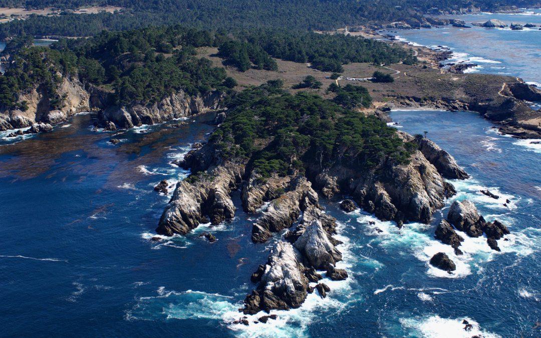
by CoastView | Mar 5, 2025 | 2025, Biodiversity, California, Climate Change, Coastal Features, Embayments, Headlands, Historical, Land Use, Natural History, Parks
Listen to the article here https://coastview.org/wp-content/uploads/2025/03/Point-Lobos.mp3 Point Lobos is a rocky headland at the southern end of Carmel Bay, lying between Cypress Cove to the north and Headland Cove, about 19 miles (31 km) north-northwest of Big Sur...
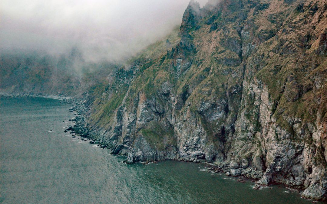
by CoastView | Mar 4, 2025 | 2025, Alaska, Biodiversity, Climate Change, Coastal Features, Embayments, Headlands, Historical, Land Use, Natural History
Listen to the article here https://coastview.org/wp-content/uploads/2025/03/Fortification-1.mp3 Fortification Bluff is a sea cliff more than 3 miles (4.8 km) long that rises almost vertically to 1,200 feet (366 m) on the south face of Step Mountain in Kamishak Bay, on...
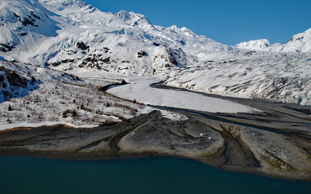
by CoastView | Mar 3, 2025 | 2025, Alaska, Climate Change, Coastal Features, Embayments, Glaciers, Historical, Land Use, Natural History
Listen to the article here https://coastview.org/wp-content/uploads/2025/03/Dirty-Glacier-1.mp3 The Dirty Glacier flows generally north for about 1.7 miles (2.7 km), from an elevation of 3,800 feet (1,158 m) in the Chugach Mountains of western Prince William Sound to...
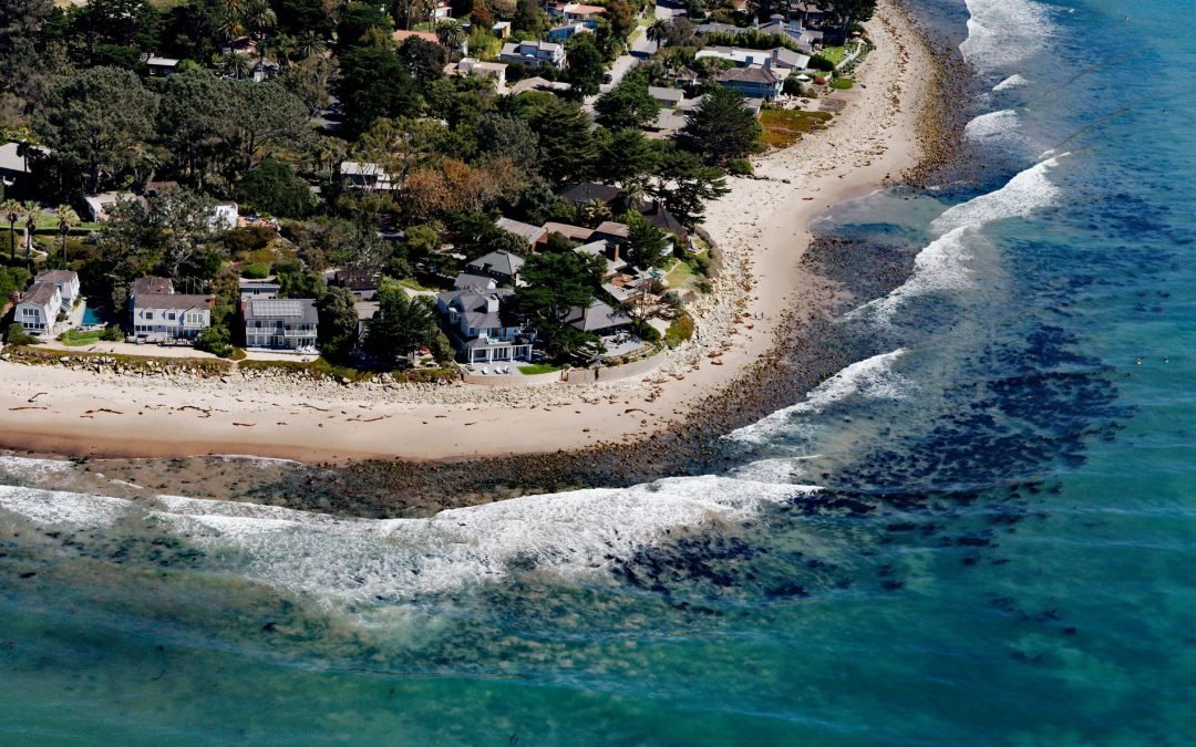
by CoastView | Mar 2, 2025 | 2025, Biodiversity, California, Chemical Pollution, Coastal Features, Communities, Developments, Land Use, Natural History, Rivers
Listen to the article here https://coastview.org/wp-content/uploads/2025/03/Rincon-Creek-1.mp3 Rincon Creek is a stream that begins in the Santa Ynez Mountains near Divide Peak, at an elevation of 4,800 feet (1,463 m), and drains a watershed of 9,352 acres (3,785-ha)...