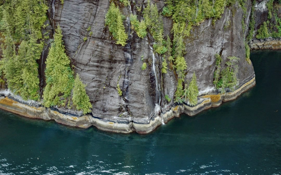
by CoastView | Oct 21, 2024 | 2024, Alaska, Coastal Features, Embayments, Historical, Land Use, Mines, Parks, Waterfalls
Rudyerd Bay is a deglaciated fjord in the Coast Range of Southeast Alaska in Misty Fjords National Monument, about 89 miles (143 km) north-northwest of Prince Rupert and 39 miles (63 km) northeast of Ketchikan, Alaska. The fjord extends northeast for 11.5 miles (19...
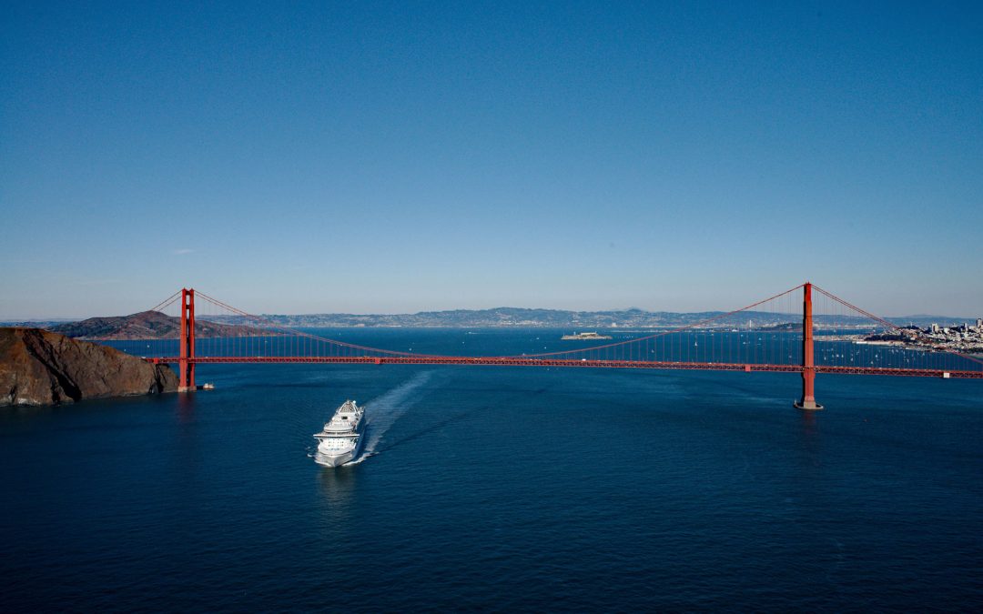
by CoastView | Oct 20, 2024 | 2024, California, Coastal Features, Communities, Developments, Embayments, Headlands, Historical, Land Use, Parks
The Golden Gate is a turbulent strait about 1 mile (1.6 km) wide, between Lime Point to the north and Fort Point to the south, that connects San Francisco Bay to the Pacific Ocean, about 4 miles (6.4 km) west-northwest of downtown San Francisco and 2.2 miles (3.5 km)...
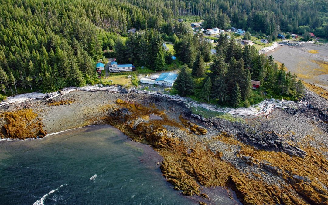
by CoastView | Oct 19, 2024 | 2024, Alaska, Canneries, Communities, Developments, Embayments, Historical, Islands, Land Use, Mines
Kasaan is a small community on the north shore of Kasaan Bay and the southern shore of the Kasaan Peninsula, on the east coast of Prince of Wales Island, about 65 miles (105 km) south of Wrangell and 33 miles (53 km) west-northwest of Ketchikan, Alaska. Kasaan is the...
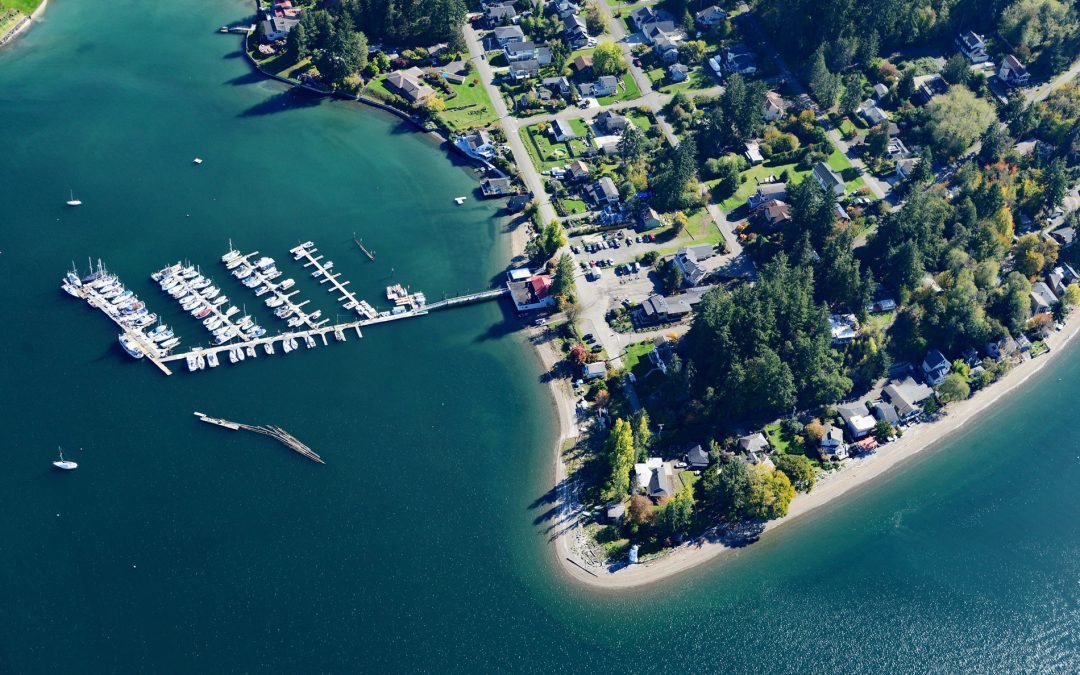
by CoastView | Oct 18, 2024 | 2024, Beaches, Communities, Developments, Embayments, Headlands, Historical, Land Use, Lighthouses, Washington
Dofflemyer Point is located in the community of Boston Harbor, on the eastern shore of South Puget Sound, and defines the entrance to Budd Inlet, about 23 miles (37 km) west-southwest of Tacoma and 7 miles (11 km) north of Olympia, Washington. Olympia was founded in...
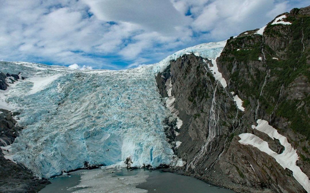
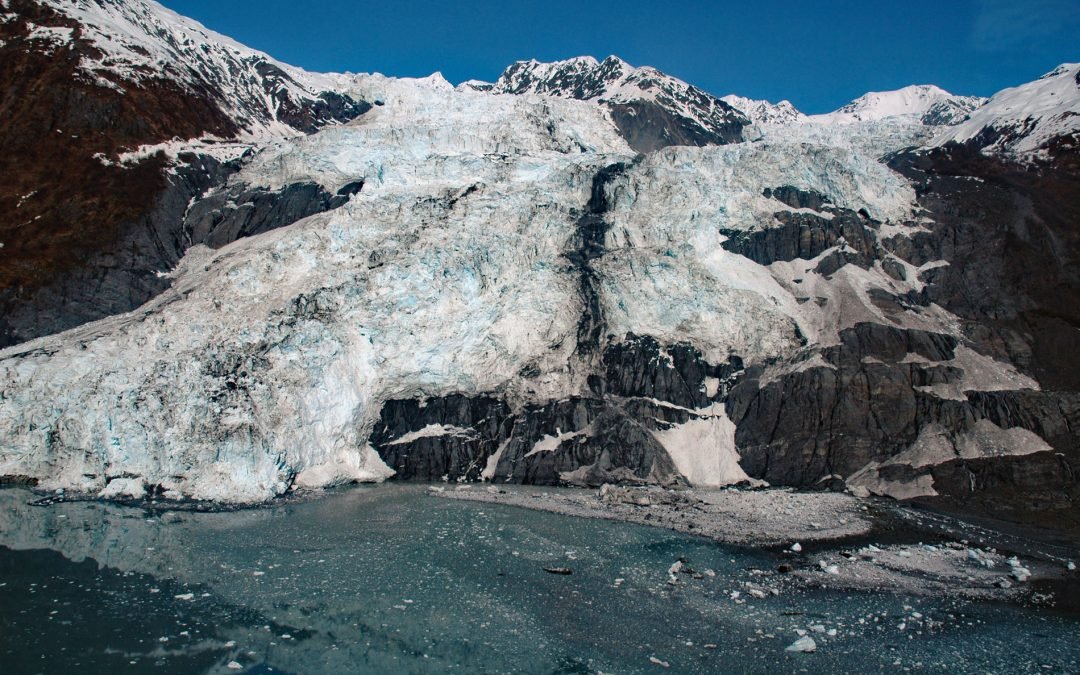
by CoastView | Oct 17, 2024 | 2024, Alaska, Climate Change, Coastal Features, Embayments, Glaciers, Historical, Waterfalls
Beloit Glacier flows northeast for about 2 miles (3.2 km) from an unnamed ice field on the Kenai Peninsula to Blackstone Bay in Prince William Sound, about 86 miles (138 km) southwest of Valdez and 9 miles (15 km) south of Whittier, Alaska. Beloit Glacier is a...
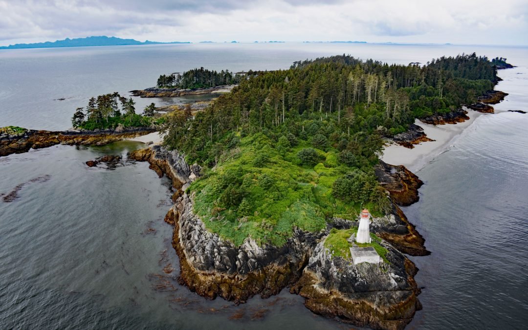
by CoastView | Oct 16, 2024 | 2024, Biodiversity, British Columbia, Coastal Features, Developments, Embayments, Islands, Land Use, Lighthouses, Parks
The Lucy Islands is a small group of islets and reefs situated 26 miles (42 km) south of the Alaska border at the intersection of Brown Passage and Chatham Sound, about 83 miles (134 km) southeast of Ketchikan and 12 miles (19 km) west of Prince Rupert, British...
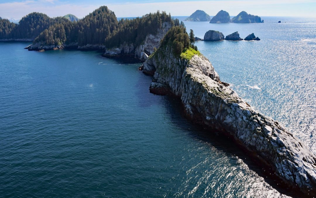
by CoastView | Oct 15, 2024 | 2024, Alaska, Biodiversity, Coastal Features, Islands, Land Use, Natural History, Parks
The Chiswell Islands are a group of rocky and uninhabited islands in the Alaska Maritime National Wildlife Refuge situated at the entrance to Aialik Bay on the south coast of Kenai Fjords National Park, about 67 miles (108 km) east of Homer and 35 miles (56 km) south...
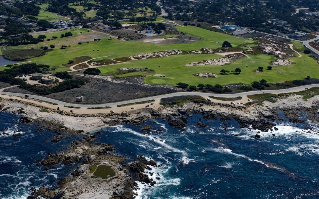
by CoastView | Oct 14, 2024 | 2024, California, Coastal Features, Communities, Developments, Headlands, Land Use, Lighthouses
Point Pinos is in the community of Pacific Grove at the northern end of the Monterey Peninsula and is the location of the oldest continuously operated lighthouse on the U.S. west coast, about 24 miles (39 km) south-southeast of Santa Cruz and 3 miles (4.8 km)...
by CoastView | Oct 13, 2024 | 2024, Alaska, Climate Change, Coastal Features, Embayments, Glaciers, Historical, Natural History
Bryn Mawr Glacier flows southeast for about 4.5 miles (7 km) to Harvard Arm of College Fjord in northwestern Prince William Sound, about 52 miles (84 km) west of Valdez and 44 miles (71 km) northeast of Whittier, Alaska. The terminus of Bryn Mawr Glacier is 1.8 miles...
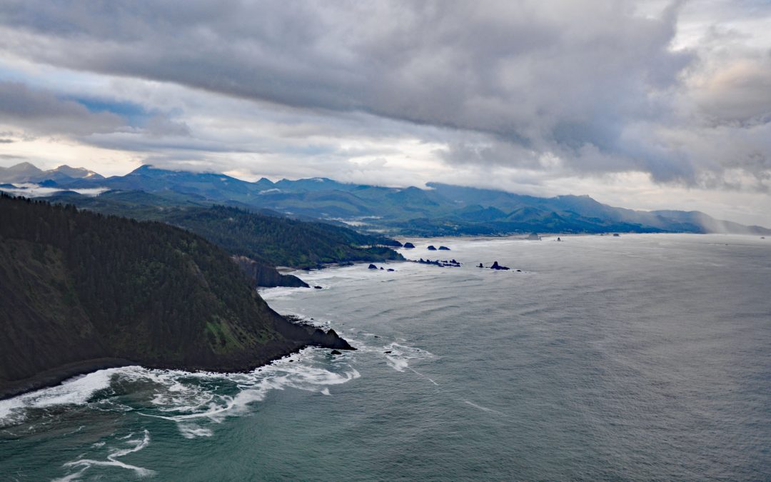
by CoastView | Oct 12, 2024 | 2024, Coastal Features, Developments, Headlands, Historical, Land Use, Oregon, Parks
Tillamook Head is a steep rocky promontory with an elevation of approximately 1,200 feet (366 m), located in Ecola State Park, about 5 miles (8 km) southwest of Seaside and 4 miles (6.4 km) north-northwest of Cannon Beach, Oregon. The promontory is named after the...