
by CoastView | Sep 2, 2024 | 2024, Alaska, Biodiversity, Chemical Pollution, Coastal Features, Headlands, Historical, Shipwrecks
Chil Bo San No. 6 is a shipwreck on Spray Cape, a conspicuous headland on the west coast of Unalaska Island between Skan Bay to the north and Pumicestone Bay to the south, about 85 miles (137 km) northeast of Nikolski and 32 miles (52 km) southwest of Dutch Harbor,...

by CoastView | Sep 1, 2024 | 2024, British Columbia, Communities, Developments, Embayments, Historical, Islands, Land Use, Mines
Crofton is a small coastal community at Osborne Bay on the southeast coast of Vancouver Island, about 34 miles (55 km) north-northwest of Victoria and 26 miles (42 km) southeast of Nanaimo, British Columbia. The area is the traditional territory of the Halalt First...

by CoastView | Aug 31, 2024 | 2024, Alaska, Communities, Developments, Embayments, Historical, Islands
Old Harbor is a small Alutiiq community situated on the western shore of Sitkalidak Strait that separates Sitkalidak Island from Kodiak Island, about 48 miles (77 km) southwest of Kodiak and 40 miles (64 km) northeast of Akhiok, Alaska. The Alutiiq name for the...

by CoastView | Aug 30, 2024 | 2024, Alaska, Biodiversity, Chemical Pollution, Communities, Developments, Historical, Land Use, Mines
Hollis is a small community on Twelvemile Arm of Kasaan Bay, north of Cat Island, near the center of Prince of Wales Island in the Alexander Archipelago of Southeast Alaska, about 41 miles (66 km) west-northwest of Ketchikan and 20 miles (32 km) east of Craig, Alaska....

by CoastView | Aug 29, 2024 | 2024, Biodiversity, California, Coastal Features, Communities, Embayments, Historical, Land Use, Parks
Bolinas Lagoon is a tidal estuary situated between the communities of Bolinas to the west and Stinson Beach to the east, about 35 miles (56 km) south-southeast of Bodega Bay and 17 miles (27 km) northwest of San Francisco, California. The lagoon opens to Bolinas Bay,...

by CoastView | Aug 28, 2024 | 2024, Alaska, Canneries, Communities, Developments, Embayments, Historical, Land Use, Parks, Shelter Cabins
Taku Harbor is a historical community and the site of an abandoned cannery in a small embayment on the eastern shore of Stephens Passage near Taku Inlet, about 86 miles (138 km) northeast of Sitka and 22 miles (35 km) southeast of Juneau, Alaska. Taku Harbor is named...

by CoastView | Aug 27, 2024 | 2024, Beaches, Coastal Features, Communities, Developments, Embayments, Historical, Land Use, Oregon
Battle Rock is a large sea stack connected to the mainland by a narrow rocky ridge, situated 500 feet (152 m) southeast of Fort Point at the head of Port Orford, a shallow embayment or bight, about 23 miles (37 km) north of Gold Beach and adjacent to the community of...

by CoastView | Aug 26, 2024 | 2024, Alaska, Chemical Pollution, Coastal Features, Embayments, Historical, Islands, Shipwrecks
FV Lisa Jo is a shipwreck at the entrance to Akun Bay on the western coast of Akun Island between Round Head to the south and Billings Head to the north, about 94 miles (151 km) southwest of False Pass and 13 miles (21 km) northeast of the village of Akutan, Alaska....
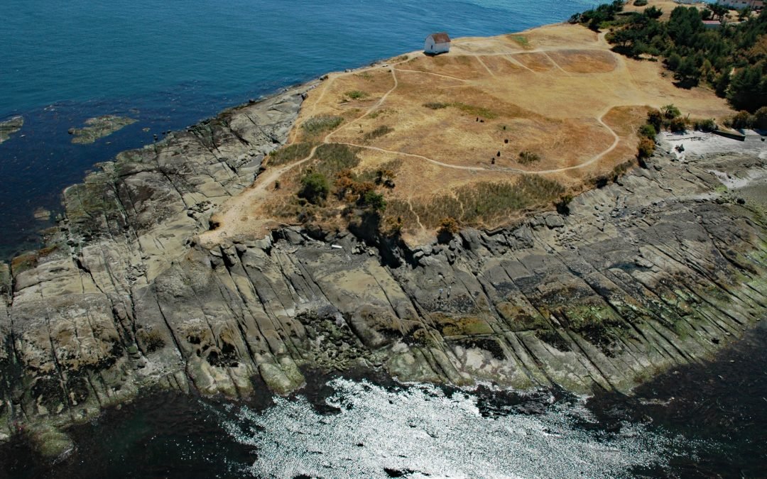
by CoastView | Aug 25, 2024 | 2024, British Columbia, Coastal Features, Developments, Historical, Islands, Land Use, Lighthouses, Parks, Shipwrecks
East Point is the end of a long peninsula at the easternmost tip of Saturna Island in the Gulf Islands National Park Reserve, about 35 miles (56 km) south of Vancouver and 18 miles (29 km) northeast of Sidney, British Columbia. Saturna is a mountainous island of 7,680...
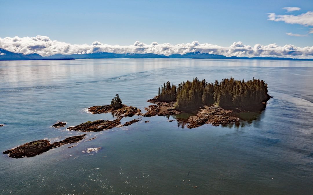
by CoastView | Aug 24, 2024 | 2024, Alaska, Coastal Features, Embayments, Historical, Islands, Land Use, Parks
Beauclerc Island is in Sumner Strait, at the entrance to Port Beauclerc on Kuiu Island, in the Alexander Archipelago of Southeast Alaska, about 80 miles (129 km) southeast of Sitka and 11 miles (18 km) southwest of Point Baker, Alaska. The island’s name is taken...