Islands
Recent Articles
More Articles

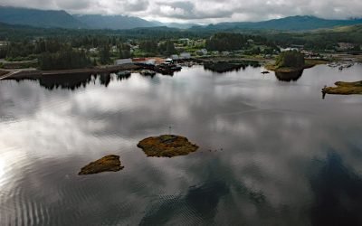
Hoonah, Port Frederick
Hoonah is a community situated on the eastern shore of Port Frederick on the northeastern coast of Chichagof Island in the Alexander Archipelago of Southeast Alaska, about 40 miles (64 km) west-southwest of Juneau and 24 miles (39 km) south-southeast of Gustavus, Alaska.

Fort Tongass, Nakat Bay
Tongass Island is the historical site of Fort Tongass located near the southern extent of the Alexander Archipelago in Southeast Alaska about 4.5 miles (7 km) north of the Canadian Border, bounded by Nakat Bay to the west and a channel called Port Tongass to the east, about 19 miles (31 km) northwest of Lax Kw’alaams, British Columbia and 54 miles (87 km) southeast of Ketchikan, Alaska.
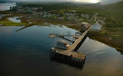
Klawock, Prince of Wales Island
Klawock is a community on the estuary of the Klawock River on the west coast of Prince of Wales Island in the Alexander Archipelago of Southeast Alaska, about 58 miles (93 km) northwest of Ketchikan and 6 miles (10 km) northeast of Craig, Alaska.
Shaw Island, Cook Inlet
Shaw Island is located in Katmai National Park and Preserve, 2.5 miles (4 km) north of the Alaska Peninsula near the entrance to Kamishak Bay on the western shore of Cook Inlet, about 119 miles (192 km) east-northeast of King Salmon and 79 miles (127 km) southwest of Homer, Alaska.
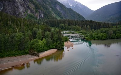
Exchamsiks River Provincial Park, Skeena River
Exchamsiks River Provincial Park is in the Coast Mountains at the mouth of the Exchamsiks River on the north side of the Skeena River, about 42 miles (68 km) east of Prince Rupert and 31 miles (50 km) southwest of Terrace, British Columbia.
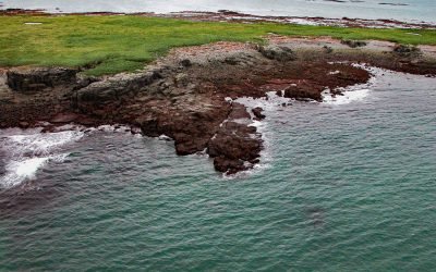
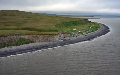
Tigalda Sea Stack, Krenitzin Islands
Sea stacks are a common feature on the Gulf of Alaska coast, particularly along the Alaska Peninsula and the Eastern Aleutian Islands, about 200 miles (323 km) southwest of Sand Point and 64 miles (103 km) east-northeast of Dutch Harbor, Alaska.
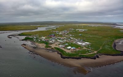
Mekoryuk, Nunivak Island
Mekoryuk is a community situated at the western entrance to Shoal Bay on the northern shore of Nunivak Island in the Bering Sea, about 153 miles (246 km) west-southwest of Bethel and 80 miles (129 km) south of Hooper Bay, Alaska.
Sand Point, Popof Island
Sand Point is a community situated on Humboldt Harbor on the western shore of Popof Island, one of the Shumagin Islands in the Gulf of Alaska off the southern coast of the Alaska Peninsula, about 262 miles (422 km) northeast of Dutch Harbor and 65 miles (105 km) southwest of Perryville, Alaska.
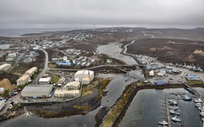
Hydaburg, Prince of Wales Island
Hydaburg is a community situated on Sukkwan Strait at the northern end of Cordova Bay, opposite Sukkwan Island to the south, on the highly convoluted southwestern coast of Prince of Wales Island in the Alexander Archipelago, about 160 miles (258 km) south-southeast of Sitka and 48 miles (77 km) west of Ketchikan, Alaska.
Umkumiut, Nelson Island
Umkumiut is a seasonally occupied Yup’ik fish camp in Kangirlvar Bay, also known as Toksook Bay, located on the western shore of Nelson Island in the Bering Sea, between Atrnak Point to the north and Chinigyak Cape to the south, about 118 miles (190 km) west-southwest of Bethel and 3.8 miles (6 km) southwest of Toksook Bay, Alaska.
About the background graphic
This ‘warming stripe’ graphic is a visual representation of the change in global temperature from 1850 (top) to 2019 (bottom). Each stripe represents the average global temperature for one year. The average temperature from 1971-2000 is set as the boundary between blue and red. The colour scale goes from -0.7°C to +0.7°C. The data are from the UK Met Office HadCRUT4.6 dataset.
Click here for more information about the #warmingstripes.