
by CoastView | Feb 9, 2024 | 2024, British Columbia, Developments, Land Use, Natural History, Parks, Rivers
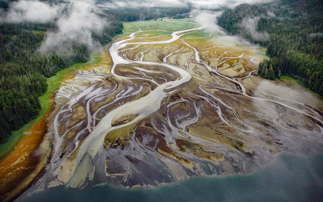
Ecstall River starts from a cirque glacier at an elevation of roughly 3100 feet (945 m) in the Kitimat Ranges of the Coast Mountains and flows generally north-northwest for about 68 miles (110 km), draining a watershed of 207,568 acres (84,000 ha), to the lower tidal...
by CoastView | Feb 8, 2024 | 2024, Alaska, Biodiversity, Coastal Features, Embayments, Islands, Land Use, Natural History, Rivers
Deep Bay is an estuary about 0.5 miles (0.8 km) across, located on the western shore of Peril Strait, on the southern coast of Chichagof Island, about 74 miles (119 km) southwest of Juneau and 29 miles (47 km) northwest of Sitka, Alaska. The name is a translation by...

by CoastView | Feb 7, 2024 | 2024, Alaska, Biodiversity, Coastal Features, Embayments, Land Use, Natural History, Parks, Rivers, Waterfalls
Paint River starts at the confluence of the Middle and South Forks and flows generally east for 17 miles (27 km), draining a watershed of 40,854 acres (16,533 ha), to Akjemguiga Cove in Kamishak Bay between McNeil Cove to the south and Amakdedulia Cove to the north,...
by CoastView | Feb 6, 2024 | 2024, Alaska, Biodiversity, Coastal Features, Communities, Land Use, Natural History, Rivers
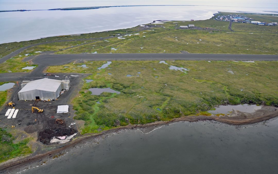
Point Lay Village is a community at the mouth of the Kokolik River on Kasegaluk Lagoon, about 94 miles (152 km) southwest of Wainwright and 134 miles (216 km) northeast of Point Hope, Alaska. Kasegaluk Lagoon is isolated from the Chukchi Sea by a series of long thin...
by CoastView | Feb 5, 2024 | 2024, Alaska, Biodiversity, Coastal Features, Islands, Land Use, Parks
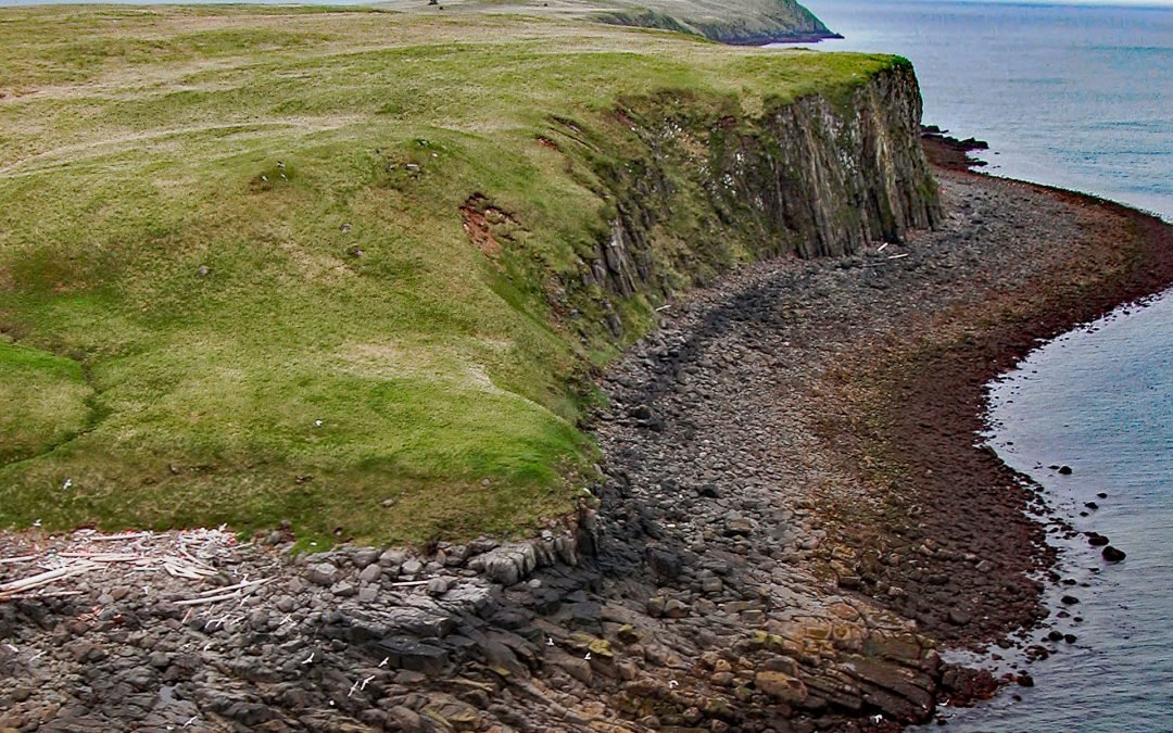
Kiukpalik Island is 1.3 miles (2 km) long and 0.6 miles (1 km) wide and is part of Katmai National Park and Preserve, but situated 2 miles (3.2 km) offshore from the Alaska Peninsula in Shelikof Strait, about 112 miles (181 km) east of King Salmon and 72 miles (116...

by CoastView | Feb 4, 2024 | 2024, Beaches, Biodiversity, California, Coastal Features, Embayments, Land Use, Natural History, Rivers
Estero Americano is an estuary about 4 miles (6.5 km) long that connects to Bodega Bay and is fed by Americano Creek that starts at an elevation of roughly 250 feet (76 m) in the coastal hills of Sonoma and Marin Counties and flows west for 11 miles (18 km) draining a...