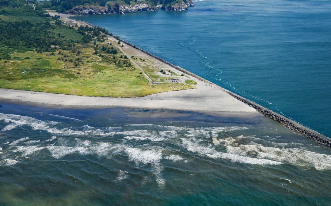
by CoastView | Jul 23, 2023 | 2026, Coastal Features, Developments, Historical, July 2026, Land Use, Natural History, Rivers, Washington
Listen to the article here https://coastview.org/wp-content/uploads/2026/03/PeacockSpit.mp3 Peacock Spit is the northern portion of a mostly submerged sand bar, generally called the Columbia Bar, at the mouth of the Columbia River, about 12 miles (19 km) northwest of...
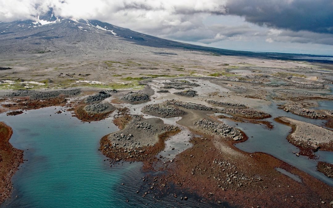
by CoastView | Jul 22, 2023 | 2026, Alaska, Coastal Features, Islands, July 2026, Natural History
Listen to the article here https://coastview.org/wp-content/uploads/2026/03/AugustineVolcano.mp3 Burr Point is a headland on Augustine Island in Kamishak Bay, on the western margin of lower Cook Inlet, about 108 miles (174 km) north-northwest of Kodiak and 69 miles...
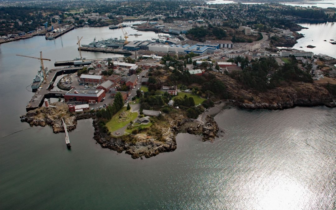
by CoastView | Jul 21, 2023 | 2026, British Columbia, Developments, Embayments, Historical, July 2026, Land Use
Listen to the article here https://coastview.org/wp-content/uploads/2026/03/EsquimaltHarbour-1.mp3 Esquimalt Harbour is a sheltered embayment on the southern tip of Vancouver Island, about 21 miles (34 km) north of Port Angeles, Washington, and 3 miles (4.8 km)...
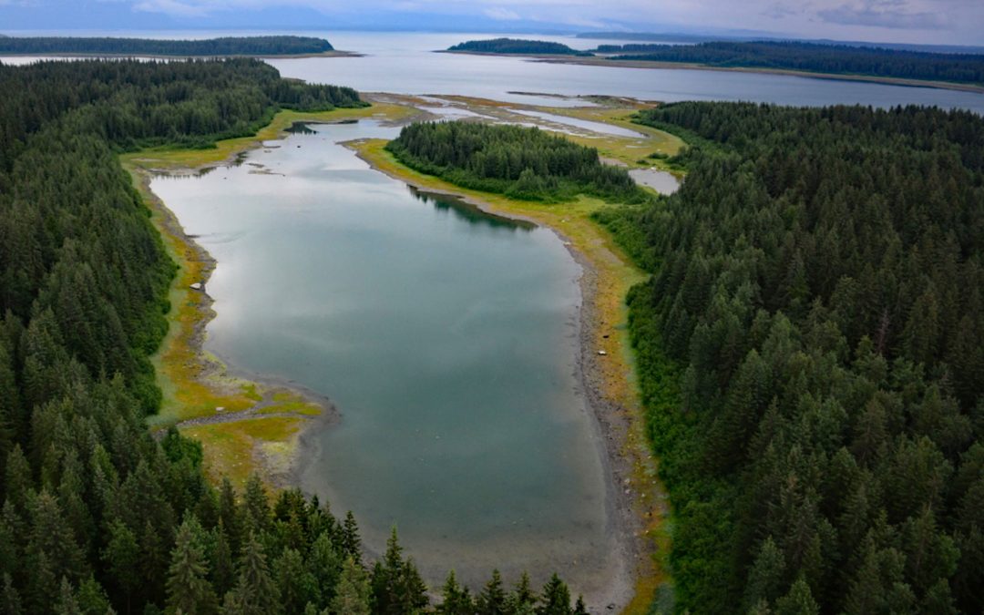
by CoastView | Jul 21, 2023 | 2026, Alaska, Embayments, July 2026, Land Use, Natural History, Parks
Listen to the article here https://coastview.org/wp-content/uploads/2026/03/BergBay.mp3 Berg Bay is in Glacier Bay National Park and Preserve, and extends west for four miles (6.5 km) off Sitakaday Narrows near the mouth of Glacier Bay, about 38 miles (61 km)...
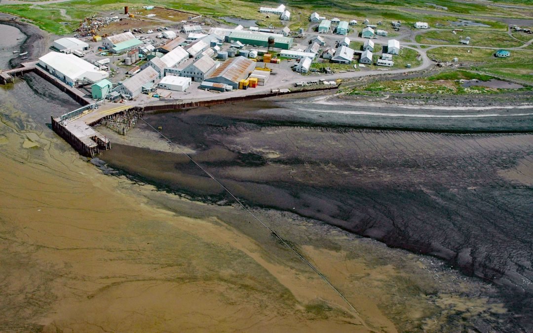
by CoastView | Jul 20, 2023 | 2026, Alaska, Biodiversity, Canneries, Communities, Embayments, July 2026, Natural History
Listen to the article here https://coastview.org/wp-content/uploads/2026/03/EkukFisheries.mp3 Ekuk Fisheries is a historic salmon cannery on Ekuk Spit, on the eastern shore of Nushagak Bay at Ekuk Cape, about 16 miles (26 km) south-southwest of Dillingham and 1.4...
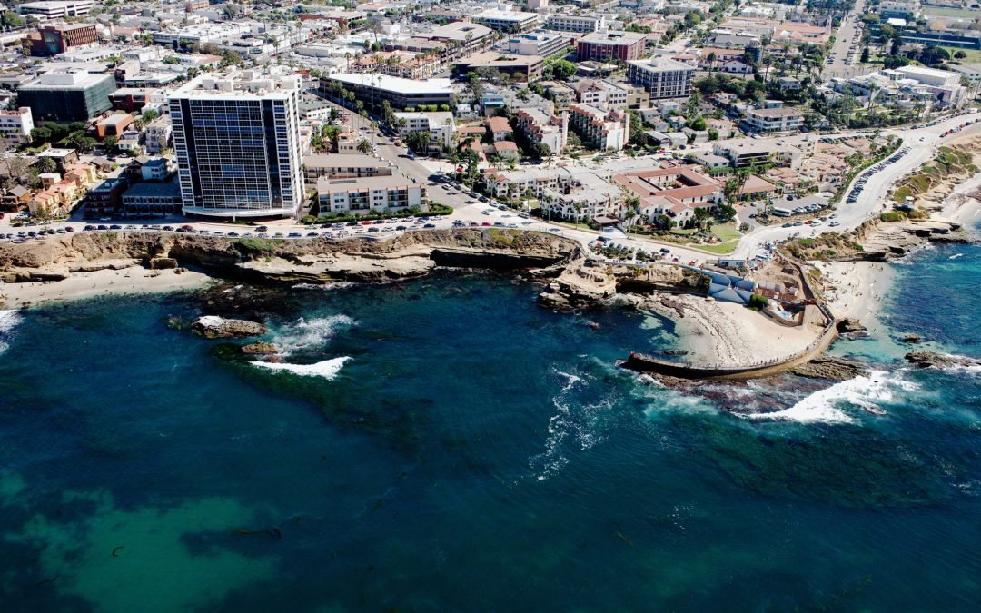
by CoastView | Jul 19, 2023 | 2026, Beaches, Biodiversity, California, Coastal Features, Communities, Developments, July 2026, Land Use, Natural History
Listen to the article here https://coastview.org/wp-content/uploads/2026/03/ChildrensPool.mp3 Children’s Pool is a rocky cove partially enclosed by a seawall, located in La Jolla, about 13 miles (21 km) south of Encinitas and 11 miles (18 km) northwest of...