
by CoastView | Apr 8, 2025 | 2025, Alaska, Biodiversity, Canneries, Climate Change, Coastal Features, Developments, Embayments, Historical, Islands, Land Use, Natural History
Listen to the article here https://coastview.org/wp-content/uploads/2025/04/Uganik-Fish.mp3 Uganik Fisheries is a historic salmon cannery on the north shore of Northeast Arm in Uganik Bay about 1.3 miles (2 km) southeast of Starr Point on the northwestern coast of...
by CoastView | Apr 5, 2025 | 2025, Biodiversity, British Columbia, Climate Change, Coastal Features, Embayments, Historical, Land Use, Natural History, Parks, Rivers
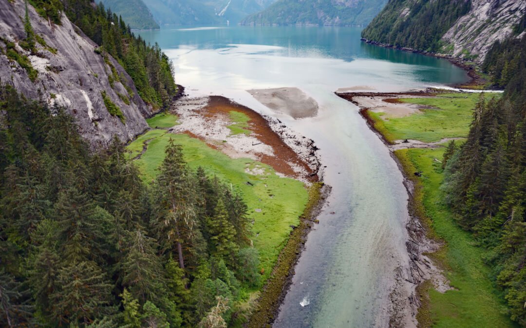
Listen to the article here https://coastview.org/wp-content/uploads/2025/03/Brim-River.mp3 Brim River Hot Springs and adjoining Owyacumish River Park protect 2,488 acres (1,007 ha) at the head of Owyacumish Bay on the north shore of Gardner Canal, about 96 miles (155...
by CoastView | Apr 3, 2025 | 2025, Alaska, Biodiversity, Climate Change, Coastal Features, Communities, Developments, Historical, Land Use, Natural History, Rivers
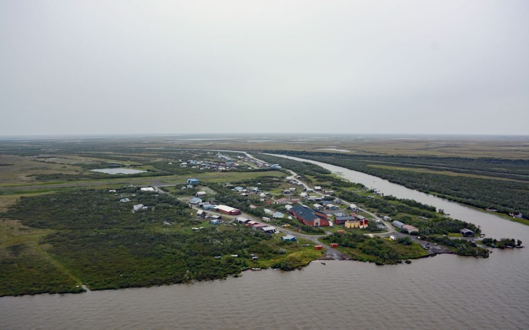
Listen to the article here https://coastview.org/wp-content/uploads/2025/03/Napakiak.mp3 Napakiak is a village located on an island situated between the Kuskokwim River to the south and Johnson Slough to the north, about 167 miles (269 km) southeast of Emmonak and 10...
by CoastView | Mar 28, 2025 | 2025, Alaska, Climate Change, Coastal Features, Embayments, Historical, Natural History, Waterfalls
Listen to the article here https://coastview.org/wp-content/uploads/2025/03/Trident-Akutan.mp3 Trident Seafoods operates the largest seafood processing facility in North America on Akutan Island, one of the Krenitzen Islands in the Fox Island group of the Eastern...

by CoastView | Mar 26, 2025 | 2025, California, Climate Change, Coastal Features, Communities, Developments, Headlands, Historical, Land Use, Lighthouses, Natural History, Parks
Listen to the article here https://coastview.org/wp-content/uploads/2025/03/Sanata-Cruz-.mp3 Lighthouse Point Park is located on Point Santa Cruz, adjacent to Lighthouse Field State Beach at the northern boundary of Monterey Bay, about 25 miles (40 km) north-northwest...

by CoastView | Mar 25, 2025 | 2025, Alaska, Biodiversity, Climate Change, Coastal Features, Embayments, Headlands, Natural History
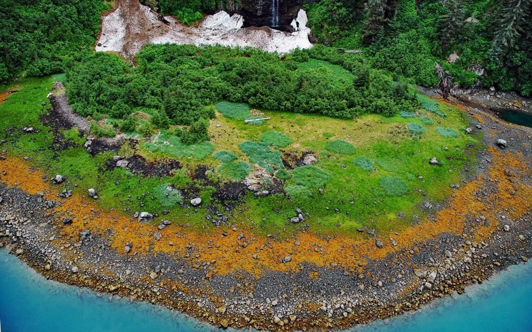
Listen to the article here https://coastview.org/wp-content/uploads/2025/03/Rocky-Cove-1.mp3 Rocky Cove is an embayment about 1 mile (1.6 km) wide at the base of Step Mountain, between Ursus Cove to the north and Bruin Bay to the south on the western shore of Cook...